By Chris Matthews
![]()
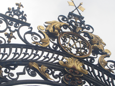
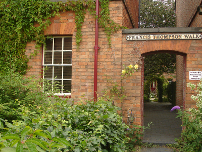
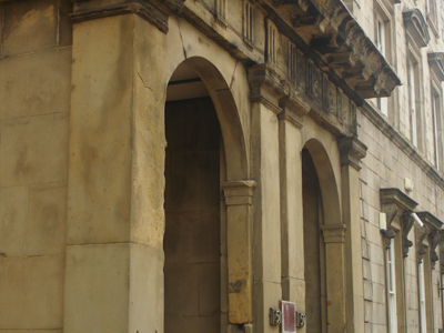
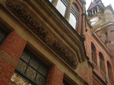
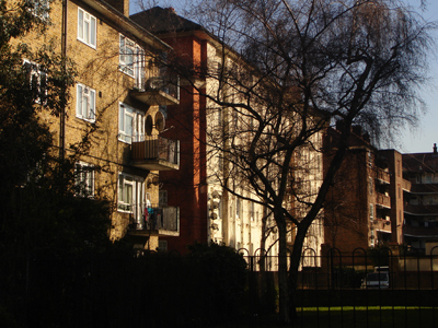
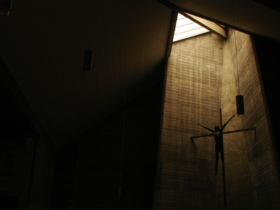
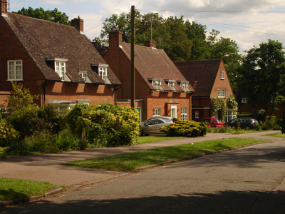
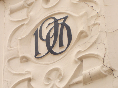
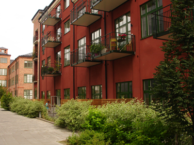
Pump Square
Ebb and flow. Drains and Bricks. Boston is man-made: how man battles with fresh and salt water for both trade and development. It all depends on the Witham and the Wash. Boston didn’t exist in 1087 but by the tax rolls of 1332 the waters were flowing and it was the fourth wealthiest provincial town in England. In the sixteenth century the river silted up and the town ebbed: Puritans emigrated and locals rioted as hired Dutchmen drained the land for private profit. But the benefit of drainage was a boom for the eighteenth century port and Boston flowed once again: its glory is that of a Midland protestant pining for Northern Europe. The Witham has been unable to keep up with the increasing size of shipping and the town has slowly ebbed. Though credited with feeding the industrial revolution the town has been lingering ever since. The puritan American forebears only begat the bloody bypass (named after the sixth president) but the Mayor of Boston Massachusetts (and father of JFK) did partly finance the repair of the church tower (aka the stump) in the 1930s. Today the town suffers from a myopic car lobby, deprivation and the odd BNP councillor here and there. There are plans to master this water’s edge once more with a new tidal barrier. Get those levels right and a twenty-first century working dock and leisure marina could be coming to town. But if this isn’t done carefully, it could mean the loss of those unforgettable tidal mud banks clawing the town back into the sea.
![]()
Facing the River Witham
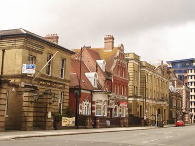
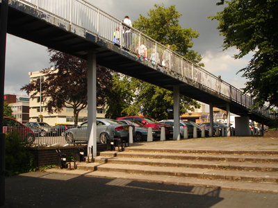
Arrival or Departure?
How do I know Boston? Nottingham holidays makers pass through the town on their way to Skegness. But whereas Skeggy offers unpretentious frivolity (beer served in a chip shop), it has very little in the way of townscape unlike Boston. On arrival I could be forgiven for jumping back on the train as despite a cute porte-cochere, the immediate Station Approach is no more of an approach than a let down. To follow an aesthetic impulse is to wander the bye law GNR terraces of Station Street but that will take you round the houses until you cross the footbridge and enter the town centre. Tower Street and the west bank view of the famous stump are a highly rewarding experience, which could be improved by more generous public landscaping between the police station and river. The brave new world may have been a bit of a let down in Boston, but the footbridge by Arthur Ling (scheduled to be replaced) is a decent bit of planning connecting the town centre with the utterly banal 90s CVS building and bus station.
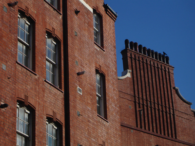
![]()
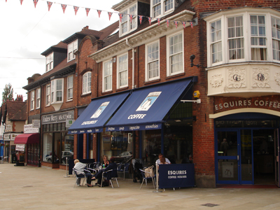
Stepped lintels, Emery Lane
The more literal route from the Railway Station involves navigating beside a landscape of car parks with the usual contemporary plonk: Asda, PC World etc. At least they are not out-of-town. Things certainly pick up beside the Swann building, where the Victorian Artisan Mannerism is reminiscent of Wilberforce House in Hull – this former feather pillow factory has thankfully found a new use as flats. However West Street is the main drag and for the most part appears symptomatic of Boston’s decline: closed shops, vacant plots and decaying shop fronts, which could be anywhere in the Midlands. But when you reach Municipal Hall, everything gradually begins to pick up and the pace quickens – it’s as though the tight knit creativity in each little street, back lane and plot was building up to the grand crescendo at Town Bridge.
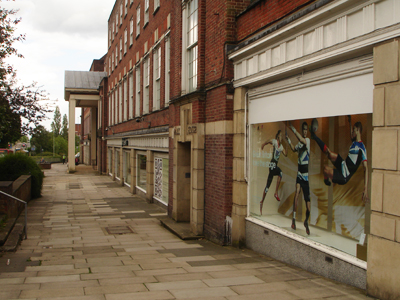
![]()
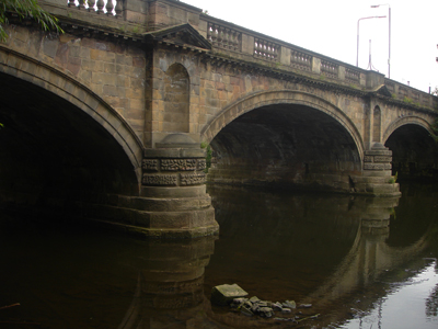
Town Bridge
A Dutch Urbanism
“God made the world and the Dutch made Holland” so the saying goes, but didn’t they also make Boston, in the Part of Holland, Lincolnshire? Given the size of the place, it has a confident urban structure that many English cities might envy. The narrow tidal mud banks of the Witham grappling at the back of the Assembly Rooms leave an impression which is quite unforgettable, but not in a twee Stamford way. This is a place with a clear physical function: a North Sea port - though reduced in importance.
![]()
The sheer size of the market – as viewed from the Stump
The market is an impressive urban space framed by the showy fronts of the aforementioned Assembly Rooms and the Grand Hotel. The pinnacle of all this is the unique stump of St Boltolph’s Church. As one of the principal ports for the export of wool in the middle ages, the town traded with France, Flanders and the Baltic. Amidst the backdrop of the stump with its lantern you can recall Bruges and indeed that once powerful and urbane medieval Flemish city was the European port of entry for English woollens. On Wednesdays and Saturdays there is great life in the market but for the rest of the week this historic and place-making locale is a sterile car park.
![]()
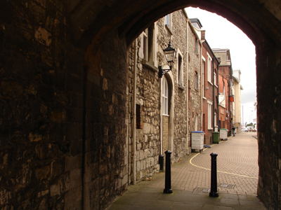
Wormgate
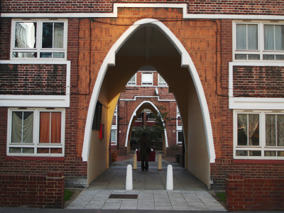
Nevertheless from here the pedestrian is excited by a mouth watering choice of urban delights which require a frenetic flick through the old architectural glossary: Flemish bond, crow-stepped gables, ornamental brackets, swan necked pediments and stepped lintels. It is all very inventive and not at all condescending. North east from the market is Wide Bargate (the former livestock area), another similarly continental public space and home to a rather unique open air auction every Wednesday. This could lead more clearly to the grand suburbanism after Park Gate but the war memorial is lost in a lonely traffic island. The pedestrian is pushed to the sides and there is little opportunity for engagement with the grand Edwardian Post Office and the fanlights of the nineteenth century merchants’ houses. Across the sea of parking and the John Adams Way is a distant mirage of fine townscape.
![]()
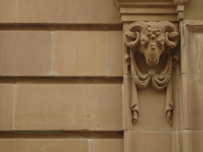
Church House: Artisan Mannerism
It is in the Wormgate area and the lanes off the market where narrow lanes of Northern Europe can be recalled: Boston doffs its cap to seventeenth century Dutch commercial supremacy and the Glorious Revolution. Each street and corner arouse architectural curiosity, expectation and occasional titillation – everything is on a human and domestic scale. The Artisan Mannerism of Church House is exceptional: in inventive display of brick jam-packed into a reasonable space. Is this the architecture of the seventeenth century Dutch Entrepôt trade at Boston? Pump Square and Spain Court are similarly Dutch and Flemish in their space and design: pantiles, hipped roofs, gables, dormer windows and bizarre Bostonian doorways with shaped entablature. And while the neo-Egyptian Freemason’s Hall gives a first rate lesson in facing the street, the same can not be said for the new Pescod Shopping Mall, which turns its arse to the lanes and could be in any post-Thatcher provincial town. Amidst the restored timber framed Pescod Hall the place resembles a theme park. It is amazing how Building Design Partnership managed to ignore everything that is so unique and abundant about Boston.
Stumped for Words
![]()
Tower Street
Everyone bangs on about the stump so much that there is little else to add, but yes the tallest medieval parish church tower in England is impressive. Completed on the eve of the Reformation and in the twilight of the Perpendicular style it shows that mad late medieval mindset to be the “Sky Scraper City” of the day. Lincoln Cathedral was the tallest building in the world, Louth has the tallest parish spire, did Boston plan to put a spire on top? And so on. The stump has a powerful presence in the town and this is accentuated by the flatness of the surrounding fens. Its gapping maw gobbles the fantastic Tower Street, but by the time you get to to it you know the drill. You are not prepared however for the nave. This is a great and almost humanistic experience – it doesn’t bring you to your knees in weak sacramental subservience and indeed this may be how it was intended. The town guilds of Boston ran the local church and not the other way round. There is much of historical importance to explore here: including a Hanseatic merchant’s gravestone and a sixteenth century Dutch copy of an Erasmus text. It’s a shame that the former (and reputedly Flemish) roof of the nave is now at St Donat's Castle. While I habitually shuffled through the curious misericords – which suggest largely unknown oral traditions to Christian dogma – the organist plays Alan Haven style swirling melodies.
Hanseatic Haven
![]()
Packhouse Quay
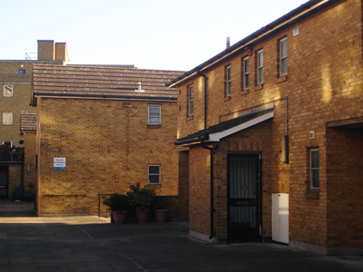
Boston was an important trading post for the Hanseatic League – a civic association of European merchants who curbed the stringent controls of medieval feudalism, until the onset of mercantile nations. The Hansa have long gone but the association is strong in Boston. South Street, Packhouse Quay and the old pre-containerisation wharfs and lanes have a character which is quite un-English. The future could be built from this Hanseatic heritage of bricky urbanism – the architectural possibilities are almost endless. Unlike other East Coast ports, Boston was dominated by Hansards from Lubeck during the later middle ages. The merchants and industrialists of the nineteenth century must have known this well: evident in the stepped gabled warehouses of Sibsey Lane and 10 South Street. They were after all building on the eighteenth century confidence of Fydell House, Customs House and the medieval Shodfriars and Guildhall. You can see why Pevsner calls this entertaining jumble “endearing”. But the view from here has been neglected by turning Packhouse Quay into a car park. The same may be said of South Square, which is courted by towering hipped and half-hipped roofs of the elongated Hanseatic style warehouses, which have thankfully found new use as flats and the Sam Newsom Music Centre. Unfortunately for Boston, the past is a foreign country. This area has recently been designated a cultural quarter by the planning department but the closure of the Haven Gallery last year is a sad reminder of the present. Though not of a particularly high standard, at least it had a stab at contemporary pastiche modernism. The new flats overlooking Haven Bridge are similar in this respect: not gated and not out of town. But that is all that can be said for twenty-first century design.
Working Life
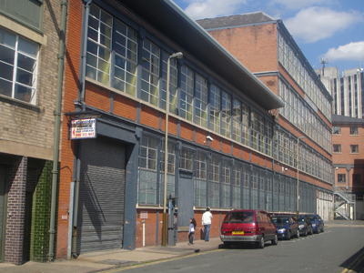
![]()
The Port of Boston
For the most part however, this is just a sore hangover for a town, which has a strong working identity and indeed there is almost a feeling of smug satisfaction. Boston has eight Batemans pubs, two non-league football teams, an exciting mix of Portuguese and Eastern European settlers, a huge market and the physical presence of the modern port. Batemans is a stalwart of the cask ale revival and though based up the road at Wainfleet, this is the town in which it is most dominant. Add this to the liveliness and compact form of the town and it has a palpable excitement on a hot spring afternoon. Marc Bolan & T Rex will forever haunt the Boston Gliderdrome.
Boston Utopia
![]()
Haven Bank
The long term effects of a process begun by Cornelius Vermuyden and his sixteenth century Dutch employees was a great lowering of the fens, and in some instances this was below sea level. This is a facinating landscape history which has been so thoroughly told by the great historical geographer H.C. Darby. This drainage left an undeniable problem, which in terms of environmental science is best left to nature. Yet in a social, economic and cultural sense it doesn’t make any sense to abandon ship here and after years of political wrangling the Environment Agency gave the go-ahead for a flood barrier. It’s not as big as the often mooted and ever changing Wash Tidal Barrier plan - from super city, to reservoir and wind farm. Yet this is still big news for a small town and could improve Boston as a commercial port and leisure marina. There is one question though: how much will the barrier limit tidal variation? Regeneration UK PLC doesn’t like mud but if the grappling banks are gone there would be huge loss of distinction. Given the threat of flooding it will be difficult to get this right.
Boston Myopia
![]()
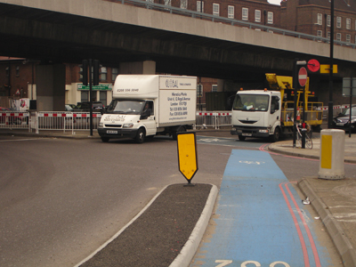
John Adams Way
Meanwhile the locals think traffic is a major problem. John Adams Way undoubtedly buggered the town up. Today it is at a seeming halt and the obvious cry from our local car lobby is to build another bypass. The lack of progress in the matter has created great political tumult to the point where independent political parties have emerged over the issue and were briefly in charge of the council. The independence of the flatlands lives on but did the Boston Bypass Party see the irony in their name? Bypass Boston. Their raison d’etre was after all a little myopic. The County Council planned a new link road but it was way down the regional pecking order: Nottingham hasn’t got a dual carriageway to the M1 and big brother City of Lincoln also wants a bypass.
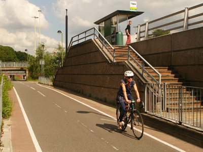
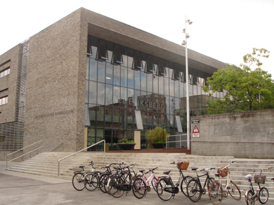
![]()
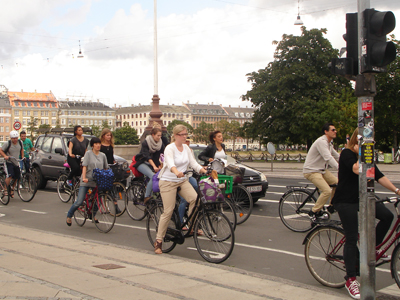
Subconsciously lending itself to cycling, burdened by poor rail
Yet a bypass is not really the solution: there needs to be better management of traffic and better facilities for alternatives, walking and cycling. The flat landscape and the narrow lanes lend themselves to the bicycle and indeed there are perhaps more cyclists here than many towns of a similar size but little is being done to encourage this beyond leisure. There is a similar dispiriting situation with the local railways: from nearby Grantham it is only an hour to London (or Leeds) but the short thirty-mile journey to Grantham Station adds at least another hour. While the similarly historic Hanseatic Dutch town of Deventer builds a sustainable transport infrastructure, Boston builds a Tesco. It’s enough to make you want to emigrate. Being a pilgrim looking out to sea is nothing new here.
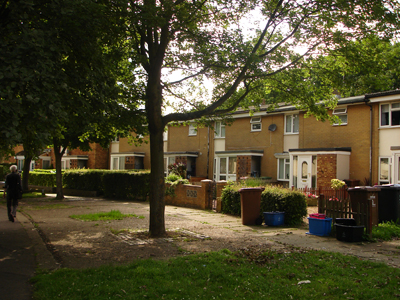
Suburban Nonconformism
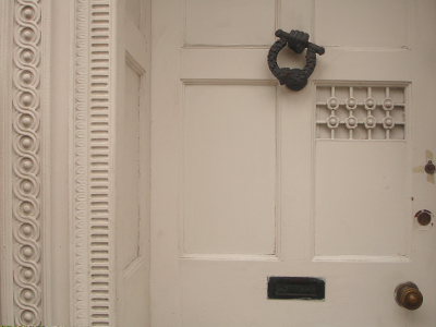
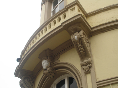
![]()
Genteel doorways are profuse
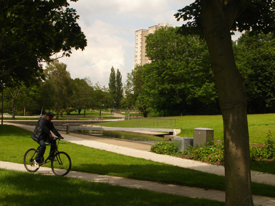
Boston doesn’t just have a strong and varied centre, but also good suburbs and generous public spaces. For this you need two wheels but these are good streets to enjoy cycling and for the most part drivers give you a wide birth. From Tower Street you can explore Haven Bank, where the split level Victorian houses are almost metropolitan. From the industrial archaeology setting of the Grand Sluice you can carry on north along the river as far as Lincoln. This is an excellent new car free leisure route called the Water Rail Way – so hats off to the local council and Sustrans. Back along Norfolk Street you meet Central Park which is packed with youth and framed by crude Victorian bay window civility. The Wrenian domes of the grand Wesleyan Methodist chapel coupled with the stump create an impressive skyline. Pevsner is disdainful about the 1909 restored façade but it is almost Louis Sullivan in its turn of the century classicism.
![]()
Wesleyan Methodist Chapel
Heading out towards the Maud Foster Drain you can explore more industrial heritage: the ubiquitous Lincolnshire Windmill, the half-hipped granary, the huge mute water tower and John Rennie’s bridge by Horncastle Road. The banks of the drain are met with nineteenth century terraces of different ages, shapes and sizes. Quite uniquely for England they face the water and are provided with half a mile of public footpath from Queens Road all the way to Windsor Bank. Regeneration UK PLC take note. Heading back into town along the hair raising boy racer Skirbeck Road it is worth seeing the post reformation Hussey Tower, if only to marvel at contemporary ignorance: it is sadly framed by a legoland cul-de-sac. The unique townscape views of the river and the half-hipped warehouses either side of Haven Bridge are ruined by the get-me-out-of-here John Adams Way. High Street down to the Black Sluice is a fascinating detour of derelict Georgian masterpieces with twentieth century dock-scape views but is treated as rat run for impatient drivers. Then just when you thought Asda marked the western end of civilisation, the Carlton Road area continues to surprise with leafy Edwardian charm and individuality.
![]()
High Street: too good for a rat run
Cosmopolitan Boston
Boston has neglected the fact that is it has constituent elements from different parts of the world. It is cosmopolitan and illustrates the varied regional and conflicting social history of England. The built environment reflects the ebb and flow of town success – it is still under-researched and in parts worryingly poor. The locals have an obsession with congestion and new developments such as Endeavour Business Park and Tesco threaten to strangle the life out of the town. Yet there is much we can learn from Boston, not just in terms of history but also as a template for good urban design: Pevsner called for a Royal Commission, Tom Dychoff called for the defibrillator but it now looks as though improvement could be on the way in the shape of major flood defences. In the meantime it should lean from its old European lowland neighbours about sustainable public transport and contemporary design.
![]()
Maud Foster Drain – note the footpath
N.B.
A swift half of Bateman’s XB was enjoyed at the Kings Arms Inn
--
References:
N. Pevsner & J. Harris, Buildings of England Lincolnshire (2002)
N. Wright, Boston: A Pictorial History (2007)
G. Morey, The North Sea (1968)
M Burkhardt, “One hundred years of commerce at a Major English Seaport”, in The dynamics of economic culture in the North Sea and Baltic Region (2007)
R.W.K. Hinton, “Dutch Entrepôt Trade at Boston, Lincs., 1600-40”, in Economic History Review, Vol. 9, No. 3 (1957)
R.W.K. Hinton, The Eastland Trade and the Common Weal (1959)
Boston Borough Council, Boston Waterways' Development Plan (2008)
Boston Borough Council, Town Centre Study (2007)
Acknowledgements:
Also thanks to @langrabbie for the Entrepôt article find

Pump Square
Ebb and flow. Drains and Bricks. Boston is man-made: how man battles with fresh and salt water for both trade and development. It all depends on the Witham and the Wash. Boston didn’t exist in 1087 but by the tax rolls of 1332 the waters were flowing and it was the fourth wealthiest provincial town in England. In the sixteenth century the river silted up and the town ebbed: Puritans emigrated and locals rioted as hired Dutchmen drained the land for private profit. But the benefit of drainage was a boom for the eighteenth century port and Boston flowed once again: its glory is that of a Midland protestant pining for Northern Europe. The Witham has been unable to keep up with the increasing size of shipping and the town has slowly ebbed. Though credited with feeding the industrial revolution the town has been lingering ever since. The puritan American forebears only begat the bloody bypass (named after the sixth president) but the Mayor of Boston Massachusetts (and father of JFK) did partly finance the repair of the church tower (aka the stump) in the 1930s. Today the town suffers from a myopic car lobby, deprivation and the odd BNP councillor here and there. There are plans to master this water’s edge once more with a new tidal barrier. Get those levels right and a twenty-first century working dock and leisure marina could be coming to town. But if this isn’t done carefully, it could mean the loss of those unforgettable tidal mud banks clawing the town back into the sea.

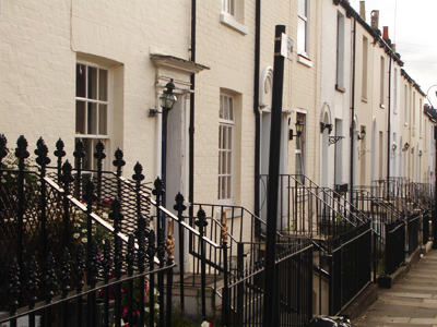
Facing the River Witham
Arrival or Departure?
How do I know Boston? Nottingham holidays makers pass through the town on their way to Skegness. But whereas Skeggy offers unpretentious frivolity (beer served in a chip shop), it has very little in the way of townscape unlike Boston. On arrival I could be forgiven for jumping back on the train as despite a cute porte-cochere, the immediate Station Approach is no more of an approach than a let down. To follow an aesthetic impulse is to wander the bye law GNR terraces of Station Street but that will take you round the houses until you cross the footbridge and enter the town centre. Tower Street and the west bank view of the famous stump are a highly rewarding experience, which could be improved by more generous public landscaping between the police station and river. The brave new world may have been a bit of a let down in Boston, but the footbridge by Arthur Ling (scheduled to be replaced) is a decent bit of planning connecting the town centre with the utterly banal 90s CVS building and bus station.

Stepped lintels, Emery Lane
The more literal route from the Railway Station involves navigating beside a landscape of car parks with the usual contemporary plonk: Asda, PC World etc. At least they are not out-of-town. Things certainly pick up beside the Swann building, where the Victorian Artisan Mannerism is reminiscent of Wilberforce House in Hull – this former feather pillow factory has thankfully found a new use as flats. However West Street is the main drag and for the most part appears symptomatic of Boston’s decline: closed shops, vacant plots and decaying shop fronts, which could be anywhere in the Midlands. But when you reach Municipal Hall, everything gradually begins to pick up and the pace quickens – it’s as though the tight knit creativity in each little street, back lane and plot was building up to the grand crescendo at Town Bridge.

Town Bridge
A Dutch Urbanism
“God made the world and the Dutch made Holland” so the saying goes, but didn’t they also make Boston, in the Part of Holland, Lincolnshire? Given the size of the place, it has a confident urban structure that many English cities might envy. The narrow tidal mud banks of the Witham grappling at the back of the Assembly Rooms leave an impression which is quite unforgettable, but not in a twee Stamford way. This is a place with a clear physical function: a North Sea port - though reduced in importance.

The sheer size of the market – as viewed from the Stump
The market is an impressive urban space framed by the showy fronts of the aforementioned Assembly Rooms and the Grand Hotel. The pinnacle of all this is the unique stump of St Boltolph’s Church. As one of the principal ports for the export of wool in the middle ages, the town traded with France, Flanders and the Baltic. Amidst the backdrop of the stump with its lantern you can recall Bruges and indeed that once powerful and urbane medieval Flemish city was the European port of entry for English woollens. On Wednesdays and Saturdays there is great life in the market but for the rest of the week this historic and place-making locale is a sterile car park.

Wormgate
Nevertheless from here the pedestrian is excited by a mouth watering choice of urban delights which require a frenetic flick through the old architectural glossary: Flemish bond, crow-stepped gables, ornamental brackets, swan necked pediments and stepped lintels. It is all very inventive and not at all condescending. North east from the market is Wide Bargate (the former livestock area), another similarly continental public space and home to a rather unique open air auction every Wednesday. This could lead more clearly to the grand suburbanism after Park Gate but the war memorial is lost in a lonely traffic island. The pedestrian is pushed to the sides and there is little opportunity for engagement with the grand Edwardian Post Office and the fanlights of the nineteenth century merchants’ houses. Across the sea of parking and the John Adams Way is a distant mirage of fine townscape.

Church House: Artisan Mannerism
It is in the Wormgate area and the lanes off the market where narrow lanes of Northern Europe can be recalled: Boston doffs its cap to seventeenth century Dutch commercial supremacy and the Glorious Revolution. Each street and corner arouse architectural curiosity, expectation and occasional titillation – everything is on a human and domestic scale. The Artisan Mannerism of Church House is exceptional: in inventive display of brick jam-packed into a reasonable space. Is this the architecture of the seventeenth century Dutch Entrepôt trade at Boston? Pump Square and Spain Court are similarly Dutch and Flemish in their space and design: pantiles, hipped roofs, gables, dormer windows and bizarre Bostonian doorways with shaped entablature. And while the neo-Egyptian Freemason’s Hall gives a first rate lesson in facing the street, the same can not be said for the new Pescod Shopping Mall, which turns its arse to the lanes and could be in any post-Thatcher provincial town. Amidst the restored timber framed Pescod Hall the place resembles a theme park. It is amazing how Building Design Partnership managed to ignore everything that is so unique and abundant about Boston.
Stumped for Words

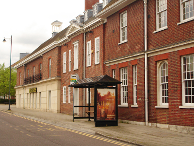
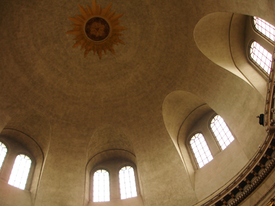
Tower Street
Everyone bangs on about the stump so much that there is little else to add, but yes the tallest medieval parish church tower in England is impressive. Completed on the eve of the Reformation and in the twilight of the Perpendicular style it shows that mad late medieval mindset to be the “Sky Scraper City” of the day. Lincoln Cathedral was the tallest building in the world, Louth has the tallest parish spire, did Boston plan to put a spire on top? And so on. The stump has a powerful presence in the town and this is accentuated by the flatness of the surrounding fens. Its gapping maw gobbles the fantastic Tower Street, but by the time you get to to it you know the drill. You are not prepared however for the nave. This is a great and almost humanistic experience – it doesn’t bring you to your knees in weak sacramental subservience and indeed this may be how it was intended. The town guilds of Boston ran the local church and not the other way round. There is much of historical importance to explore here: including a Hanseatic merchant’s gravestone and a sixteenth century Dutch copy of an Erasmus text. It’s a shame that the former (and reputedly Flemish) roof of the nave is now at St Donat's Castle. While I habitually shuffled through the curious misericords – which suggest largely unknown oral traditions to Christian dogma – the organist plays Alan Haven style swirling melodies.
Hanseatic Haven

Packhouse Quay
Boston was an important trading post for the Hanseatic League – a civic association of European merchants who curbed the stringent controls of medieval feudalism, until the onset of mercantile nations. The Hansa have long gone but the association is strong in Boston. South Street, Packhouse Quay and the old pre-containerisation wharfs and lanes have a character which is quite un-English. The future could be built from this Hanseatic heritage of bricky urbanism – the architectural possibilities are almost endless. Unlike other East Coast ports, Boston was dominated by Hansards from Lubeck during the later middle ages. The merchants and industrialists of the nineteenth century must have known this well: evident in the stepped gabled warehouses of Sibsey Lane and 10 South Street. They were after all building on the eighteenth century confidence of Fydell House, Customs House and the medieval Shodfriars and Guildhall. You can see why Pevsner calls this entertaining jumble “endearing”. But the view from here has been neglected by turning Packhouse Quay into a car park. The same may be said of South Square, which is courted by towering hipped and half-hipped roofs of the elongated Hanseatic style warehouses, which have thankfully found new use as flats and the Sam Newsom Music Centre. Unfortunately for Boston, the past is a foreign country. This area has recently been designated a cultural quarter by the planning department but the closure of the Haven Gallery last year is a sad reminder of the present. Though not of a particularly high standard, at least it had a stab at contemporary pastiche modernism. The new flats overlooking Haven Bridge are similar in this respect: not gated and not out of town. But that is all that can be said for twenty-first century design.
Working Life

The Port of Boston
For the most part however, this is just a sore hangover for a town, which has a strong working identity and indeed there is almost a feeling of smug satisfaction. Boston has eight Batemans pubs, two non-league football teams, an exciting mix of Portuguese and Eastern European settlers, a huge market and the physical presence of the modern port. Batemans is a stalwart of the cask ale revival and though based up the road at Wainfleet, this is the town in which it is most dominant. Add this to the liveliness and compact form of the town and it has a palpable excitement on a hot spring afternoon. Marc Bolan & T Rex will forever haunt the Boston Gliderdrome.
Boston Utopia

Haven Bank
The long term effects of a process begun by Cornelius Vermuyden and his sixteenth century Dutch employees was a great lowering of the fens, and in some instances this was below sea level. This is a facinating landscape history which has been so thoroughly told by the great historical geographer H.C. Darby. This drainage left an undeniable problem, which in terms of environmental science is best left to nature. Yet in a social, economic and cultural sense it doesn’t make any sense to abandon ship here and after years of political wrangling the Environment Agency gave the go-ahead for a flood barrier. It’s not as big as the often mooted and ever changing Wash Tidal Barrier plan - from super city, to reservoir and wind farm. Yet this is still big news for a small town and could improve Boston as a commercial port and leisure marina. There is one question though: how much will the barrier limit tidal variation? Regeneration UK PLC doesn’t like mud but if the grappling banks are gone there would be huge loss of distinction. Given the threat of flooding it will be difficult to get this right.
Boston Myopia

John Adams Way
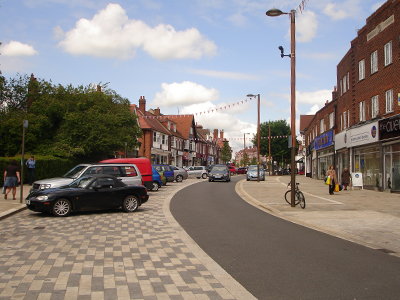
Meanwhile the locals think traffic is a major problem. John Adams Way undoubtedly buggered the town up. Today it is at a seeming halt and the obvious cry from our local car lobby is to build another bypass. The lack of progress in the matter has created great political tumult to the point where independent political parties have emerged over the issue and were briefly in charge of the council. The independence of the flatlands lives on but did the Boston Bypass Party see the irony in their name? Bypass Boston. Their raison d’etre was after all a little myopic. The County Council planned a new link road but it was way down the regional pecking order: Nottingham hasn’t got a dual carriageway to the M1 and big brother City of Lincoln also wants a bypass.

Subconsciously lending itself to cycling, burdened by poor rail
Yet a bypass is not really the solution: there needs to be better management of traffic and better facilities for alternatives, walking and cycling. The flat landscape and the narrow lanes lend themselves to the bicycle and indeed there are perhaps more cyclists here than many towns of a similar size but little is being done to encourage this beyond leisure. There is a similar dispiriting situation with the local railways: from nearby Grantham it is only an hour to London (or Leeds) but the short thirty-mile journey to Grantham Station adds at least another hour. While the similarly historic Hanseatic Dutch town of Deventer builds a sustainable transport infrastructure, Boston builds a Tesco. It’s enough to make you want to emigrate. Being a pilgrim looking out to sea is nothing new here.
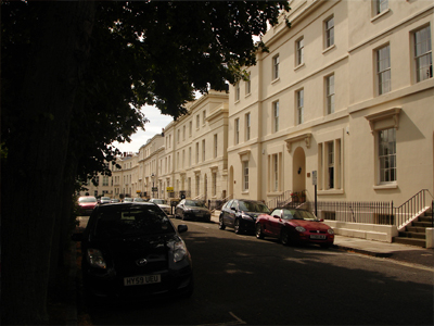
Suburban Nonconformism

Genteel doorways are profuse
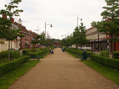
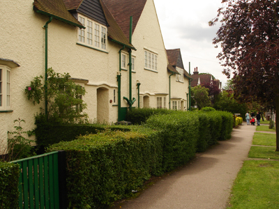
Boston doesn’t just have a strong and varied centre, but also good suburbs and generous public spaces. For this you need two wheels but these are good streets to enjoy cycling and for the most part drivers give you a wide birth. From Tower Street you can explore Haven Bank, where the split level Victorian houses are almost metropolitan. From the industrial archaeology setting of the Grand Sluice you can carry on north along the river as far as Lincoln. This is an excellent new car free leisure route called the Water Rail Way – so hats off to the local council and Sustrans. Back along Norfolk Street you meet Central Park which is packed with youth and framed by crude Victorian bay window civility. The Wrenian domes of the grand Wesleyan Methodist chapel coupled with the stump create an impressive skyline. Pevsner is disdainful about the 1909 restored façade but it is almost Louis Sullivan in its turn of the century classicism.

Wesleyan Methodist Chapel
Heading out towards the Maud Foster Drain you can explore more industrial heritage: the ubiquitous Lincolnshire Windmill, the half-hipped granary, the huge mute water tower and John Rennie’s bridge by Horncastle Road. The banks of the drain are met with nineteenth century terraces of different ages, shapes and sizes. Quite uniquely for England they face the water and are provided with half a mile of public footpath from Queens Road all the way to Windsor Bank. Regeneration UK PLC take note. Heading back into town along the hair raising boy racer Skirbeck Road it is worth seeing the post reformation Hussey Tower, if only to marvel at contemporary ignorance: it is sadly framed by a legoland cul-de-sac. The unique townscape views of the river and the half-hipped warehouses either side of Haven Bridge are ruined by the get-me-out-of-here John Adams Way. High Street down to the Black Sluice is a fascinating detour of derelict Georgian masterpieces with twentieth century dock-scape views but is treated as rat run for impatient drivers. Then just when you thought Asda marked the western end of civilisation, the Carlton Road area continues to surprise with leafy Edwardian charm and individuality.

High Street: too good for a rat run
Cosmopolitan Boston
Boston has neglected the fact that is it has constituent elements from different parts of the world. It is cosmopolitan and illustrates the varied regional and conflicting social history of England. The built environment reflects the ebb and flow of town success – it is still under-researched and in parts worryingly poor. The locals have an obsession with congestion and new developments such as Endeavour Business Park and Tesco threaten to strangle the life out of the town. Yet there is much we can learn from Boston, not just in terms of history but also as a template for good urban design: Pevsner called for a Royal Commission, Tom Dychoff called for the defibrillator but it now looks as though improvement could be on the way in the shape of major flood defences. In the meantime it should lean from its old European lowland neighbours about sustainable public transport and contemporary design.

Maud Foster Drain – note the footpath
N.B.
A swift half of Bateman’s XB was enjoyed at the Kings Arms Inn
--
References:
N. Pevsner & J. Harris, Buildings of England Lincolnshire (2002)
N. Wright, Boston: A Pictorial History (2007)
G. Morey, The North Sea (1968)
M Burkhardt, “One hundred years of commerce at a Major English Seaport”, in The dynamics of economic culture in the North Sea and Baltic Region (2007)
R.W.K. Hinton, “Dutch Entrepôt Trade at Boston, Lincs., 1600-40”, in Economic History Review, Vol. 9, No. 3 (1957)
R.W.K. Hinton, The Eastland Trade and the Common Weal (1959)
Boston Borough Council, Boston Waterways' Development Plan (2008)
Boston Borough Council, Town Centre Study (2007)
Acknowledgements:
Also thanks to @langrabbie for the Entrepôt article find