Quantcast
Channel: Jones the planner
Viewing all 79 articles
Browse latest View live

Nottingham - A Reluctant City

$
0
0

Historic patterns and new technology - there's something in that


After ‘The Killing’ Birger Larsen has moved the action of ‘Murder’ from Copenhagen to Nottingham. He thinks Nottingham is exotic. Well, having blogged about Copenhagen perhaps it is time for us to take a look at our home city. Actually not quite my home city but I was a planner there for 30 years, latterly as Director.


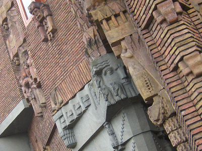
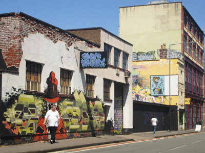
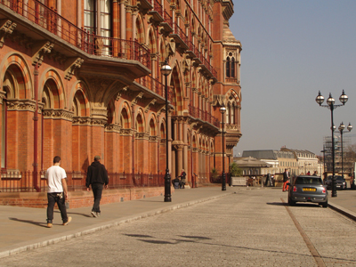
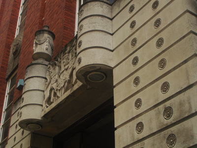
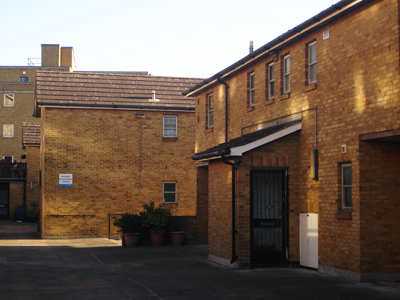
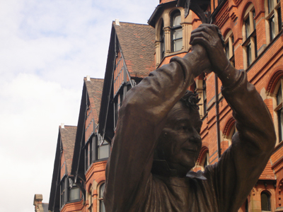
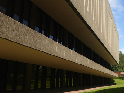
Careful, DH Lawrence might have pissed here - Arkwright Building NTU

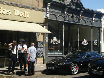
When I first arrived in the 1970s I was struck by the strong, independent character of the place, summed up by Ian Nairn as ‘neither Midland nor Northern but with a black veined soul of its own’. Of course your image of Nottingham could not help but be shaped by ‘Saturday Night and Sunday Morning’. Twenty years after Albert Finney’s fine portrayal of Arthur Seaton, and despite massive slum clearance and redevelopment, Nottingham was then still very much the place of Sillitoe’s portrayal; a working class, bolshie city that played hard and took full employment for granted. That was one view of Nottingham anyway; the Council had a more self satisfied picture of the place; it was ‘the Queen of the Midlands’. There is something in that too: the exciting topography, the impressive space of the Old Market Square, a confidence and sometimes grandeur in the buildings. But radical Nottinghamians would subversively preface this soubriquet with ‘the arse of the north and ...’.


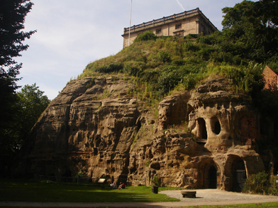
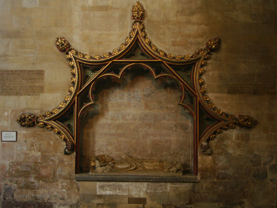
The Castle: the real history is more interesting than Robin Hood

Nottingham has never been quite sure of its identity. Bloody Robin Hood has a lot to answer for, or at least Basil Rathbone and Alan Rickman camping it up as the Sheriff of Nottingham. Of course this is impossible to live up to. The merest tarted up fragments of the medieval town remain. The Castle on the dramatic Castle Rock was rebuilt in 1687 as a north Italian palazzo. Burnt down by radicals in the 1831 Reform Act riots it was ineptly restored by the ubiquitous Victorian hack T.C. Hine as the dreariest museum and art gallery you can imagine. The Castle does have its moments though; the fantastic flight of steps up to the magnificent Baroque east façade, and the stupendous view of the Trent Valley.


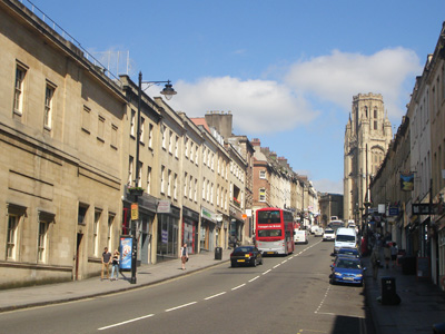
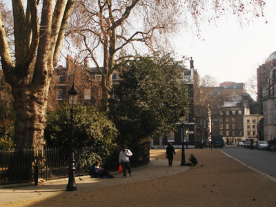
Ancient streets surviving the numbskull age of the private car 

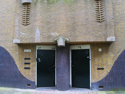
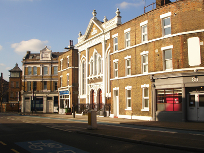
The influence of Errol Flynn’s tights has been quite profound on Nottingham’s view of itself. It clings to the idea that it is a historic city, and yes of course it is albeit re-written by the Victorians. Ian Nairn lamented the destruction of the Stuart and Georgian streets between the Old Market Square and the Castle and some remnants did survive. Castle Gate was restored by the City Council in the 60s, I had assumed out of guilt and remorse at the destruction of the streets around it. Now these fine buildings, formerly used as a museum, are empty, boarded up and on the market as ‘an exciting commercial opportunity’, so I must have been wrong. Byron’s house on St James’s St faces an NCP car park; an interesting juxtaposition, but not conventionally touristy.


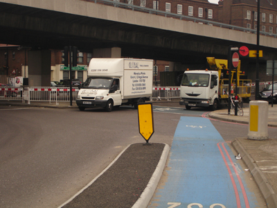
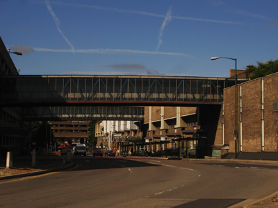
Castle Gate: How this was scythed by the following image


Nottingham: an early martyr of highway engineering

Nottingham’s laissez faire attitude to planning, which resulted in the hideous Maid Marian Way and Broadmarsh Centre, came to an abrupt halt in the early 70s. It was replaced by militant conservationism. Public opinion reflected by politicians seemed in a state of shock, a genuine sense of loss for what had been before. The desire to return to a 1950s arcadia became so much the received orthodoxy that there could be no rational discussion. Simon Jenkins spits particular venom at Nottingham today because of the destruction in the 1960s of the city he remembers, visiting the sins of the planners upon their successors unto the third and fourth generation. The problem with this is that it is a sentimentalised and dishonest view of the past. Sillitoe in novels like ‘The Loneliness of the Long Distance Runner’ shows us why Nottingham needed to change. Coates and Silburn paint a damning picture in their seminal study of St Ann’s before its redevelopment, ‘Poverty, the Forgotten Englishman’.


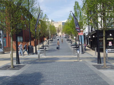
Extending pedestrianisation northward at Old Market Square


Somewhere in a parallel universe, Cloughie became Prime Minister

Conservationism and the Robin Hood delusion are actually part of a wider Nottingham psychosis - its reluctance to be a big city. It was made a City in 1897, not because it asked to be one but Bradford and Hull, with typical Yorkshire bumptiousness, were pressing for city status and the civil servants realised that Nottingham was actually larger. Earlier the town had refused to expand beyond its medieval boundaries onto the common fields until 1845, leading to fearful overcrowded slums and leaving a pernicious legacy of slum housing into the mid C20th. This led to the heroic if flawed massive clearance and redevelopment in the 60s and 70s. There was a further fateful consequence too – when in the 1920s Nottingham sought to expand its boundaries to include the burbs, they successfully pointed to the City’s slum problems. The boundary extension was not approved and the City did not try again. Instead it built the pompous Council House completed in 1929. Designed by the Council’s architect Cecil Howitt as Elain Harwood points out it displays all the classical tastes of the day. The interior is beautifully appointed like a gentleman’s club, which it was - the antithesis of the ‘People’s Palaces’ town halls of the 1930s. The suburbs are still politically separate, not real places at all but defined by NOT being part of the City. This profoundly debilitates the capacity of Nottingham to think and act as the city it actually is, a clearly defined urban area of about 600,000 people.


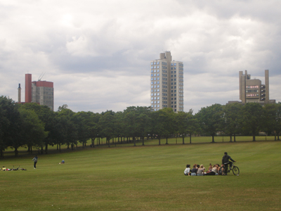
Jubilee phase I - nice, though a long way from the world of Arthur Seaton

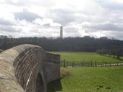
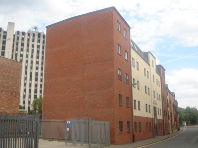
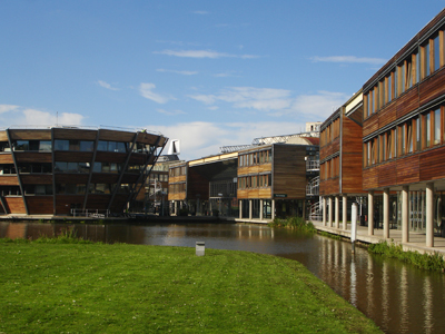
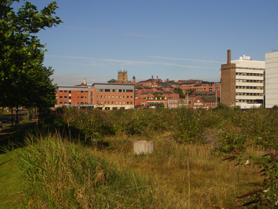
Nottingham, an industrial city, took a huge knock when mad monetarism closed down much of its industry. Because of its broad industrial base, this came later than in Sheffield and other northern towns and was less dramatic and visible. There were not huge swathes of derelict heavy industry, but lots of empty factories. The basis of the working class city changed irrevocably, so much so that Nottingham now has less manufacturing employment than the national average. Arthur Seaton famously said ‘don’t let the bastards grind you down’, but global capitalism did. The Raleigh factory where he worked is demolished. The bikes are imported from China and the factory site is now the Jubilee campus of Nottingham University, which has many Chinese students and a campus in Ningbo; as neat a metaphor for economic change as you could find.


Boots: A modernist masterpiece - if you can get past security

Boots, always synonymous with Nottingham, has not only survived but prospered in the global economy but with a very different culture to the patrician company which commissioned wonderful buildings at its Beeston fiefdom. This is an area the size of Monaco to which you won’t get access, which is a pity because the Owen Williams buildings are just stupendous and the 60s SOM HQ is to die for. Nearby the Players Horizon factory by Arup is heroic.


Standing up to central government - The Inland Revenue building


A public street not dominated by car parking but shame about G4S

Nottingham’s reaction to de-industrialisation was not go for development at all costs. It did not court regeneration, like Manchester or Birmingham, nor did it just lie back and let it happen, like Leeds or Southampton. Its bravest decision was rejecting the government’s bog standard design and build for the new Inland Revenue HQ, resulting in a design competition won by Michael Hopkins. I think the result is outstanding, particularly the confident plan with almost collegiate spaces between the buildings not dominated by car parking – a scheme far ahead of its time. More generally the City took a basically reactive and sceptical approach to development, keen not to compromise its self image as the ‘Queen of the Midlands’. In this it was not entirely successful as the most cursory exploration will show. But things could have been a lot worse if the development industry had really been interested in Nottingham, which it wasn’t.


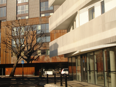
Wasteland Eastside: Now twinned with other neoliberal disasters

Landowners and regeneration quangos dreamt grand schemes but not much came of them. The former Boots works at Island St provides a good insight. Promoted by the private sector over 20 years ago as a mini Canary Wharf (which we nicknamed Budgie Wharf), decontamination and infrastructure were publically funded through City Challenge but only a few business park type offices and cheap hotels materialised. Then in the Blair boom another hugely ambitious plan for offices and now including apartments with vibrant mixed uses, on an even bigger site including derelict railway warehouses. Years of negotiation ensued, a bonanza for consultants: environmental impact assessment (in large boxes), flood risk assessments, masterplan, design codes, listed building consents, highways agreements, waterway agreements, affordable housing, S106 and phasing plans. Nothing happened. And then came the siren of Tesco as regeneration enabler; not a shed as you know it but seductively cloaked by Mangera Yvars. To its credit the Council said no. The site is still a wasteland, the warehouses pathetically derelict, and there is no plan.


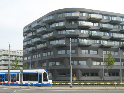
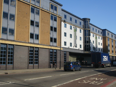
Southreef: still incomplete because the financial world is failing us 


Another utterly incompetent building from Jurys Inn

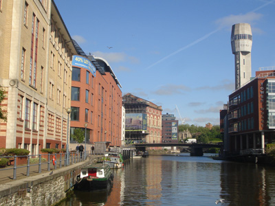
Elsewhere regeneration was more successful, such as along the Nottingham Canal. Here you will find some impressive schemes including Hopkins’s Inland Revenue, Castle Wharf by Franklin Ellis, offices by ORMS (now occupied by the Council) and Southreef by Levitate; a clever and satisfying mixed use design for a very difficult site, but sadly showing the fragility of the local market as the developer can’t seem to complete it. Opposite this Jury’s Inn displays its usual sensitivity, although this was not entirely the architect’s fault – the Planning Committee wanted it to be more ‘iconic’. Yes, well.


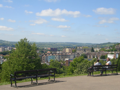
The admirable aesthetics of a once paternalist city - Highfields Park

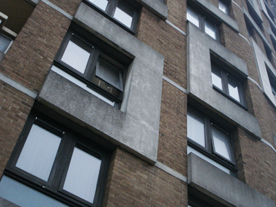
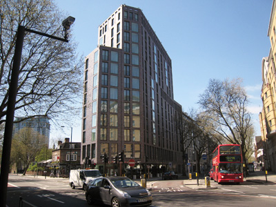
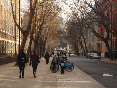
A huge driver of the new economy has been Nottingham’s two universities, THE Nottingham University (TNU) and Nottingham Trent University (NTU); one a Russell and the other ex Poly; both highly successful. The City was slow to appreciate the economic importance of the universities but the impact of 50,000 students became a big problem in the terraced streets of Lenton in particular – Nottingham’s version of gentrification. The only real solution to this is to promote new student housing blocks but this is a notoriously difficult design typology. The barracks flats of Radford are nothing to be proud of but at least the more recent developments are making an effort.


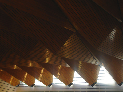
The Hallward Library TNU: Wow but the interior has been buggered


Jubilee phase II features the most pointless bridge in town

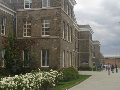
TNU’s rolling parkland campus began in the 20s with Portland stone and moved on to surprisingly good neo Georgian in the 50s (both underscoring the conservative nature of the institution) before a convincing shot at Brutalism. The first phase of a second 'Jubilee' campus on the old Raleigh factory site was designed by Michael Hopkins and, like his Inland Revenue HQ, is a carefully considered, quietly confident and slightly flawed essay in sustainable design, ideal you would have thought for a university with a strong sustainable energy and construction reputation. But evidently it was not jazzy enough for a university competing in a global market. The second phase is by Make. There is no point in my competing with Owen Hatherley’s coruscating denunciation of this in his book ‘Ruins’. To my shame I was the officer on the planning bridge when this happened.


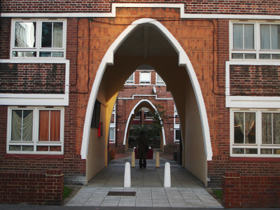
NTU renewal - sorting out the courtyard mess


From awkward corner to public space

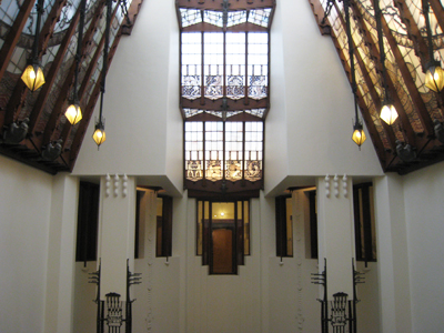
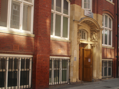
Meanwhile NTU was trying to make sense of its disjointed city centre buildings, including the original university Arkwright Building designed by Lockwood and Mawson in 1877. Howitt’s amazing Stalinist tower in Portland stone, the Newton Building, was built as late as 1958. Both are listed but needed huge investment and new functions. Hopkins again was called in and his solution – a very elegant glazed atrium between the two buildings and a new quad - provides a focus for the whole campus. However this eminently sensible and carefully considered design resulted in a titanic struggle with English Heritage over such Jesuitical niceties of procedures as would try the patience of someone much less hot tempered than me. Eventually the scheme was splendidly executed. In its latest commission NTU have gone for an Alsop-esque eye catcher.


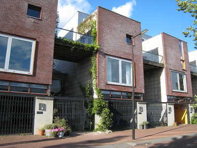
Inequality & security are close relations - The Park Estate


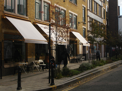
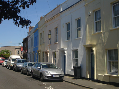
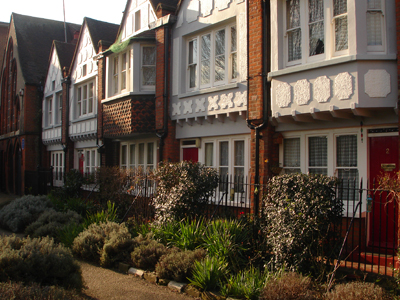
Inner city bourgeois charm  - unusual for industrial England

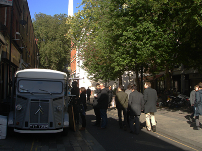
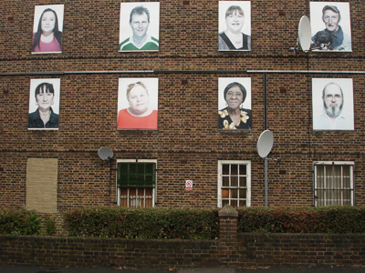
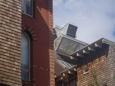
As elsewhere the transition to a service economy in Nottingham has been at the expense of the working class, job security and social cohesion. This is not immediately obvious because inequality is most pronounced in the extensive sub garden city banlieue rather than in the sometimes too dynamic inner city. Unusually too for an English industrial city the haute bourgeoisie live right next to the city centre in the Park Estate, a Victorian gated community. Birger Larsen chose Nottingham for ‘Murder’ because of its edgy reputation, a fiction which becomes self fulfilling by tabloid repetition. Actually the place is not that exotic but it is interesting. Areas like Sneinton (unpronounceable) retain a fascinating village like feel which defies gentrification. Hyson Green once notorious for its deck access flats has reemerged as an interesting multi cultural area with inviting Asian supermarkets and independent shops. The New Art Exchange by Hawkins Brown is the first regional arts centre devoted to promoting ethnic and minority arts. Along Gregory Boulevard is Foster’s Djanogly City Academy, elegantly cool; a big statement for the area if not one I approve of.


Sneinton: Defying gentrification - through civic responsibility (and poverty)


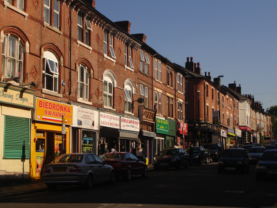
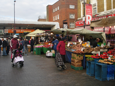
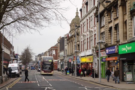
One of the most interesting high streets in the city - Radford Road


The best samosas in town mate - Hyson Green

Like most cities there is a lot of poverty alongside conspicuous wealth. This relentless alienation of the dispossessed is painfully captured in Shane Meadows’s films, so much so that I can hardly bear to watch. A more nuanced view of the city can be seen in ‘Weekend’ directed by Andrew Haigh, a sort of gay ‘Brief Encounter’ where they actually get to do it. This is shot to give amazing new perspectives of the city you thought you knew; a really insightful and delightful film.


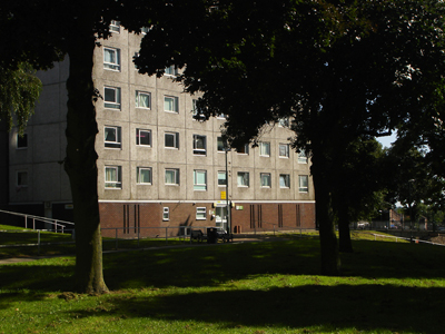
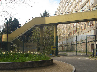
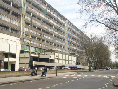
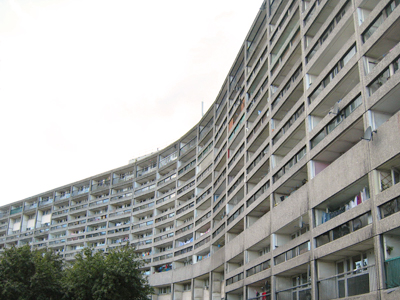
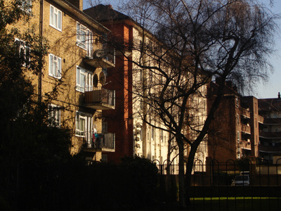
Greener than any Legoland estate - Lenton Flats


Popular with residents so what's the problem?

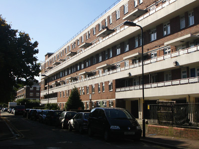
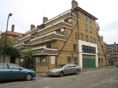
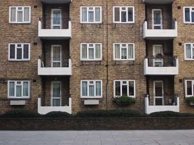
The action in ‘Weekend’ revolves around the Lenton flats, tower blocks built in the 60s which form an attractive composition in long views together with the topography and landscape. They were part of the massive programme of high rise and deck access developments of that era in Nottingham which had one of the largest clearance programmes in the country. In the 70s over half the homes in Nottingham were Council houses or flats, but within a few years the deck access flats were being written off as a disaster and demolished. The Thatcher view of Council housing as failure is pervasive. Problems are perceived with all typologies of Council housing even if Alice Coleman’s theories are easily disproved by a visit to garden city inspired estates built between the wars, where the worst problems of deprivation are to be found. It is not the houses, it is poverty and lack of opportunity. But poor maintenance and management are used to justify a ‘knock it down and start again’ solution and this sadly seems now to be the fate of the Lenton flats, although how this can be sustainable or economically sensible is hard to see.


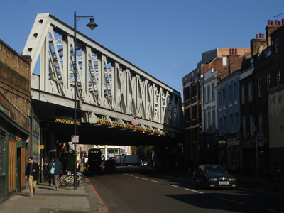
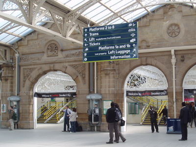
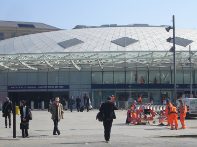
The Edwardian dinosaur

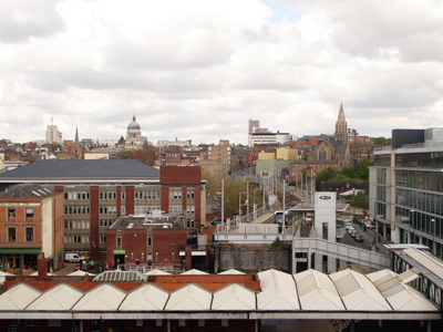
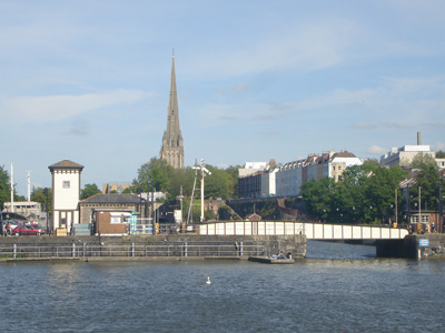
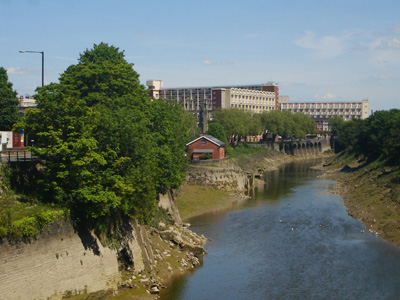
The parting in ‘Weekend’ takes place at Nottingham Station against disembodied announcements – ‘24 hour security is in operation at this station; please do not leave your luggage unattended as it may be removed or destroyed by the security staff’ - brilliantly capturing the anomie of the place. Nottingham Station has been almost as peripheral to the privatised rail industry as Carnforth but this grand Edwardian dinosaur is finally being renovated and extended thanks to the persistence of the City and Nottingham Development Enterprise, which also promoted the Nottingham tram. This took 15 years of nagging the government until finally Prescott gave in – but it was worth it. By far the handsomest tram in Britain, care was taken in its integration with the streetscape of the city centre, unlike other cities where engineers ran amok. Two new tram lines are currently being constructed from the Station. Now NDE is folding because of lack of funding, another victim of Coalition Britain’s cluelessness.


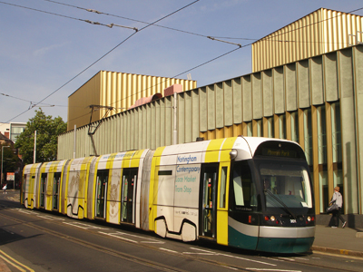
Perhaps the best new art gallery and tram in Britain


Taming the expressway for people - Maid Marion Way today

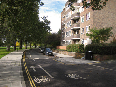
Although Nottingham has always lacked a clear planning vision, it is strongly focused when it comes to transport policy. In the early 70s the City scrapped plans for new highways and introduced traffic restraint and public transport priorities far ahead of its time. In 1998 the City became a unitary authority again with a radical transport agenda at a time when Prescott was turning on the funding tap. It is the only city to have introduced a tax on workplace parking spaces – a lot of fuss about that but it has been done and funds the new tram lines. Courageous schemes like closing a whole section of the inner ring road had strong political support and Nottingham has done a lot to make the city centre pedestrian-friendly, getting rid of nearly all the subways and creating new public spaces. However, although high quality materials are (mostly) used street design lacks flair, certainly compared with Leicester. The Campaign for Better Transport ranks Nottingham as the least car dependent city after London and Brighton. Nottingham’s use of public transport is the highest outside London; three times higher than in Bristol, a similar sized conurbation.


More of this please: pedestrian and cycle improvements in Hockley 


And less of this: The Broadmarsh gyratory 

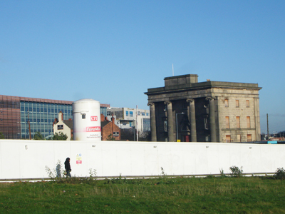
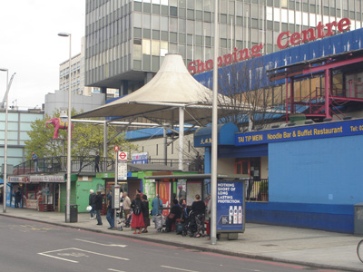
But on leaving the Station you will soon discover the grim face of Nottingham. Your route to the city centre is blocked by the execrable Broadmarsh Centre, the area dominated by roaring ring road traffic, the buildings and townscape the meanest it is possible to imagine. And this at the principal entrance to the city centre, overlooked by the Castle and the Lace Market, a shocking indictment of Nottingham and its  incapacity to shape its own destiny. Birmingham’s 60s Bull Ring presented similar complicated challenges, but Birmingham had the vision and determination to change the situation. Nottingham now has more empty shops than any major town, or so Today says, based on the usual dodgy data.


An insult to the Castle and the Lace Market cliff - Broadmarsh

Nottingham was unfortunate in that Westfield, or Wastefield as it is known in Bradford, bought the centre and spent 10 years developing ever grander plans for redevelopment. In retrospect these plans look like  prototypes for White City; alien, alarming and anti-urban. All the Design Review in the world cannot wash away the damage such a flawed concept will inflict on a city. And yet we are expected to believe that the Olympic Westfield is a triumph of regeneration. In some ways Nottingham was lucky that Wastefield pulled the plug last year but the City now waits on the new shopping centre owners, who have appointed mall specialists Benoy to come up with a scaled down scheme. So the future of the city centre will be determined in board rooms far away, not by Nottingham.


An urban balls up - Trinity Square

The contemporaneous Victoria shopping centre has always been more confident and successful than Broadmarsh. Although dismissed as a concrete eyesore it has wonderfully sculptural Council flats above which if viewed enfilade look like an expressionist liner. It is a pity the flats have been painted blue and pink in an attempt to make the concrete look cosier. Worse is the plan to further extend the shopping centre as an inward looking box such as even Westfield would no longer dare. Across the way the new Trinity Square development is violently hated, a good example of the fallacy that redevelopment of 60s buildings will necessarily be an improvement.Design guru Peter Bishop says this is one of the worst new developments he has seen. Cheapjack and over scaled certainly but I think he needs to get out more; the small new public space is actually well used despite its crass paving. There is currently a competition to improve it, which seems very much like fiddling whilst Broadmarsh burns. Looming over Trinity Square the new E-on HQ currently under construction makes itself ridiculous by trying to disguise its bulk with a crude curved roof defering to the redundant Victorian Guildhall next door. Down the street the interesting 30s police and fire stations are apparently doomed.


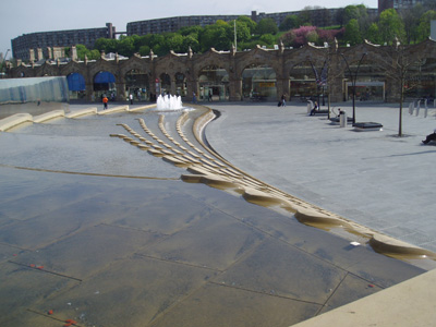
The people are always more interesting than the "events" - Old Market Success

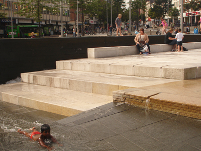
The friendly and generally attractive city centre streets radiate from the Old Market Square, after Trafalgar Square the largest in England and the spiritual heart of Nottingham. The market was turfed out when the Council House was built and Howitt redesigned it as a formal ‘Slab Square’. A highlight of my career was (with NDE) to get Nottingham to accept a redesign of the Square, which went against its conservative instincts. The winning scheme designed by Gustafson Porter is, in my clearly prejudiced view, a stunning triumph of elegance and functionality, although not achieved without glitches and tears. It has been hugely popular with Nottinghamians; so many children play in the water features that life guards have had to be employed. One of the great pleasures is to sit quietly admiring the space and people watch. Unfortunately there is an obsession with staging events so that you can hardly ever fully appreciate the space without a clutter of extraneous crap. The latest threat is a monstrous TV screen on one of the buildings. What sort of moron would inflict that on the ‘Queen of the Midlands’?


In the 60s the local Tories had alternative plans for a car park

Despite a general conservatism and complacency in planning, Nottingham has been willing to take brave decisions, sometimes. Peter Moro’s Playhouse was one of those back in 1961. More recently the Planning Committee unanimously supported Adam Caruso’s Nottingham Contemporary despite the yellow press. Almost braver was its support of Benson and Forsyth’s uncompromisingly Modernist hotel and shops at Fletcher Gate in the Lace Market, intelligently commissioned by local developer Bildurn. This brilliantly broke all the conventional platitudes of the planning brief for the site. But generally Nottingham was content to be reactive, which I found very frustrating. I remember once showing some planning bigwigs around the City, explaining what was wrong and what needed to be done and one of them said ‘do you like anything about Nottingham?' Well yes, but it could be so much better if only….


Tramlines and De Stijl squares - Benson & Forsyth's The Pod


But militant conservationism has its good points. The Lace Market is a case study. This unique area, where grand Victorian warehouses crowd narrow medieval streets and collide with the elegance of the C18th around the magnificent C15th St Mary’s church, was virtually derelict by the 1970s. Its restoration is a great success story of perseverance, but it is a Forth Bridge job. The Lace Market is once again in decline, burned by the recession. The fashion trade has gone, many of the creative industries have folded or moved, city living has lost its glamour and the once hedonistic night life has been tamed by a new authoritarianism. The new Lace Market Square, with imaginative artwork and landscaping by Fiona Heron, has not managed to let its restaurants and bars. WW2 bomb sites remain undeveloped and no solution can be found for the remaining derelict buildings. It is the morning after the night before. The new City Deal for Nottingham includes vague plans for a ‘cultural quarter’ in the Lace Market and nearby Sneinton Market; standard regeneration issue. But Nottingham does at least have a strong artistic tradition and maybe its edgy reputation is not always a liability. Sneinton Market has recently been handsomely if slightly austerely redesigned by Patel Taylor and Sneinton Baths splendidly rebuilt by Levitate, retaining the Victorian tower. The infrastructure is there, but needs animation.


Sneinton Market - handsome, if slightly austere

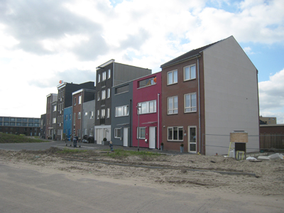
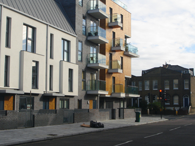
When I first came to Nottingham it was a confident, independent minded city. Now like the rest of industrial England it is a client and supplicant of Whitehall, the City of London and globalisation. It has not helped that Nottingham has been slow to perceive and define a new role for itself, but in any event it lacks power, political and economic. This is really evident in planning and housing. What the city needs is family housing but in the Blair-Brown boom years what it got was a deluge of bog standard buy to let speculative flats, mostly repeating the design and (lack of) management mistakes of the recently demolished Council flats. If Nottingham got off lightly compared to places like Leeds, this was largely down to the determined opposition of Councillors. What Nottingham also needs is real jobs in industries such as construction and green technology, where there is significant local strength.


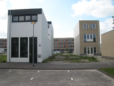
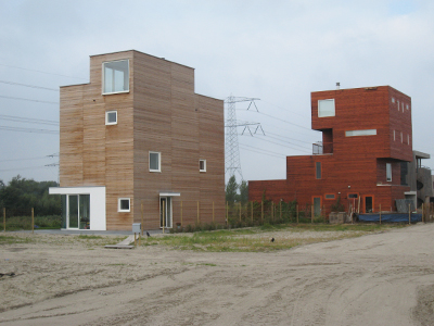
Marsh house - the Meadows


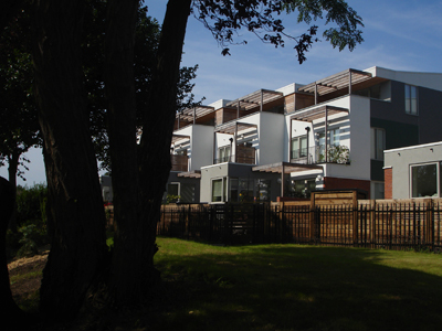
Green Street - the beginning of better inner-city housing? 

Maybe there are some glimmers of hope. Near Trent Bridge at Green Street (not a marketing invention) developers Blueprint have built new energy-efficient high quality family terraced housing on a brownfield inner city site, designed by Julian Marsh whose own innovative and award winning zero carbon house is nearby. You can get there on the Big Track, a 10 mile cycle circuit along the River Trent with new bridges linking this to the Nottingham Canal towpath. It is being extended along the Leen Valley through what was industrial Nottingham, past the old Raleigh site. Bikes and Nottingham – makes sense. There is strong political commitment to improving the cycle network although a long way to go before Nottingham will rival Copenhagen for bikes as well as moody atmosphere. Nevertheless the Big Track is one of the best ways to see this fascinating if frustrating city. Enjoy.


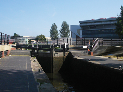
New bridge connecting canal towpath to riverside path


The Big Track & Victoria Embankment - a cycling and public realm triumph

A much more comprehensive account of Nottingham is found in the outstanding Pevsner City Guide by Elain Harwood who comes from Nottingham, ok Beeston.

Ken Powell’s Nottingham Transformed (Merrell) written in 2006 before the world turned upside down (or rather before we noticed) deals expansively with the developments of the last two decades.

Owen Hatherley’s chapter in his ‘Guide to the New Ruins of Great Britain’ (Verso) lays bare the reality that is Nottingham today.

Self Build & the Amsterdam School

$
0
0

The Amsterdam School - too brilliant for words

In 2010 the new Planning Minister Nick Boles pronounced that he and the Coalition leaders did not believe planning can work: ‘chaotic in our vocabulary is a good thing’ apparently. So he must think the Coalition is doing exceptionally well. The blizzard of contradictory policies and initiatives has certainly created chaos, confusion and paralysis in the development world and would be laughable if it was not so fucking serious. It is down to a lethal cocktail of arrogance, incompetence, naïveté, cynicism, Bourbon stupidity, short lived policy wonk enthusiasms and now desperation.


Amsterdam School and oligarchy – Sheepvaarthuis 1917

Not long ago the much hyped government enthusiasm was for self build housing. Well it would be wouldn’t it - never pass up a libertarian sound bite. But as ever self build is not quite what it seems. Firstly, it does not usually mean building your own house Grand Designs style. It might mean commissioning your own house from an architect as the upper classes have always done. To Tory policy geeks, vaguely remembering John Betjeman’s celebration of English eccentricity, it is probably a new version of Essex plot lands. More sober minds envisage collective private development; sounds boring but actually has the seeds of a very good idea which takes us back to the roots of social housing.


One old colonial roué visits another – the RN at IJ Haven

We followed in the footsteps of Grant Shapps to Holland, which has led the way with self build. Dutch housing has a good reputation for design and space standards and is often cited as an exemplar compared to the dire quality of new British housing. In many ways the Netherlands is very similar to Britain: Protestantism, maritime empires, that sort of thing. It also turns out that the Dutch, like the Brits, are mortgaged up to the hilt and the housing market is at rock bottom. Dutch society has always been pluralist, accommodating very different impulses. So, on the one hand it is ordered, restrained and sober and then can be hedonistic, individualistic, vulgar and sentimental. This is reflected in its architecture, popular taste and politics.


Self Build - formerly known as The Wild West (cue Morricone)

The impetus to self build in Holland is political, as with its Tory imitators. Whilst it is tempting to see northern Europe as the model of the society we could and should become, in fact the Netherlands is going through very much the same stresses as Britain. Many politicians want to fundamentally remake the economy and society, to break the consensus tradition and the welfare state model which is no longer seen as affordable. Self build is a part of that libertarian impulse, but perhaps surprisingly championed by a Labour politician, Adri Duivesteijn. Its objectives are to foster organic growth, small scale, demand driven and personal housing – a huge challenge to the traditional approach to housing. 10 years ago a law was passed requiring a third of new houses be self build by 2040. Of course it is much harder to deliver than to dream, and especially so in the midst of an economic and housing crisis unparalleled since the war. To push forward his dream Duivesteijn became Alderman of Almere, a new town outside Amsterdam where the biggest self build experiment is now underway.


Koolhaas cool – Almere’s new shopping centre

It is a shock to get off the train 30 minutes from Amsterdam and find yourself in what initially looks like Corby. Almere was built on land reclaimed from the Zuider Zee, starting in the 70s. It now has a population of 200,000 and is set to nearly double in size. The 70s town centre is pretty grim but Rem Koolhaas has masterplanned an extension which is cool if impersonal - buildings as confident objects not especially trying to please, open streets and a market - so about as good as you are going to get from a shopping centre. In the suburb of Homeruskwartier a 100ha site has been allocated for ‘self build’. 3,000 houses are planned, divided into sub areas of about 700 houses, each area with a theme prefixed ‘I Build’; Live-work, Sustainable, Free, Garden Homes, Canal Houses, Extra, Developer. So far about half the houses have been built.


Are they insane? The house with no windows

What you will find challenges many assumptions about the built environment. There is virtually no control on design so what you get is an extraordinary cacophony of style, much that is absolute crap like crude pastiche of traditional Dutch farm houses and the inevitable International Hacienda style. Some is mad (like no windows) but surprisingly amongst all this are some really interesting and well designed houses. Plots are developed in a random way so the place is a permanent building site. The roads are laid out but there is hardly any landscaping and this on flat, sandy reclaimed land, so it looks very, very bleak. The general impression is of a wild west building site with no urban coherence whatsoever. If this is what Tory geeks have in mind for Middle England they will soon be swinging from lamp posts.


Self build in action - the future for Middle England?


Self bodge: freedom is not a licence for chaos

But there are some interesting lessons here. Firstly there is more planning than may be immediately apparent. The municipality owns the land, commissions the masterplan and provides the infrastructure. Plots are sold cheaply – about £25,000 for an average sized plot. How different from Blighty where land is ridiculously expensive, volume builders call all the shots and there is endless argument about infrastructure costs.


The sheer banality of raw individualism


The sad opposite of planning

The essential thing about ‘self build’ is that the occupier has much more control – they actually set the brief for the house they want. Often a developer will customise a fairly standard house design but many people do employ an architect who manages the construction. The absence of design control has encouraged architects to ‘rethink the parameters’ so it is mostly screamingly individualistic. The kit houses come as aesthetic relief. Despite the ‘look at me’ designs most people, we were told, are much more interested in the internal space than what the house looks like, which possibly explains why so many design concepts are so poorly executed. Interestingly, most of the new houses are small – only about 40 square metres on average, which was a surprise especially after the recent RIBA lobby. Apparently when people plan their own space they design it more economically. The other factor is that many can now only afford small houses.


iBuild (and don't get out much)

Perhaps the most interesting aspect of self build is the potential for ‘club’ development, sometimes called collective private development (although ‘collective’ won’t do as a marketing tag). Collective development is where a group gets together to act as its own developer, usually for row houses or a small block of flats. Often someone with a construction background will organise the club of between 10 and 30 people and collectively they will write a brief for an architect then let the building contract. However the houses are individually owned and everybody raises their own finance. The involvement of people in designing their homes from the outset, we were told, results in much higher levels of satisfaction and pride and commitment to the local community. It is not usually cheaper –you save developer profits but construction costs tend to be higher because design is customised, not standardised. However there must be opportunities for more prefabrication and for people to fit out the shell of their new homes, which doesn’t happen much in Holland.


Ok, some interesting housing ideas here, but the street is a dog's dinner

So, despite the initial shock, there may be much to learn from self build in Almere. Certainly it is unfair to judge development that is not yet complete, especially as allegedly it is weathering the deep recession much better than the conventional builders. The visual and constructional chaos of Homeruskwartier contains the germs of some good ideas, but perhaps less ideology and more pragmatism would help to achieve a more satisfactory outcome. The lack of any control over design is actually inhibiting investment as people fear what will be built next to them. And if self builders are more interested in the interior, why make such a fetish of the freedom of vulgar external display? It is a bit like your dog pissing to mark his territory. The Dutch also excel at handsome, understated and very well landscaped suburban villas which serve as a far better model.


Ah that's better - thank god for professional and planned design

The concept of collective development goes back to the genesis of Holland’s exemplary social housing of the early C20th. With far more prescience than today’s triumphalist neo-liberals, the Dutch establishment recognised that insanitary, overcrowded housing for the working class represented a threat to their own health and security. A 1901 Housing Act provided funding for housing associations to build new model homes. Holland avoided involvement in the First World War so whilst the combatants slaughtered each other in nearby Flanders, Amsterdam was building extraordinary new workers’ housing. The famous Het Schip development was built in 1917–20 for the housing association of the dock workers’ union, which employed Michel De Klerk to meet planning requirements. He and the other likeminded ‘Amsterdam School’ of architects broke away from the proto modernism of Berlage to create an extraordinary eclectic style owing much to Arts and Crafts but expressed not as nostalgia but as a sort of organic abstraction which is startlingly original.


A brilliant school of thought - Het Schip

For De Klerk, form did not follow function; beauty was all. This led to some extreme whimsicality at times in his designs and far from sensible internal layouts, but what is so engaging about Het Schip is the way the imaginative design concepts are so painstakingly carried through. The quality of the workmanship and detailing is extraordinary, the brickwork often subtly parabolic and wonderfully executed … it is just so beautiful. Of course the development went wildly over budget. The centrepiece, now a museum to the Amsterdam School, was a post office which served an important social function as it is was here that the dock workers were paid, not in the pub as previously.


Telephone booth for the workers – note telegraph wire and insulator motif

The slightly later De Dageraad complex designed by De Klerk and Piet Kramer was commissioned by the General Workers Co-operative in 1920. It was a symbolic statement of the socialist City Council as well as the co-operative and was described as ‘a social and moral victory’ and ‘a dream in bricks and mortar’. The estate included a clubhouse, schools, library and shops and the flats were spacious, comfortable and hygienic. They were also beautiful: ‘nothing is too fine for the workers’ declared De Klerk. The designs are extraordinary with the corner elements wildly exuberant like fantastical castles – you can see where Odeon style comes from. These idiosyncratic facades and layouts had little regard for function but created a tremendous sense of place and belonging. This is a stunning achievement which shows the immense symbolic and political importance of social housing, a lesson we should be learning. Today 47% of Amsterdam’s homes are social housing, the highest proportion outside China.


Detail and civic minded architecture - back this way


Plan Zuid

The early years of the C20th were clearly a high point of Dutch prosperity, confidence and architecture. Amsterdam was growing rapidly. In 1917 a plan for a new south extension to the town was commissioned from Berlage. The Plan Zuid is a masterpiece of urban planning, taking its inspiration from the concentric canals of the C17th town to create both monumental and picturesque townscape. Three quarters of the housing was built for the working class, but it is largely gentrified today. The buildings in sombre brown brick are artfully articulated with sweeping curves, turrets and exaggerated eaves, the boulevards busy with shops and cafes and the side streets peaceful and beautifully detailed. Here you can almost see that Welwyn Garden City would have been good if de Soissons had displayed the same urban confidence, and the bricklayers had been as skilled.


Wester Dok bling

In recent decades Holland followed a very similar path to England, with Amsterdam becoming a global city of finance and tourism whilst workaday places like Rotterdam declined. The historic canal districts have been carefully preserved with much new development in the old docks along the canalised IJ, which is shut off from old Amsterdam by Centraal Station and the railway. It is difficult to characterise such huge scale development based on a short visit but impressionistically, whilst much of the new buildings are International Bland, the context and relationship to older areas and of the new buildings to each other is much more coherent than you find in British waterside regeneration. This is partly about the close proximity – like being able to actually walk to Salford Quays or Porth Teigr in 10 minutes. It is also about the much more careful consideration about how areas should be planned as communities. This is not always the case - the parade of 11 storey boxes flanking IJ-haven is dreary enough for the Albert Embankment. The monumental blocks of new Wester Dok are on a different planet from the nearby residential zones which include Het Schip. But even here there is more attention to the street, better architecture, better materials and workmanship together with imaginative uses of old buildings and piers.


Borneo Sporenburg (where Richard Rogers wants to live)

The more widely known Amsterdam waterside regeneration is the extensive eastern docks and in particular Borneo Sporenburg. Richard Rogers and other seers regard this as a model for British regeneration. Redevelopment here has been carefully planned by the City planning department. Each island and peninsula has its distinctive character and development policies. Borneo Sporenburg was one of the later phases built in 1995-2002. The overall plan by West 8 is based on a high density low rise ‘sea of houses'. Over 100 architects were involved, with design codes covering everything from the streetscape to private open space, usually a small patio or roof garden. The plan is a simple grid with largely 3 storey terraces, although the houses often have quite complex layouts, being ‘paired’ like Tyneside flats or with houses to the rear so as to allow for internal parking and some open space. There are also 2 vast flats complexes which, according to the blurb, are to ‘anchor’ the development. This could probably be more honestly translated as ‘to meet the density and social housing targets’.


Self build for lawyers and accountants – Scheepstimmermanstraat

Borneo Sporenburg is long and narrow with plenty of water frontages which lend themselves to continuous terraces, along the lines of the historic Amsterdam canals. The water is animated by dinghies and houseboats and the Dutch have a delightful habit of spilling over pots of flowers onto the pavements by their front doors, so it is all much more charming than the typically sterile British dockside housing. However the terraces can sometimes be stark and monotonous, not helped by security mesh across car parking spaces, which is certainly not very friendly. Perhaps the most successful of the terraces is the self build at Scheepstimmermanstraat, but this was done using very different rules to Almere - in fact the designs were very strictly controlled. 56 houses were individually commissioned from different architects, each conforming to overall rules derived from the traditional Amsterdam canal house. There is lots of interest in the narrow vertical rhythm of the facades, rising sheer from the water and played out with differing heights, fenestration and materials. The ensemble is convincing, certainly compared to the very much applied façade variation to a basic shell that we saw for example at Slussen (in Copenhagen). The problem is that this sort of traditional development is very expensive indeed, reputedly only affordable by lawyers and accountants.


You put the infrastructure in first, see – IJburg College and tram


IJ Haven is big

Amsterdam has a target of 25% of new houses being self build but this is unreal as only a few developments are underway. Perhaps the largest are part of IJburg, a new urban extension on a series of reclaimed islands about 8km from the centre. IJburg is big; it will eventually have about 18,000 homes, about half of which are now built. The masterplan is based on a grid said to be inspired by Marylebone. Naturally the outcome is not much like Marylebone but it does have qualities which equivalent British developments tend to lack. Firstly it is very well plugged into the city centre by a fast, frequent tram (got that Cardiff Bay?) Then the grid makes the place very legible and there is clarity about public space and private space. There are lots of public facilities - schools, colleges, sports centre, library etc and it is not dominated by supermarkets and retail parks, although strangely there are not that many shops either. It does feel like a real place but is rather lacking street life and animation, certainly compared with inner Amsterdam.


An old idea renewed: canal-side gardens 


Street activity and continuous terraces

The main islands are developed with perimeter blocks of apartments and long continuous terraces. We were told a lot of effort has gone into improving design quality but the results are pretty mixed. Some of the terraces are really pleasing, especially those along the water frontages and internal canals. Often these have gardens going down to the water with a boat moored alongside – all 15 minutes from the city centre. However the long grid blocks can be very unforgiving and at times it is obvious that corners have been cut and the results can be mean and badly maintained. There is a strong suspicion that social housing is of a generally poorer quality. Apartment blocks vary tremendously from the quite stunning to those which would be pretty much at home in any of Britain’s dire waterside regeneration disasters.


Another self building site - IJburg

Two small outer islands of the new archipelago are allocated for self build. The current state of play looks very similar to Homerusqwartier. What appears so wasteful is the low density in such a well connected location and the individualistic dreams are frankly dispiriting. There are some examples of collective self build elsewhere in Amsterdam, including an 8 storey block of flats in the Wester Dok. If self build is to really contribute to solving the housing problems of middle income groups in crowded cities and countries like Holland and England, then collective action must be the way forward and within a design framework set by the interests of a wider community and not just the individual homeowner.


IJburg housing and public space - not sure

The Netherlands has a lot to teach us about housing and urban design. However sadly at times it seems to be emulating the worst aspects of American and British development. As we left for Schipol we noticed the Mahler 4 cluster of office towers around Zuid Station, which is like a giant assemblage of Liquorice Allsorts. One of the towers looks like Fafner has been sick over it (actually it is polyester and stone). Another has diagonal slashes across its floor plates as though Fasolt had cut it up – why for God’s sake? Yet this has all been carefully planned, apparently. Amsterdam is now full of vacant offices, which the City is now trying to get converted into flats.


Social democracy and The Amsterdam School

But the Dutch tradition of careful, well proportioned, humanistic design re-asserts itself in much of what is new in Amsterdam. The quality of construction and especially the use of brick is outstandingly good, and forms a seamless continuum with the glory days of the C17th and the early C20th. This is the lesson we should be learning - the model we should be following.

Closer to home, Libertarian rhetoric about ‘getting the planners off your back’ may play well with the faithful at party conferences but the reality will not be pretty or palatable to Middle England.

--

References:

Amsterdam Architecture – A Guide edited by Kemme and Bekkers is a very useful starting point to understanding the city.

Around Amsterdam’s IJ Banks by Sabine Lebesque is a comprehensive and up to date guide to dockland regeneration.

Design Quality in New housing – Learning from the Netherlands by Matthew Cousins is also a useful read.

The Amsterdam School Museum, Het Schip at Zaanstraat (22 bus) is a must see and has many publications with some English translation.

Hackney Hipsters

$
0
0

Broadway Market

Hackney is one of the best places to observe the dramatic changes brought by the age of triumphant neo-liberalism to London and British society. Here on the edge of the City of London, that symbol of conspicuous wealth, obscene greed, recklessness and short-termism, you will find in a ‘world city’ of extravagant riches one of the poorest communities in Britain. Every ward in Hackney is amongst the 10% most deprived in the country and nearly half its children live in low income households. But despite this social injustice Hackney is in many ways a dynamic, resilient and successful community, one which has housed immigrants from around the world and who now make up nearly half the population. With its traditional industries now largely extinct as a direct consequence of the infatuation of Britain’s political elites with finance and the City, Hackney residents in service jobs play a crucial if largely unrecognised role in underpinning the comfortable lifestyles of the metropolitan bourgeoisie. But Hackney is also at the cutting edge of a new economy with the ‘silicon roundabout’ at Old Street, the great hope for a new white heat of information technology revolution.


Looking for Douglas

Hackney is famous for Hipsters – those shock troops of gentrification difficult to define but easy to spot that regularly provoke the very amusing wrath of locally based writer and critic Douglas Murphy. Although concentrated in Shoreditch, hipsters may now be observed in unlikely places such as Hackney Wick and Stoke Newington. Shoreditch is allegedly Europe’s biggest concentration of creative industries and is seen as a model for regeneration which even Osborne is willing to fund. Gentrification of inner city areas is positively promoted by public agencies – all part of the Urban Renaissance agenda. But just as the built environment outcomes of the regeneration industry are usually highly dubious, so are the social effects of adaptive re-use and ‘mixed communities’. This is explored by Benedict Seymour in ‘Shoreditch and the Creative Destruction of the inner city’, and in his London Particular films.


A lively working class high street - Hackney Central


Few hipsters here - Lower Clapton Road

But Hackney is much more than Shoreditch. Like most London boroughs it does not make much geographic sense, having many distinct neighbourhoods. The magic roundabout is on the border with Islington while Shoreditch High Street becomes Tower Hamlets, all a bit confusing. Hoxton which was uber cool is in Hackney but seemed too obvious a starting place for our search, so being literal minded we went to Hackney Central. Here north of the station we found a lively but far from cool inner London high street - a jumble of impressive Victorian buildings, Georgian survivals and familiar chain store styles. Greggs is at the upper end of the shopping hierarchy and Mare Street does not have the opportunity to ‘love Waitrose’. The village-like jumble quickly becomes Lower Clapton which, as Clapton Square illustrates, has lots of potential for gentrification but as yet just a few subtle examples. Lots of buildings are desperately in need of adaptive re-use.


Vintage civic (Hackney Town Hall)


PFI civic (Hackney Library)

To the south Mare Street becomes an arterial road displaying the confidence of Hackney’s early C20th heyday, when London was actually a great industrial city, as Jerry White shows in his absorbing history. Here you find a ‘cultural quarter’ around the unexceptional 1930s Portland stone town hall with its nice Deco light fittings and exotic palms in the formal gardens. It is flanked by Matcham’s wonderful, restored Hackney Empire, a riot of Baroque terracotta, and by the recent Hackney Technology and Learning Centre (library) designed by Hodder and Partners. This is as cheap and tacky as you can get, all dumb cladding and pointless gesture. It is shamed by the quality and coherence of the Edwardian Methodist library opposite, once the infamous Ocean music venue and now transformed by Fletcher Priest into the Picturehouse. The developers see this as the latest step towards gentrifying the area, following the example of The Ritzy in Brixton. Currently screening an interesting programme of African films, this arts cinema does seem like a good move for Hackney but also underscores Benedict Seymour’s thesis on art and gentrification.


A good thing


Broadway Market - markedly different from Hackney Central


Sometimes I wonder about the hipster in me (nice paving by the way)

If you follow the bike route through London Fields you reach Broadway Market, a case study in gentrification. It is almost like a Home Counties market town; simple small scale late Georgian, early Victorian brick buildings now sporting every kind of niche shop you can imagine with a few useful ones hanging on as well. It is not colonised by the usual suspects like Spitalfields Market and the Brunswick Centre however. Art, or rather style, is the main driver, not Mammon, and some shops clearly have a definite green ethic. Bikes are big and it is difficult not to like the ambience of the place even if you do not entirely approve. It is all an amazing contrast to Mare Street, maybe a kilometre away; noticeable too that the street paving is of far higher quality than that for the shoppers of Hackney Central.


Dalston Culture House


There's hope in Dalston Market


Making things better - pavement widening, Kingsland High Street

According to the Core Strategy Hackney Central is only a ‘district centre’ whereas Dalston is the borough’s ‘town centre’. Kingsland Road was a Roman highway and dictates a very different character although with the similar mix of surprisingly grand fin de siècle buildings, more modest earlier survivals and quite a few flashy inter war shops together with the lovely streamlined Rio cinema. The new wide pavements on Kingsland Road are a quiet exemplar of how to get the balance right on a busy high street. Just off the high street the jam packed Ridley Road street market has amazingly exotic food stalls and is high on atmosphere whilst the antiseptic indoor shopping centre next door is virtually empty, so maybe there is hope. Hope too in the Dalston Culture House which includes the Vortex jazz club, gallery and artist workshops as well as outdoor performance space at Gillett Square. This was a backland car park but is now reimagined as a new public square on the oft quoted but rarely realised Barcelona model. Designed by Hawkins Brown, as Jonathan Glancey says ‘what is particularly right about this building is its lack of pretension; it is a working tool rather than the kind of showy icon ….which would have been in danger of going out of fashion within a couple of years. Instead, the Culture House feels almost elegantly anonymous.’


Hang on, this is nice. Is this Dalston Square? (The Print House)


Nope, sorry - this is.

The new Dalston Square development does a different sort of anonymity – in your face but instantly forgettable. A classic ‘regeneration partnership’ between Hackney and Barratt Homes its 8ish storey boxes with balconies crowd around a bleak plaza which may eventually boast a Sainsbury’s Local. Public private partnerships are not big on quality as evidenced by the new library under the flats; the architect, Muf, was ditched midway through the job, with the specifications downgraded, and it shows. The clinical nature of the development is in striking contrast to its surroundings which actually are vibrant and mixed use. Across the road the Reeves artists’ materials factory has gorgeous mosaic decorations. It is partly converted to the Arcola Theatre which stages ‘Grimeborn Opera’ – très amusant.


Useful youthful urbanism

Dalston Square is yuppiefication rather than gentrification. It is built above the new East London Overground line station which has finally put Hackney on the Frank Pick map (the borough is only served by Underground at its extremities). The Overground, procured directly by TfL, is a great success story which underscores the idiocy of privatisation and rail franchising elsewhere. The new line will quickly whizz you to Hoxton and Shoreditch, the epicentre of hipster culture, of which we had only found tentative traces in Dalston. (My daughter points out that actually Dalston  is now hipster central at least after dark, but we missed it.)


Hard engineering - Shoreditch High St


Gaudy Victoriana - Hackney Rd

Shoreditch is still kind of edgy, not yet fully manicured and sanitised with familiar shop and restaurant brands. Along High Street many of the buildings are unreconstructed and the Overground bridges emphasise a hard engineering ethic. However the massive early C20th Tea Building on the corner of Bethnal Green Road is emblematic of the new economy, converted by AHMM in 2004 to an easily adaptable ‘ideas factory’ for creative and media companies. Opposite in front of Shoreditch station a Pop Up shopping mall has materialised – 60 shipping containers filled with designer brands which you could see as an entirely appropriate metaphor, or just shit. It will soon be replaced by a less honest permanent shopping centre.


Hoxton Square: neo-liberal hipsters & refurbishing experts


Suddenly we were in a provincial retail park - Holiday Inn


Self regarding Rivington Street

The attraction of Shoreditch is proximity, available, attractive, adaptable and flexible ex industrial and warehousing buildings like Clerkenwell, and the rents are (relatively) low. The main streets, dominated by traffic, are not people places but can be very interesting not only in the buildings but their specialist uses – like Hackney Road is wacky handbag central, if you’re interested. Cafes are full of creative types talking loudly but serve excellent coffee. Side streets like Rivington Street are stuffed with interesting shops, galleries and bars although some of these places are very self regarding. Across Old Street is Hoxton Square, home to the original White Cube, which has just announced its closure - the end of an era. It is difficult not to be seduced by this eclectic group with well considered new additions fitting seamlessly into the collection. Although already passé for hipsters it is worth noting how relatively recent the Hoxton phenomenon is. Right next to the Square on Old Street you find a real bummer – a Holiday Inn Express of the most desperate ‘we must have development at any cost’ kind that you would find in a depressed provincial backwater. This is what is so strange about the silicon roundabout - the extraordinary juxtaposition of the really cool and the utterly crass.


Windows Vista: Old Street roundabout


Apple Mac: Whitecross Street market

Old Street roundabout really must be about the ugliest, most depressing place in central London with its hideously assertive office blocks of which Dallas would be ashamed, its ludicrous advertising arch to provide identity (God help us), its swirling traffic and lavatorial subways. AHMM’s plans for a new 16 storey ‘White Collar Factory’ here certainly look competent by comparison and its concepts based on Silicon Valley experience are an interesting harbinger for future office design. But this monumental block will also be parasitic, feeding on but not contributing to the ‘social infrastructure’ of older city buildings, attractive streets and diverse activities and uses in the wider Shoreditch area. The workplace itself is less significant than its context. Cocooned in your private world of lap top and imagination the office environment is less important than the social life of nearby bars, restaurants, hip shops and street markets like Whitecross Street where you buy your fabulous lunch. But if this is the future, how is it to be replicated? There is a fundamental mismatch between what ‘regeneration’ does and the sort of organic development that resulted in the Shoreditch of today. Regeneration development is simplistic and tidy minded, focused on ‘quick wins’ and, for all the prattle about vibrant mixed use, usually produces a very standardised monoculture. Most developers do exactly the opposite of what makes Shoreditch successful. The lesson really has to be for the planning process to be much more focused on the incremental than on large scale ‘solutions’. Maybe the post-crash economy will eventually drive this, but in the short term everyone will get increasingly desperate to reinvent 2006.


Fashionable Boundary Rd 

What also makes Shoreditch such an interesting area is the extent and variety of its Council housing. Hackney has the highest proportion of social rented housing in London. Thatcher and Blair saw Council housing as a bad thing and it has been scapegoated for society’s ills for decades. But of course Council housing was an essential response to market failures of private renting and to the unacceptability of slums to broader society. The Boundary Road estate just off Shoreditch High Street (but in Tower Hamlets) is one of the earliest examples of large scale LCC housing and was featured in what was the best of an otherwise irritatingly shallow TV series ‘The Secret History Of Our Streets’. Begun in 1895 the layout around a central raised circus of garden was bold and the design of the flats, inspired by Arts and Crafts tradition, is striking. As Pevsner says they look at least as attractive as contemporary mansion flats in Kensington. After years of decline the area is now trendy - used for advertising shoots like current Renault ‘no matter where life takes you we’ll be there’ campaign (meaning what, for fuck’s sake?) The new social demographic is evident on the street with wildly chic greengrocers next to the Asian general stores for the surviving poorer families.


Social history & social housing


Civil Sivill House

Gentrification is slower in the Dorset Estate along Columbia Road, designed by Lubetkin with his partners Skinner and Bailey. The original 13 storey Y shaped blocks with patterned façades of reinforced concrete date from 1955 and are named after Tolpuddle martyrs – a nice touch. The circular library is also interesting. Sivill House of 1964 also shows the influence of Lubetkin in the spectacular curved service tower between the two blocks and in the bold patterning of applied concrete panels of the façade.


Large scale post war redevelopment in Haggerston - Weymouth Terrace

A nordic drama - The Bridge Academy

North of Hoxton Square you are soon into interwar estates of interesting Council flats with more than a nod to the Amsterdam School. (Similar blocks appear elsewhere in Hackney.) Some of the new private flats around here are carefully proportioned and detailed in brick and could also be refugees from Holland but, more typically, new buildings lack this confidence and insist on gimmicky forms and assertive cladding, like kingfisher blue. In Haggerston there was large scale post war redevelopment which included Haggerston School, 1962 by Erno Goldfinger, his only secondary school. Pevsner says it is outstanding for schools of that period and has recently been restored by Avanti Architects, but it is difficult to appreciate from the street because of the overgrown landscaping. The estate as a whole has a remarkably leafy and tranquil feel. On Whiston Road the impressive Haggerston Baths of 1903 looks derelict but ambitious plans for renovation to provide healthcare and community facilities are allegedly being progressed by the borough. Beyond, next to the Regents Canal, is the striking but ungainly new Bridge Academy designed by BDP and which won an Engineering Excellence award. Security apparatus makes it look like a Belfast police station - so much for being in the community.


Portrait of a community that was not mixed enough, apparently

Across the canal is one of the saddest sites of our travels. The windows of the boarded up Samuel House facing the canal display a moving array of portraits of ex-residents. Initially we assumed this to be a cynical PR ploy, although actually it was the idea of the residents who will eventually be re-housed in the new development. Hackney decided that refurbishment of the extensive Haggeston West and Kingsland estates was not economic. The new development is funded by the HCA, that strange quango survivor, and will be at double the current density – the extra homes being for sale of course and the social housing passed to a Housing Association. These were the rules of the New Labour housing game. It does not seem a coincidence that this estate, picked for demolition rather than refurbishment, has a south facing location next to the Regents Canal. Further west along the canal the Colville estate is lined up for similar treatment. A masterplan by Karakusevic Carson which again will double the density and provide 50% of housing for sale has been approved and BD just announced that an ‘all-star shortlist of architects’ will compete for the design of the new estate. So why do I feel uneasy?


Loves the canal more than the street - Adelaide Wharf

Hackney’s population is expected to grow by 30,000 by 2025 and there is huge pressure on social housing. Planning policy seeks 50% ‘affordable housing’ but since 2001 75% of new housing has been private. Of course government policy would see this as a move in the right direction towards a social and tenure mix and a more balanced community. It probably does not feel like this if you are on the waiting list – mixed communities don’t seem to work in the opposite direction, as the recent nasty little episode about ‘million pound Council houses’ illustrated.


Decent social stuff - Richmond Road

Much of Hackney at least superficially looks very des res so it is no wonder that there is such pressure on housing from middle class incomers. The Queensbridge Road area is a good example. Next to the Regents Canal flashy new apartments arise taking rather leaden inspiration from their setting, like balconies suspended by mock cranes. This could be forgiven but why must it be a gated community, the commendable bike park being afforded extraordinary security. North of the canal attractive villas interplay with leafy council estates. A number of pastiche developments fit into the Islington-like feel and can be quite effective. The council housing around Brownlow Road by Colquhoun and Miller (1983) takes its inspiration from the very stripped down, severe early C19th villas nearby and is particularly good. However the Holly Street development of circa 1968, which Pevsner describes as bleak, quickly became a sink estate and, apart from one tower, has been rebuilt as low rise by Levitt Bernstein. According to its current managers, Circle - ‘Enhancing Life Chances’ - this has been a huge success, with 93% of residents now wanting to stay, although Ian Sinclair’s evaluation in ‘Hackney, That Rose Red Empire’ is rather less positive. A new housing scheme just north of Holly Street includes a very attractive street of terraced houses: clean lines, careful thought out details, ticks all my boxes. Unfortunately the price for this appears to be a dog’s dinner of flats on the main road. You don’t actually need all those materials and funny angles.


Ok, ten points to Adrian for finding this one - Lennox House


Intelligent and pleasant - Gascoyne Rd

Hackney is a big borough and we only explored a relatively small part of it but including South Hackney, which alongside Victoria Park, is about as far from the stereotype of the place that you can get. Facing Well Street Common on Gascoyne Road is a very fine group of streamlined brick flats built by the LCC in 1947, as elegant as Marylebone. Gascoyne Road is also an example of sensible low key traffic calming and bike provision. Not far away at Bentham Road are two elegantly thin Corbusian slab blocks, early LCC from 1952, reminiscent of Roehampton. Back towards Mare Street perhaps the most interesting example of social housing is Lennox House on Cresset Road built in 1937. Pevsner notes that this brick ziggurat of pantile roofed flats with stepped out private balconies is cantilevered out over a central space originally intended for a market. The traditional materials conceal an innovative concrete structure. It is a precursor for developments like the Brunswick Centre in the 60s.


Too exciting - Old Street

Other than Shoreditch, Hackney was largely unknown to us before our recent foray and the main surprise is how different it is from its stereotype. The hipster count actually seems fairly low outside the obvious hotspots. Gentrification is clearly widespread and spreading but less brash than yuppiefication - all those shiny ‘stunning’ luxury apartments. Of course with the towers of the City and Canary Wharf looming so close gentrification is inevitable. But it is not just proximity which is the attraction it is the place: the buildings, the parks, the facilities, the buzz and the community. The overwhelming impression of Hackney is vibrancy and diversity; it is an exciting place to be – maybe too exciting at times. Hackney is a poor borough, usually towards the bottom of those mendacious Blairite league tables, but it seems like it has done a reasonably good job in coping with the massive social and economic changes of the last 30 years within the limitations imposed by the sinister disempowerment of local councils by Thatcher and her political children. Three out of four residents think that different groups get on well together in Hackney and that is certainly the feel on the streets.


Fellows Court - London could not function without you

Crucial to this has been the role of social housing; in fact it is inconceivable that London could function at all today if it had not been for the extraordinary achievement of the LCC/GLC and the boroughs particularly in the pre war and post war periods. For 30 years social housing has been derided and denigrated, with politicians and the media playing up design and tenure as the cause of crime and social problems. Councils have been starved of resources for sensible maintenance and forced to outsource management in order to get funding, as we have seen along the Regents Canal for example. Actually what communities like Hackney need is for their local authorities to have more power and autonomy to provide social housing, not as a supplicant to the private sector but as the democratic and accountable expression of their communities.


A city is nothing without people

Big City Brum

$
0
0

Keep the Ziggurat

Birmingham is Britain’s second city in a statistical sense – its largest local authority with a population of over a million. But it doesn’t feel like Britain’s second city. How can it compare to the shock of Glasgow’s scale, grandeur and architectural invention or to Manchester’s style and pizzazz? It looks tame against the thrilling townscape drama of Edinburgh or Newcastle and dull compared to the magnificence of the mercantile heritage of Liverpool or Bristol. But although Birmingham’s city centre initially appears small and unexceptional it is a very big city nevertheless with an even larger conurbation sprawling out over the watershed of middle England into bucolic Borsetshire and gritty Staffordshire. However one town merges into another with few topographical or distinguishing architectural features. Its exoskeleton is the prominent and mostly elevated motorways since Brum is the centre of England’s motorway system, and indeed of its rail network, but paradoxically this makes it more travelled through than to. Birmingham remains inscrutable to outsiders.


Mk 4 Birmingham - City of London outsourcing (Snow Hill Queensway)

I first went there for an interview at Birmingham University. The city was frenetic and confusing, then tearing itself apart for the Mark Three version of itself. I liked the University but they didn’t offer me a place which as my first choice, LSE, had accepted me without an interview I took as an insult. How different my life would have been if my UCCA offers had been the other way around.


Mk 2 - civic gospel (Margaret St)


Mk 3 - forward (Birmingham Ballroom)


Mk3 - backward (Charles St Queensway)

The Mk3 version of the city quickly lost the gloss of its vulgar new modernity. Certainly it seemed to lack presence, with most of the disadvantages but none of the glamour of the industrial north. Birmingham’s image was irredeemably naff, like Noddy Holder’s ‘Merry Christmas’, Crossroads and that ridiculous advert jingle – ‘at the Bull Ring shopping centre there’s a smile on every face; from the moment that you enter you know it’s a friendly place’ (So why did they tear it down then?). This was then still the workaday ‘City of a thousand trades’ with its own inward looking self confidence and self reliance, but that did not save it from catastrophic industrial decline in the 80s; it was the worst hit of all the manufacturing heartlands. The story of the last 20 plus years has been about Birmingham struggling to reinvent itself – to make a Mk4 city and, as we shall see with the current ‘Big City Plan’, a Mk4 on steroids.


Mk1: The Great...


...Village

Mk1 industrial Birmingham developed quite differently from the big northern cities - Asa Briggs in Victorian Cities describes its myriad small businesses, the many workshop entrepreneurs, the relatively skilled workforce and social mobility. Although capable of grand civic statements like the Town Hall, a symbolic Roman temple of 1835, Birmingham was more typically described as a ‘great village’. However in the later C19th under its charismatic mayor Joseph Chamberlain the city came to symbolise municipal enterprise and improvement such as Lord Heseltine would like to reinvent today. Birmingham had the vision, the confidence and the ability to shape its own destiny rather than rely on Westminster and in 1890 it was considered ‘the best governed city in the world’; its greatest asset the municipal civil service. The achievements of municipal enterprise in the late C19th and the first half of the C20th – municipal gas, electricity, water, sewerage, tramways, hospitals, schools, libraries, colleges, parks, art galleries, fine civic buildings, grand new streets and of course Council housing - are extraordinary and especially when considered at a time when the present leader of Birmingham City Council says that Coalition cuts mean the end of local government as we know it.


Corporation St: a love story in 6 parts: #1 The beginning


#2 Pride


#3 Expansion

One of the grandest expressions of civic enterprise in Birmingham was the construction of Corporation Street. Begun in the 1870s and conceived of as a Parisian boulevard it radically altered the whole topography of central Birmingham. Its rationale sounds very contemporary: the city was considered to be ‘under shopped’ and lacking in dignity, but the new street was never quite a Parisian boulevard - its architecture is highly eclectic and lacked Haussmann’s ruthlessness. Corporation Street is now difficult to appreciate as an entity because it has been truncated by Mk3 Birmingham. The section north of New Street shows the fine conception with a host of good buildings with exciting rooflines of gables and turrets, some in warm stone, others in the characteristically Birmingham harsh terracotta. However we are quickly into postwar rebuilding, the former C&A store exhibiting residually elegant moderne whilst the huge House of Fraser store designed by T.P. Bennett 1957 is a rather fine monolith. But opposite is the totally trashy Martineau Galleries of 1999 – Birmingham, what the hell were you thinking of? Fortunately the second phase of this cancerous development has been shelved by the recession but it still threatens the Corporation Square shopping precinct of 1963 by Frederick Gibberd which has an admirable clarity of design and plan and would be even better without gimmicky additions circa 1990. The former Lewis’s store of 1924 opposite is huge and classical, certainly the architecture of imperial pretension and of a Big City.


#4 Intimacy


#5 The pinnacle 


#6 Vintage years

Beyond Old Square Chamberlain’s boulevard reappears with a fabulous flourish. The Victoria Law Courts designed by Aston Webb and Ingress Bell in 1886 are absolutely stunning, the sumptuous detail made possible by the lavish terracotta. Opposite, the Methodist Central Hall of 1900 by Ewen and Harper is also faced with lavish terracotta and, as Andy Foster notes in his Pevsner guide, its strong defined composition and verticality is the perfect complement to the informal composition of the Courts. The ensemble of grand buildings in this area is one of the glories of Birmingham but it is out of the mainstream with a neglected and slightly bohemian feel, not surprising as this is now a dead end. The northern part of Corporation Street has been subsumed into the Aston Expressway – that terrifying free for all between Spaghetti Junction and the switchback of Manzoni’s inner ring road. The subway which takes you under the expressway to Aston University looks horribly uninviting but actually Lancaster Circus is an exciting place – a green space with the drama of a beautifully sculpted curving overpass running through it, the roar of traffic overhead. This could be a great urban space if animated with the sort of uses and designs by young architects which Olly Wainwright recently showcased on the Culture Show, but at the moment it is probably pretty scary after dusk.


The end of Corporation St - sigh


Ok Manzoni, that's actually impressive (Lancaster Circus)

Lancaster Circus shows at its best the powerful, masculine, muscular character of Manzoni’s Mk3 road building trip. He was the City Engineer from 1935 – 1963 and in charge of all municipal works from road building to housing. An engineer, not an architect or a planner, he had little time for either; this explains quite a lot. It is easy to see him as the direct heir to Joseph Chamberlain and his confident gospel of civic enterprise. Certainly the basis of the post war rebuilding of Birmingham city centre was laid in a 1918 plan by the City Architect, with a foreword by Neville Chamberlain.


If Coventry made Birmingham


How the rest of the inner ring road should have looked

The war gave the opportunity to reimagine the city centre. Manzoni drew up the inner ring road plan in 1943 but this was not a comprehensive rebuilding plan for a blitzed city, like Gibson’s Coventry plan. It was an inversion of that - a road plan that the city was to remake itself around. This misplaced confidence in the benefit of infrastructure investment per se still underlies Birmingham’s planning today. Post war austerity delayed construction until 1957 and it was completed in 1971. The earliest section, Smallbrook Queensway, is by far the best. It was conceived as a boulevard not a motorway and is on a grand scale with arcaded shops. The careful massing of the blocks, the subtle curve of the street and the deeply modelled facades with super trough uplighters make this an underappreciated masterclass in urban design. Ironically it was planning dogma as translated by ‘Traffic in Towns’ which dictated the disastrous vehicle and pedestrian segregation along the later sections of the ring road where 8 lanes of traffic writhes through under and over passes and swirls around circuses with pedestrians lost in labyrinthine subways. Only Glasgow can rival Brum’s motoring hubris.


Go Kart Mozart - the concrete collar

Disillusionment with Colin Buchanan’s urban nostrums was quickly followed by Mrs Thatcher’s slaughter of the manufacturing sector and Birmingham realized it had to reinvent itself as a service economy. The city core within Manzoni’s ring road is very constrained and densely built up, a physical and psychological barrier to expansion, a ‘concrete collar’. Birmingham, first to embrace a ‘Traffic in Towns’ future, became the first to decide to dismantle parts of its ring road to allow the city centre to expand, although this has proved much harder in practice than in concept.


I AM IRONMAN (sorry, had to say it)

The early planning for diversification of the economy included the ambitious Convention Centre and Symphony Hall beyond Paradise Circus. This is architecturally disappointing, particularly externally and the American style mall street is really the opposite of what Birmingham needed – the reinvention of urban structure. However there is no doubt of the economic and cultural success of the project. The city core is linked to the convention quarter by an ill conceived, confused pedestrian route, a ghost of Buchanan’s segregationist vision. This starts at Victoria Square, an almost accidental space between the Town Hall, Council House and the end of New Street which was somewhat floridly overdesigned as a pedestrian space replete with grand flight of steps, fountains, ‘the Floozie in the Jacuzzi’ and a Gormley iron man.


John Madin's Birmingham library - internationally important

Up the steps you find the smaller Chamberlain Square with, on the one side, the magnificent Art Gallery proudly located above the Gas Department in the Council House and on the other the stunning Central Library, designed by John Madin in 1964. Andy Foster calls it ‘the finest example of the Brutalist aesthetic in Birmingham and a civic project of European importance ….. typical of Birmingham in being entrusted to a local architect’. The massive inverted ziggurat of the reference library contrasts with the lighter curving wing of the lending library; it is a real tour de force. The space within the inverted ziggurat, which is quite small, has tremendous power but in 1989 it was enclosed with a glass roof to form an arcade route to the convention quarter. It was also filled with ‘retail offer’ tat currently including a Wetherspoon’s and Eat 4 Less. Other alterations have also undermined the integrity of the building’s design. This degradation is sadly only a prelude to total demolition which the Council has pursued with a boneheaded philistinism recalling Macmillan and the Euston Arch.


After the revolution this will be rebuilt (bar the advertsing hoarding)

The motives for this vandalism are instructive. The library, only 40 years old and generally regarded as a model, is apparently ‘not fit for purpose’. Yeah, right. The site needs to be redeveloped to provide a new vibrant, mixed use street network bridging the ring road to Centenary Square. But what is wrong with reconnecting Paradise Street direct to Centenary Square? The real reason is stylistic fashion, or a rather sad conformity; the Prince of Hearts probably sealed the fate of the library when with typically bloodless incomprehension he likened it to ‘a place where books are incinerated, not kept’.


An impressive Hall of Memory for a city which keeps forgetting

Centenary Square is a huge plaza which would be at home in North Korea except for the OTT red brick paving which tries to give coherence but actually emphasizes formlessness. Around the space are various monumental buildings. The most exciting is the Alpha tower from Richard Siefert, 1969, reminiscent of Centre Point. It is dramatic, elegantly tapered and cranked at the centre; a fine piece of townscape although sadly isolated by the ring road system. Next to this the municipal savings bank and opposite grand council offices, both good Portland stone classical by Howitt (of Nottingham’s Council House). At the far end of the plaza a black glass Hyatt Regency which the late Larry Hagman would have felt at home in and opposite the unprepossessing entrance to the Convention Centre.


Interesting buildings but the public space is tawdry

Still behind wraps is Mecanoo’s new library; it will be the biggest library in Britain, Europe, possibly the galaxy. The scale and massing work well against the vast plaza although the relationship with the underwhelming Rep Theatre next door is not very well resolved. A sunken amphitheatre will project into the plaza, an interesting concept. The interior spaces under the curving rotunda could be good. The main design motif is the filigree façade of overlapping aluminium rings which will cover the library from the first to the eighth floor. The architect says these were inspired by the gasometers, tunnels, canals and viaducts which fuelled the city’s industrial growth. Hmmm.

Through the Convention Centre mall and beyond the rejuvenated canalside is Brindleyplace, something of an urban exemplar illustrating a more reflective period of Birmingham planning when size was not quite so important as it seems to be now. The Tibbatts, Colbourne, Karski, Williams study in 1990 looked at the urban structure and morphology of Brum and provided the basis of much more studied approach to urbanism. Brindleyplace was an early example, a mixed use predominantly office scheme around a square laid out in 1995. The blocks are big and various from cool Stanton Williams modernism to Porphyrios’s flat vaguely Byzantine classicism. The place is not exactly vibrant although Piers Gough’s café does its best. Overall it is an impressive achievement. Nearby is the splendid Ikon Gallery, a Ruskinian Gothic board school neatly restored and converted in 1997.


Cube - made with Adobe Illustrator's vacuous building tool

Broad Street running from Centenary Square to the cluster of office towers at Fiveways is a louche, eclectic mixture of building styles but tending towards the 60s and a penchant for vertical drinking. Lots to explore but particularly interesting is the 16 storey slab between Gas Street and Berkley Street designed by John Madin, 1965, with very expressive textured abstract reliefs. Next to this Jury’s Inn limit the damage by converting a Seiferian-like tower. Down Berkley Street is the nice CBSO HQ with a retained façade of 1921, but you are likely to be gasping ‘oh my God’ as it is Make’s Cube which dominates the prospect. This is a typically glitzy show-off building with one side of the cube a gigantic open fretwork at upper levels. Marco Pierre White is somewhere inside the pokey atrium but not, it seems, many punters.


Hate to admit it but the Mailbox has balls

The Cube gives on to a canal which charts the progress of regeneration styles from timid to contextual to braggart. Beyond the lively basin is the Mailbox, an extraordinary development which displays a quite opposite ethic to the Cube. This was a gargantuan postal sorting office built in 1970. It was converted to upmarket retail (Harvey Nicks et al), hotels and flats in 2000, an extraordinary act of commercial imagination given its location, isolated by the inner ring road at Suffolk Street. From this street the building has tremendous presence, almost like an Italian palazzo as Andy Foster says. A narrow internal arcade was cut through the structure, open to the skies, the shops on three levels which adds drama, supporting piers with dark metal framing and terracotta panels. It is quite something especially at dusk. You are guided on the far from inviting route to New Street under the ring road and along Navigation Street by coloured baubles and street art, some by Thomas Heatherwick, but the really exciting thing you see is the New Street Signal Box, a wonderful abstract Brutalist composition in massively corrugated rough concrete.


Charming - Birmingham Marylebone


Obsessed with its Selfridges


The sunken church is weird; Bull Ring view re-emerges

The biggest challenge in the Mk4 reshaping of the city centre was the Bull Ring, a hopelessly confusing failed prototype for indoor shopping which was also part of the megastructure of the ring road. It is to Birmingham’s great credit that it had the vision and tenacity to make the redevelopment happen despite the myopia of the property market and the need to take out a whole section of the inner ring road – a huge conceptual leap and an example to other cities like Nottingham. The new Bull Ring with its iconic Selfridges by Future Systems has transformed Birmingham’s retail ranking, now third in the country. A key urban design requirement of the redevelopment was to make a new open street between New Street and St Martin’s, with Digbeth beyond. This is an important achievement; the view is quite spectacular and makes you realize what a hilly place Brum is, often hidden by the dense massing of tall buildings and the complex levels of Manzoni’s rebuilding. St Martin’s looks diminutive at the bottom. However the new street is almost too steep needing steps in places, an awkward arrangement dictated by an unnecessary tunnel for buses between the severed sections of the ring road. The pedestrian street has to rise up from New Street before descending and the street levels also have to defer to 3 levels of internal mall, one of which goes under the new street which is quite disorientating. Internally the malls are utterly standard anonymous. However the floors of Selfridges, each fitted out by different architects, are interesting as is the extraordinary elevation in long views at least. From the street the long blank facades are overpowering and inhuman, but at least honest in turning its back on the street – form following function. There was a nice café by the St Martin’s amphitheatre by Marks Barfield, apparently already demolished to make space for more Chapman Taylor. Other architecture is standard Benoy and all very dull. The Debenhams facing Smallbrook Queensway has the same depressing dumb drum at its entrance that you find in most retail parks.


Pedestrians battle with highway engineering


Hesitating over Brum's second city status

A really big problem however is the relationship of some of Birmingham’s Big City projects, the Bull Ring, New Street station and the future HS2 terminal to each other. Your view from the exit of New Street station is disastrous – the open maw of the bus tunnel and service areas, a narrow passage of steps leading you up to the Bull Ring upper plaza. If anything it is worse from the other side. Moor Street station (Birmingham’s Marylebone) now looks out at the intestines of the Bull Ring and the backside of the Selfridges where the AR’s assessment of it as ‘blue blancmange with chicken pox …. scaleless, uninviting’ sounds generous. This is where HS2 passengers will arrive in Birmingham. The Big City Plan promises that ‘a high quality pedestrian route will provide an attractive an convenient connection, but is short on how. A bit of a lash up.


The Indoor Market - socially a very good thing anyway


Looking up to the arts at the Custard Factory

The huge markets have been relocated in unpretentious sheds at St Martin’s and are teeming with life, a good barometer of Birmingham’s multiculturalism. Beyond, the newly revealed Digbeth is an interesting organic place with occasional traces of its market town past. The (Bird’s) Custard Factory conversion by Glenn Howells is a slightly flashy but apparently successful artistic colony amongst the factories and magnificent artefacts of the GWR viaducts. This area give a real flavor of the industrial Brummagen of small workshops. An amazing find amongst this is the Arts and Crafts primitivist St Basil’s church on Heath Mill Lane. Back up Fazeley Street are interesting examples of Birmingham’s history at the centre of Britain’s canal network including a warehouse as late as 1935. New Canal Street leads to Curzon Street where the frontage of Hardwick’s counterpart to Euston – Curzon Street Station of 1838 – survives in a wasteland pregnant with ambition.


Lurching from one badly planned railway boom to another


If Mies van der Rohe was a Park Keeper

This is Eastside, a vast post-industrialscape with only a few artefacts for memories; derelict pubs, roads that no longer make sense. It is what you see from the train as you approach New Street. In the middle distance an immensely long steel and glass shed with terracotta sun screens that is Millennium Point, sort of designed by Nicholas Grimshaw. Between that and Curzon Street a linear City Park designed by the excellent Patel Taylor is nearly complete. It provides a new structure for the area and a coherent link to the city core at Moor Street; ambition to be applauded. The wasteland between the park and the railway is earmarked for a new HS2 station. Birmingham is a main cheerleader for this expensive boys’ toy – the central idea seems to be to make Brum as convenient as Croydon for City outsourcing.


Better than Grimshaw - Jennens Lane Car Park


What's the Millennium Point?

You can’t fault Birmingham for ambition but fulfillment can be very disappointing as Millennium Point demonstrates. This is a strange hybrid designed around lottery funding criteria and in the process failing to express or celebrate its uneasy components, the Think Tank (the Science and Industry Museum which includes good stuff in a dismal setting), an IMAX cinema and accommodation for City University. It is Birmingham’s equivalent of the Dome. Can I be more damning? Well yes, just try accessing its gloomy atrium from Jennens Lane on the Aston University side. The multi storey car park is more interesting. Jennens Lane is the spine road for an academic quarter including Aston University, City University and other colleges. It is all unremittingly and pitifully awful. It makes Cardiff Bay looks, well better. How is it possible for a high ranking university like Aston to commission such shit? I despair.


Stupid - Aston University


Taking down the concrete collar to build this...


...but things are getting better for pedestrians (Masshouse Circus)

Birmingham has put huge effort and resources into reshaping Eastside, most spectacularly dismantling the huge ring road megastructure at Masshouse Circus. Rebuilding is maybe half completed; every building wants to be 20 storeys high, as cheap as possible and to hide this by brash assertiveness or attempted anonymity. There is no relationship to the street, no streetscape, no street life. Vast open car parks await a similar fate.


Reconnecting this...


...with this

Birmingham is currently rebooting its 1990 city centre strategy with a new BIG CITY masterplan. This appears to envisage the next 20 years as a heady continuation of Urban Renaissance boom times. The scale of the ambition is heroic. The city centre floorspace will be expanded by 25%. If you look on the plans the areas slated for redevelopment are vast, not only Eastside but the ‘Southern Gateway’ (Digbeth and Smallbrook), ‘Westside’ (Central Library and Paradise Circus), Snow Hill and New Street station.


Digbeth High St - the ghost of legibility 

Redevelopment is already underway at New Street station. This is of course the worst advertisement for Birmingham and for the 1960s, so unfathomable that I have never managed to exit it where I hoped I was going to. Its rebuilding to a concept by Foreign Office Architects is to be welcomed and only in Birmingham would the Council have the balls to make it happen by buying up the wretched Pallisades shopping centre on top. The plan is good given the immense constraints of the site; the concourse will be 3 times larger with glazed dome introducing daylight, a masterstroke. However I’m not convinced by the swirl of silver external cladding; didn’t work at Newport. Images of the new John Lewis sitting alongside the station are also unsettling – is not one vast free form department store that doesn’t relate to anything and particularly the street enough for Birmingham?


A Big City Plan which needs to focus on its detail

The Big City Plan, like so many plans, says many of the right things - about place quality, cultural and economic diversity, connectivity etc. However this is all Big Picture stuff; it is not translated into any convincing expression of how this will create successful streets, social spaces and urban quarters. The plans are just broad brush diagrams and pious intentions. But, as can be seen in Eastside and elsewhere, fine words and good intentions do not deliver what is hoped for and promised. As Jonathan Meades (quite a fan of the city) comments, Birmingham is ‘all vigour and no finesse …. low on aesthetics, high on energy’.


Another piss up by Urban Splash

Birmingham’s obsession with big projects, its Big City bluster, must surely be rooted in an inferiority complex. Yet the city has lots to be proud of from all stages of its development. Strangely for a place with such a tradition of enterprise its planning often seems heavy handed, over prescriptive, even ruthless making for simplistic urbanism and limiting the potential for innovation and organic developments. The city has not come to terms with its past, and again like Glasgow does not seem to appreciate its own great achievements. Birmingham’s insouciance about its post war architecture is very much in the Manzoni tradition. He is quoted as saying ‘there is little of real worth in (Birmingham’s) architecture. Its replacement should be an improvement as long as we keep a few monuments as museum pieces.’ For Brum the post war icon is the Rotunda, the 24 storey tower which survived redevelopment of the Bull Ring but was dumbed down by Urban Splash. The rest is expendable. So one of the great periods of the city’s history is air brushed out. The extraordinary contribution of John Madin is discounted, demolished; the Central Library soon following in the footsteps of the Post and Mail and Chamber of Commerce buildings. Like Glasgow and Greek Thompson.


Grand old Old Snow Hill


The Jewellery Quarter: proof that Brum does urban renewal 

Yet there is much to discover and admire; like its two cathedrals, St Phillip’s, an C18th church of national importance and Pugin’s St Chad’s at Snow Hill. The remnants of old Snow Hill are wonderful, like Farringdon, and in the capital would be highly prized. The Jewellery Quarter deserves its national reputation. The commercial streets around Colmore Row are very fine; classical plus gorgeous Arts and Crafts, lots of inter war buildings of quality too and of course Madin’s National Westminster with its stunning metal doors – empty but standing. Across the city centre there is so much good architecture but the streetscape is often fractured. The Big City Plan approach of massive redevelopment is a sledgehammer to crack this nut. The city actually needs more appreciation, understanding, reuse and repair rather than wholesale demolition and start again. That way lies mediocrity, but Birmingham can become a mature city if it wants to.


Birmingham: you can not go forward without learning from the past

Andy Foster’s Pevsner Architectural Guide to Birmingham (2005) is your indispensable guide to the often hidden riches of the city and I have drawn on it heavily in this blog.

Owen Hatherley’s analysis and critique of Birmingham and its recent developments in ‘A New Kind of Bleak’ (2012, Verso) are both very insightful and extremely funny.

Asa Briggs’s history of Birmingham’s great period of civic enterprise in Victorian Cities, published in the 1960s, is worth going to the library for.

Clerkenwell Cool

$
0
0

A visual delight at Golden Lane

Clerkenwell was cool before Hoxton was hip. It is stuffed full of architects, designers and creative types and has a minimalist self confidence rather different from self-regarding Shoreditch which it adjoins. A more logical structure would have put the two together but the old Finsbury borough was merged into Islington. To the west is the (concealed) Fleet valley with Grays Inn and Bloomsbury beyond. North Finsbury is also late Georgian, part of the great arc of west and north London estate development although here more fragmented. Clerkenwell, like Southwark, was medieval edge city full of activities deemed unsuitable in the City itself – slaughterhouses, breweries, fairgrounds, dissenting chapels and multifarious illegal activities, all of which make the area so fascinating today. The boundary with the City is fairly arbitrary, running alongside the Barbican and Smithfield. Clerkenwell developed over centuries in an ad hoc village-like way but its loose organic form was overlaid in the C19th by a series of grand infrastructure projects. The Fleet was culverted although cyclists of an Ackroyd disposition allege you can still hear it beneath the streets.  Farringdon Street was created together with the world’s first underground railway to its initial terminus at Farringdon. The irregular shaped open Smithfield market was expunged by the leviathan meat market sheds in the same sort of extraordinarily confident insouciant way that characterised so much post WW2 reconstruction. Many factories and warehouses were built in the late Victorian and Edwardian period, some grand and florid but mostly unassuming and almost proto modern in their clarity, simplicity and flexibility. It is the layered complexity of the area, the scale and adaptability of the turn of the century factories, the proximity to central London and the lack of entrenched professional cultures in the area which is the key to its success and popularity with creative businesses today.


Townscape, industry and non-conformity


Peabody flats - the origins of impressive social housing

London is a city of global villages, its influence ubiquitous, its tentacles ever extending. This is nowhere more evident than in Clerkenwell. Although in places it has its grand city scale, mostly associated with the new Victorian streets, the pattern of the older city with its irregular streets and smaller scale buildings is easily discerned. There is a real sense that these are mixed local communities with terraces, squares, well planned Council estates all jumbled up with schools, myriad local facilities, workspaces, hospitals, universities, shops, street markets, restaurants. It is almost like an idealised planning or architectural vision of what urban life should be like. Could it be that so many architects' masterplans for ‘vibrant mixed use communities’ drawn up by professionals, many of whom are based in the area, are projecting the Clerkenwell model onto much less fertile ground?


English municipality begins with water

There is no doubt that Clerkenwell with its laid back self confidence is a success story but big changes are coming which threaten its individuality. Farringdon today is one huge building site for a new Thameslink and Crossrail interchange station. Up the road are the re-imagined King’s Cross and St Pancras stations. All this massive infrastructure investment now makes Clerkenwell one of the best connected places in London which is bound to have a profound effect on its attractiveness in London’s global real estate market. Much of Clerkenwell is in conservation areas and Islington does not share the same gung-ho enthusiasm for development as the business-dominated City which controls the fate of Smithfield, so in the short term at least planning policy is set to try and protect the integrity of this community.


Where architects have their lunch break - Spa Fields Park


For all your coffee table book & bagel needs - Exmouth Market


The lively character of Clerkenwell is particularly apparent in places like Exmouth Market where we commenced our tour. It is full of cafes and restaurants, and until recently even had an eel and pie shop, but there also signs of the appropriation of ‘urban authenticity’ which Sharon Zukin critiques in Naked City like the original butcher’s shop façade concealing a trendy restaurant, that sort of thing. The continental atmosphere is enhanced by the amazing late C19th Holy Redeemer church with its powerful Italian Renaissance design which dominates the small scale street. The former Finsbury Borough offices terminates the street, a riot of fin de siècle Baroque.


Site of Fabian pilgrimage


Council housing (this good) will save us all

In the mid C20th Finsbury was famous for its radical approach to tackling poverty, poor housing and health and it is this legacy also which contributes so much to its urban quality. Bridget Cherry in Pevsner says ‘Finsbury expresses a C20th urbanity more reminiscent of a continental city than any other part of London’. Tucked away on a back street off Farringdon Road is one of the great icons of the C20th – the Finsbury Health Centre designed by Lubetkin and Tecton and opened in 1938. This is important not only as an example of Modern Movement design but also of its social purpose. The Health Centre provided by Finsbury Borough effectively served as a model for the future NHS. Its provision was part of a remarkably progressive and far sighted Finsbury plan to redevelop what were then crowded slums of Spa Fields but the new flats had to wait until after the war. Immediately opposite Sadler’s Wells are Spa Green flats, 3 blocks designed by Lubetkin in 1946 that were the most technologically innovative public housing in England at the time. They form a really attractive composition with some beautifully conceived flourishes like the curved canopies and ramps. The Finsbury Estate around Skinner Street completed the redevelopment in 1968. The 25 storey tower has an impressive profile of scalloped balconies to St John's Street and lower blocks with gardens look out towards Spa Fields Park – a very well considered ensemble. What is quite striking about this area in the heart of London is how little traffic there is, how quiet and calm the area is.


Europe endless Europe - Finsbury Estate

The redevelopments paid little regard to the old street pattern but often the relationship works really well with attractive older streets interleafed with newer developments. Sekforde Street is one of these, where Ian Nairn singled out what at first glance is the unexceptional Finsbury Savings Bank (1840) for his extraordinary insight. Everywhere too those appealingly modest Edwardian warehouses and factories appear, usually converted to some quietly stylish modish new uses. The Clerkenwell Workshops conversion which began the trend dates from as early as 1975.


Historic detail and...


... understated Marxism at Clerkenwell Greeen

Clerkenwell Green is a most extraordinary place, bypassed by the Victorian improvements of Farringdon Road and Clerkenwell Road it retains an C18th feel presided over by the Middlesex Sessions House with the attractive landmark of St James just up the hill. Its provincial informality is remarkable and the space is not at all tarted up, the ‘Green’ dominated by parking which seems right for once. Facing the Green you will find the self effacing Marx Memorial Library in what was the Welsh Charity School of 1738, only identified by the red flags in one window. Upstairs a mural by Viscount Hastings in the style of Diego Rivera entitled ‘The Worker of the Future clearing away the chaos of Capitalism’. Nearby St John’s Square with the gatehouse of the C12th priory manages to retain an intimate character despite Clerkenwell Road having been blasted through it. Lots of interest in the eclectic older buildings which can just about absorb the new stuff. Britton Street which contains the best surviving C18th buildings in the area leads to Cowcross Street, a really lively street of Georgian, big warehouse conversions and some just about ok infill. Here Polpo is sandwiched between Subway and an old fashioned Italian. Itsu invites us to ‘eat beautiful’.


Ancient Turnmill Street twists into...


... Cowcross Street. Marvellous.


Cowcross Street will soon be overwhelmed by the new Farringdon interchange at the end of the street. Currently a massive construction site, the new station entrance will be subsumed within an overwhelming new office block at the corner of Farringdon Road, a sacrifice to appease Crossrail funding. Farringdon Road is of course another world, a canyon of tall buildings, many Victorian and fairly gradgrind but always managing to have some interest in their elevational treatment and ground floor activities, unlike the gross shiny mirror glass offices mostly from the loadsamoney 80s boom, completely gormless at street level. However there is a rare treat – the 1961 GPO building enlivened what would otherwise have been its blank ground floor with beautiful murals by Dorothy Annan, intended as a narrative of the futuristic development of telecommunications and the scientific and cultural development of the city. The C20th Society were instrumental in the murals being listed and will be repositioned at the Barbican rather than being lost in the forthcoming  GPO redevelopment.


The white heat of technology - Farringdon Rd murals by Dorothy Annan


Fabric was always disappointing after viewing this

Islington’s planning strategy seems to be to try and contain the impact of Farringdon’s new uber-accessibility to development in the narrow Fleet valley corridor. Some good urban design studies have been produced to give backing to quite restrictive development policies and include interesting ideas for making more of the dramatic cutting of the Metropolitan line, with hanging gardens and green bridges evoking the spirit of the culverted Fleet valley. Would be nice. But it is likely that the massive public investment in Crossrail and Thameslink will sex up the Farringdon property market rather more than the thoughtful local planners want.


An impressive race track for white vans and taxis


The goods station: one of those "London is big" moments

South of the new interchange is Smithfield Market in the territory of the City of London which has a very different outlook. Here is a new conservation cause-celebre as plans for the redevelopment were recently submitted to the Corporation, which of course also owns it. Smithfield is the only one of the great Victorian wholesale markets to survive supermarket buying blackmail and motorway distribution parks, although it is contracting. Serving the restaurant and local market it opens before dawn and its business is largely done before you have had your second cup of coffee, so quite a dead hand on the area in some ways. The main market halls date from 1866 and are not one of the greatest architectural works of the era - Pevsner is distinctly lukewarm – but the plan was amazing as underneath was a ginormous goods station accessed by a lovely spiral carriageway in West Smithfield Square. The adjacent Poultry market was rebuilt in 1962 and is very handsome with an elliptical concrete dome, the largest in Europe when built, with small circular glazed lunettes. It makes a very impressive space with tremendous possibilities for the future.


The Poultry Market - twinned with Coventry Market


Could easily be restored - The General Market

But the issue is about the General Market to the west dating from 1879, similar but less lucid (Pevsner) than the original buildings, together with the adjacent wedge shaped Fish Market of 1886 and its Red House cold store, the earliest such example and recently listed. Plans for redevelopment were thrown out in 2008, even Hazel Blears accepting that the buildings made a significant contribution to the area. Now plans by McAslan propose largely gutting the buildings to construct lowish office towers within a girdle of retained perimeter buildings with shops and restaurants to the streets and a new internal arcade.


A grand procession

SAVE however sees Smithfield as ‘the grandest procession of market buildings in Europe’ and evoking old battles like the Coal Exchange (and indeed Les Halles) has commissioned a very different plan from Burrell Foley Fisher to save the buildings. This sees refurbishment and restoration of the ‘magnificent’ glazed roofs to provide a ‘fashion hub’ and retail/leisure space which certainly seems much more likely to be interesting than the McAslan version. Better, the SAVE plan proposes opening up the huge underground areas for various public uses. No contest – this is just a much better idea, it really clicks with the character of the area. The McAslan scheme frankly looks silly, hiding itself behind frontages but with its dim towers apologetically poking up above, giving the lie to the whole obfuscation. This isn’t about conservation versus development; rather it is about the whole direction of cities – between creativity, livability and distinctiveness on the one hand and financial commodity and standardisation on the other. The Corporation own the building, so it will be ok then? Probably not.


Flint: a nice reminder that we are in the south-east of England


Charterhouse Square


Austerity Britain - College Hall

Charterhouse Street is big powerful stuff alongside Smithfield  but becomes small scale as it kinks to Charterhouse Square, with an amazing Art Nouveau front to the Fox and Anchor. The Charterhouse, which Nairn describes as ‘a nest of medieval and Renaissance buildings …. demonstratively private’ remains so today but you can access the former school campus, now a medical university with a disparate collection of buildings including the carefully proportioned College Hall of 1949, a very satisfying piece of architecture with super wavy balconies to the top floor. Charterhouse Square itself is quite surprising with its most prominent building, 10 storey service flats of 1936, poised as Pevsner says between modernism and Art Deco. The view across the (private) green is dominated by the miraculous towers of the Barbican Estate.


Future historians will point to Arthur Scargill's flat

Ah yes the Barbican, where conventional urbanist nostrums are turned upside down. Concrete tower blocks, elevated walkways, inscrutable, impermeable, highly prized by its residents and increasingly fashionable. Yes, say the critics but it was designed for the middle class and is well managed and maintained. True dat, which rather makes the point. The Barbican is another world, a bastion of civilised life turning its back on the barbarian world of London Wall and Moorgate with their bloated and loathsome office towers of corporate finance. Barbican means an outer fortification to a city, designed as a cover to the inner works, and this is exactly how the development works. From Barbican station the enclosed concrete ramps even have fanciful arrow slits and from most points elevations are resolutely blank and access initially inscrutable, although in places you can see from the street into the gardens. The best way to begin exploring is from the perimeter on the ‘highwalks’ the elevated pedways that were part of a much larger system of vertical segregation envisaged in the late 50s, which was probably no more mad an idea than many current follies like building the Walkie Talkie because it will include a public viewing gallery (the excuse of Peter Rees). From here the overall plan is apparent and you can appreciate the historic context and relationships – the remnants of city walls and few remaining old buildings like St Giles Cripplegate - to which the design is remarkably deferential. It has been argued that given its emphasis on historical references and decoration the Brutalist complex is actually post-modern in spirit.


The birth of the post-modern?

Once you have entered into the heart of the complex you are seduced into an almost magical, secluded world, like walking through the wardrobe. The scale and drama of the ultra long blocks, often ten stories, the huge columns, the massive spans is breathtaking. The towers with their upwardly curved balconies are magnificently sculptural. The main material is dark grey concrete with granite facings, bush hammered, and as Simon Bradley in Pevsner says ‘used in tough masculine forms in a mighty way …. It must be allowed that none of this is for the faint hearted’. But it takes your breath away. The grandness of the conception maintained over the 25 years it took to build (1956-81), the confidence and quality of design and detailing is just wonderful. The care that was given to the choice of hammered concrete finish can be seen in the many trial panels kept behind the locked doors of the materials library, which you can see on guided tours (highly recommended). The blocks of flats are formed around piazzas and large mostly private gardens at the lower levels which you look down on from the second floor podium. The central feature is an extensive formal lake which is bridged by buildings and walkways in the most dramatic way and flanked by a south facing promenade in front of the Barbican Arts Centre. Above this is an extensive winter garden.


Getting lost is part of the fun

The whole amazing Barbican project is entirely exceptional, made possible by the blitz, conceived and lavishly funded by the City Corporation for its own oligarchical reasons. There are over 2,000 flats, built for professionals. The population intended to be 6,500 is depleted especially at weekends as nearly all the flats were bought by wealthy tenants and used as pieds-a-terre. The Barbican is not without its difficulties. It completely lacks legibility for the ingénue and it is deliberately designed to be inward looking, so you need to want to explore it, in which case the walkways work really well. It is sad that the highwalk is being deliberately run down, with what would be a very useful group of small shops now vacant and boarded up. The biggest problem is finding the Barbican Centre which has no real street presence. Within the arts complex the levels are notoriously confusing, apparently because of late changes to the brief which greatly expanded the size of the concert hall and theatre. However internally the halls are very fine. The Barbican breaks all the urbanist’s rules, but it does so magnificently. It shows just what well resourced and independent local government can achieve.


Light and space


A more reasonable design idiom than the Barbican

The architects were Chamberlain, Powell and Bon who earlier built the highly influential Golden Lane estate immediately to the north of Barbican. As relatively unknowns they won the 1952 competition to develop 1,400 flats for the City Corporation on a bombed site then in Finsbury Borough. It was one of the most ambitious schemes since the war. The architects had a strong urban concept of blocks on a loose grid around four courts of differing sizes. The tallest block is 16 storeys with bright yellow glass curtain walling, two stacks of balconies and perched on the top a wayward concrete butterfly which hides plant, ‘an early and much remarked expression of discontent with pre-war Modernism’s limited vocabulary of forms’ (Pevsner). Lower blocks also employ strikingly bright coloured curtain walling. Nairn thought the architecture somewhat fussy ‘but this is unimportant compared with the spaces between them. Every trick in the book is brought in, and not for cleverness, but to create a real place. There are half a dozen ways of crossing the site …. all are meant to be used’. Eat your heart out Alice Coleman. Nairn talks about the space fluctuating and flickering, new views always opening and faster than the eye can take them in. The courtyards exploit different levels, some hard, some down to grass. There is a rose garden, well kept private gardens for some flats, tennis courts and a recently restored swimming pool open to view under one block. Entrances are sometimes foiled with delicate screens, almost like the Alhambra; the whole ensemble is an absolute delight, a quite exceptional achievement.


St Luke's and the pleasant sounds of five-a-side football


A bigger splash - contemporary municipal design

Back to Old Street to discover the extraordinary fluted obelisk spire of Hawksmoor’s St Luke’s. The church was scandalously left ruined until rescued as a venue for the LSO now celebrating its tenth anniversary.We found these traffic free streets enlivened by the spectacle of five-a-side. Around the corner is the recently restored Ironmonger Baths by Tim Ronalds; sensitive to history without whimsy and offering some hope for a municipal future. To us, this sort of thing is infinitely more important than the Shard. Further west along Old Street quite elegant shops and offices from the early 50s front the Stafford Cripps Estate, named after the Chancellor who invented austerity but managed to maintain high levels of social spending whilst rebuilding the economy. Some lessons there maybe, but sadly this estate is a rather poor relation to Tecton’s achievements in Finsbury.


Reading the landscape: the Fleet valley descends on Wharton St


Sober and understated - Amwell Street

The northern part of Finsbury was developed as a series of late Georgian residential estates in part overwhelmed by later building, like Northampton Square laid out in 1805 which now foils and civilises the extensive campus of City University. However on the hills north west of Rosebery Avenue, which provided the springs and eponymous wells for London's water, there is an extensive zone of streets and squares from the early 1800s - Amwell Street, Myddelton Square, Lloyd Square, Lloyd Baker Street, Percy Circus. The houses are sober and understated, rather like Edinburgh in their austere feel but in stock brick of course. Nairn says of these streets and squares ‘they need to be seen as an unselfconscious chain, not as isolated architectural specimens. In fact their merit as places to live is the lack of architecture’. Not architecture maybe but pretty impressive townscape and highly desirable – and being inside the Congestion Charge zone amazingly quiet.


Looking for Albert Angelo - Percy Circus


Sleeping policemen - Charles Ronan House

The surviving late Georgian sits reasonably happily with later developments. One of the most startling is Charles Ronan House on Merlin Street designed in 1927 as flats for the Metropolitan Police, expressionist in red brick with strong verticals and quite wild chimneys. At Holford Street is Bevin Court by Lubetkin and others, 1952, an 8 storey Y shaped block in the distinctive Tecton style but somewhat pared down; balconies were too expensive. Pevsner says the surprise is a stunning central staircase, ‘one of the most exciting C20th spatial experiences in London’. Unfortunately we did not get past security to appreciate this. Interestingly ‘urban authenticity’ now extends to sold off Tecton flats which are advertised by estate agents for their edgy social credentials. Welcome to Coalition Britain. Nearby, Penton Rise flats is a dramatic example of the sculptural possibilities of concrete, but it needs maintenance, a quieter road and some better landscaping. Perhaps it could take its cue from Priory Green on the other side of Pentonville Road. This Tecton design for the council is now under the management of Peabody and the treatment is altogether more sensitive.


An essay in social housing and Anglo-Soviet relations


Peabody takes over council housing at Priory Green

Clerkenwell or Finsbury is a really enjoyable urban experience, an outcome partly of historical accidents, partly of the tremendous wellspring of creativity which London taps into. But it is also a consequence of humane social policy and good planning over a long period so that in the heart of a world city you actually have very liveable villages not just for the rich and artistic, but for ordinary people too, although under tremendous pressure from the mad housing policies of recent governments. What we really liked is how humane London can be - despite the brash shit nearby in the City and the inevitable unwanted views of the Shard from everywhere. Nice schools, good council housing often next to an attractive little landscaped park or five-a-side pitch, well kept pavements, cycleways, all without the dominance of traffic we usually get in Britain. But then London has powers of control and government funding for transport that the rest of us can only dream about. And we do.


More grown up than the Walkie Talkie - Rosoman Place

--

The Pevsner Architectural Guide to North London by Bridget Cherry (covering Finsbury) is invaluable as is the City volume by Simon Bradley.

Elain Harwood’s book on Chamberlain, Powell and Bon for the C20th Society and EH is excellent.

Nairn’s London does not say much about the area but savour what he does say,

High Speed 2 Nowhere

$
0
0

"Bend an ear and listen to my version...."

I s’pose I’d better admit that I used to be a train spotter, although you’ve probably guessed that already. I was in short trousers when I ‘copped’ Evening Star, the last steam locomotive to be built by British Railways, I think pulling ‘The Red Dragon’. But we thought that the new diesels were great; they heralded an age of modernity and progress. These days I don’t much enjoy railway travel. It is not just that the trains are so expensive or the relentless cacophony of headphones boring into your skull but the way they constantly reinforce to you what a rip off privatisation is. You get on the train and immediately hear threatening announcements about what will happen if you have the wrong sort of the ridiculously complicated tickets, and it does too; ritual humiliation and a legalised scam. ‘Next train’ announcements insist on telling you the name of the fucking train company before the destination, as if we care – actually we own the railway. And then there is nowhere to sit at St Pancras to wait for your Nottingham train unless you buy something from a global capitalist (or to be fair Sourced), yet the station was built with our bloody Mapperley bricks! So I am not romantic about railways, but I do think they would be a good idea if run as a public service, as does everyone on the left/green spectrum.


St Pancras - made in Nottingham (the bricks)


However HS2 is not a good idea; in fact it is a catastrophically bad idea and a fatal distraction from what really needs to be done to improve our railway system. I have always been suspicious of grands projets which seem to be strongly related to male pride (or inadequacy) and national chauvinism. If the Frogs have got TGV and RER then we must have them too or we are not pissing high enough up the wall of international prestige. This extremely grand projet has been parachuted in as a solution without any serious analysis or debate about what the problem is or any honest evaluation of alternatives. Worst of all there is no effective scrutiny as the job has been outsourced to a private company, HS2 Ltd, which is not run by train spotters exactly but by single minded enthusiasts. It is wholly owned by the DfT - what a very modern way of doing things.  The justification for HS2 is now being sold and spun to us by a bunch of consultants that we end up paying very handsomely for.


HS2: London benefits at the expense of the regions

There is a lot of number crunching and modelling behind HS2 but the real issue is the validity of the founding assumptions. HS2 was first proposed as a means to help boost the economies and competitiveness of provincial cities a la Heseltine. Sounds like a good idea but when we look at the figures it turns out it actually boosts London’s economy at the expense of the regions. Then it was promoted as a ‘green’ project to reduce air and road traffic and thereby reduce CO2 emissions. However the modeling unfortunately points out most passengers will transfer from existing rail and there will be hardly any reduction of flights or of CO2. But the Tories had got into a mess over the 3rd runway for Heathrow so decide on HS2 as some sort of alternative, which of course makes no sense at all. Nevertheless Cameron needs to look statesmanlike and visionary; he wants to try and lift morale in the enveloping economic gloom. What better than a grand projet where the costs and the chickens coming home to roost are way in the future. This is how political decisions on big infrastructure projects are made.


Lord Adonis, dreaming of HS2, would not electrify the Midland Mainline 

I met Lord Adonis once, when he was just launching the HS2 kite. I said HS2 would be a nice idea but what we really needed was electrification of the Midland Main Line. The MML line serves 3 of the 9 largest cities in England outside London – Sheffield, Nottingham and Leicester and important places like Derby too. It has long been starved of investment and has the slowest trains of any main line, especially to Nottingham which is paradoxically its biggest market. More money was spent on car parks for Richard Branson’s Virgin trains under Labour than was spent in total on improvements to the MML– amazing but true. Even Network Rail could show a cast iron economic case for electrification, it is a no-brainer, but Lord Adonis as transport minister would make no such commitment. At the same time he was dreaming up HS2.


Nottingham: new tram network expanding over the station

Blair and Brown’s cowardice over rail privatisation and the failure to plan long term investment in the rail infrastructure is a shocking indictments of the last government (one of many). The one thing the Coalition has got right is to commit to a major programme of electrification and improvements of the ‘classic’ rail network, including MML. You may doubt how this can be delivered given the hopelessly protracted way DfT procures and the ravaged and fragmented supply industry but nevertheless in theory MML electrification and major infrastructure upgrades will be completed by 2021. Major upgrades are also programmed for the East Coast main line which will substantially reduce journey times to Leeds, Newcastle and Edinburgh. St Pancras and King’s Cross have already been magnificently restored and remodelled, as has Sheffield’s fine Edwardian station. Sheffield has made this a central plank of its regeneration of the city centre with impressive improvements to the public realm including a fine new square in front of the station. A £60million renovation and expansion of Nottingham Station is underway, largely due to the persistence of and significant funding from the City Council. Rebranded as the Nottingham Hub it is the focus for the £480million expansion of Nottingham’s tram system, as well as for bus and cycle improvements. Nottingham’s planning policy (like Sheffield’s) is to focus new development around the Station because of its public transport accessibility.


Sheaf Square at Sheffield station - shows what out-of-town can't do


Award winning 'Gold Route' links city centre to Sheffield station


The HS2 company however has other ideas. With the green case lost, the Heathrow connection an embarrassment and the regional competitiveness argument threadbare, they fall back on rail capacity number crunching as the rationale for the grand projet. The argument goes like this. The West Coast Main Line (which recently had a very expensive upgrade with Virgin screwing the taxpayers) will soon be at capacity. It is no good tinkering about with improvements – a new high speed line to Birmingham will be much easier to deliver and cheaper in the long run - why even the Spanish have AVE – we haven’t had a new main line since Victorian times – time to think big. Of course Big City Brum is gagging at the prospect of HS2, the idea being it will become an honorary part of the booming south-east. But other cities fear they will be left behind and even on HS2’s terms the business case does not stack up for a line just to Birmingham, so extend it to The North – that should solve the number crunching and the politics.


High Speed 2 enters the Trent Valley here, near Sawley


Toton Marshalling yard - the site of the HS2 East Midlands station

Plans for extending HS2 to the city centres of Manchester and Leeds with links to the West Coast and East Coast main lines northwards have recently been published. On the Leeds line there will also be intermediate stations at Toton and Meadowhall. You probably know about Meadowhall – as featured in The Full Monty it is an out of town mega-mall built on the ruins of Sheffield’s metallurgical industries some four miles from the city centre that it devastated. But Toton? Only serious train spotters know about Toton.


Toton: getting ready for High Speed sprawl


Toton field already earmarked for out-of-town mixed use

Toton is a largely deserted marshalling yard on the edge of Nottingham’s green belt, six miles from the city centre and nine miles from Derby. It is close to the notoriously congested A52 ‘Brian Clough Way’ between the two cities, and hence to the M1. The HS2 station is to be called the ‘East Midlands Hub’, confusing as no-one knows where the East Midlands is and Pickles has just abolished it. The Nottingham Hub is presently under construction and East Midlands Parkway which is on the MML only opened a few years ago three miles away down the MI. The headline is that HS2 would take only 51 minutes to London, compared to the lethargic 1hour 45 minutes from Nottingham on East Midlands Trains at present. It will have a ginormous car park near the M1. Result happiness, except that Toton is hopelessly inaccessible from either Nottingham or Derby. It is not on the MML but a freight line with no passenger services. So new shuttle trains are proposed from Derby and the Nottingham Hub, which counter-intuitively would take you northwards to catch your southbound London or Birmingham HS train. The Nottingham tram could also be extended although this would inevitably be slow. Even with frequent shuttle trains it is going to take an extra 20-30 minutes including the inconvenience of changing trains.


HS2 doesn't give a monkeys about urban renewal in Derby 


So the real journey times from Euston to Nottingham or Derby city centres would be about 1hour 20minutes. Even today EMT do St Pancras to Derby in 1hour 31 minutes and with electrification and other planned investment in the MML this could be reduced to about 1hour 20minutes. Nottingham is closer to St Pancras than Derby and similar timings are easily possible. Sheffield will be well under 2hours from the capital. However the HS2 business case claims that 80% of passengers from Nottingham will transfer from MML to HS2, and to help this heroic punt come true, hidden in with the small print, you find the assumption that direct trains from the new Nottingham Hub to St Pancras will be cut by half. Well, that will do a lot for city centre competitiveness, I don’t think.


Nor does it give two figs about crossing with ease at Leicester station

So actually Nottingham, Derby and Sheffield get a worse train service to their city centres, where most people want to be, than they do now - but great if you want to drive to a Parkway station. Leicester, a city of some half a million people will no longer have a mainline service as such. It is bizarre if not surprising that a project which started with the aim of boosting provincial cities should end up promoting plans which will hugely undermine city centres and urban economies and positively promote exurban motorway sprawl. All the cities have planning policies to focus development in city centres and on brownfield land, and to reduce greenfield development to a minimum. The Nottingham/Derby green belt is there specifically to prevent the coalescence of the two cities, so it is fairly obvious that locating an HS2 station here is a bad idea.


 Car parks and kitsch: a vision of the HS2 future

What is so frustrating is how ridiculously un-joined up all this is. Is it really so difficult to grasp the links between planning, regeneration, sustainability and transport infrastructure investments? But when you have a grand projet it develops a life of its own, it becomes a juggernaut and nothing must get in its way. HS2 are determined about that as Anna Minton shows in ‘The Lobby and the Failure of Democracy’. Their lobbyists have successfully focused the HS2 debate on nimbys in the Chilterns versus growth. But actually the Chilterns AONB is important for the benefit of the nation, not just for  local toffs.

To be just another dormitory of London

The HS2 case is a house of cards stacked on a series of questionable and sometimes dubious assumptions. When did we decide that the only future for the Midlands was as a dormitory of London and that promoting long distance commuting was a sensible idea? It may be the case that passenger numbers will grow exponentially at the rate we saw during the Blair-Brown financial bubble, but why is it a sensible policy to make this a self fulfilling prophecy? The DfT maintain that the West Coast main line will run out of capacity south of Rugby by 2025 but this is highly questionable especially with the revelations that Beardie is running his Virgin trains half empty in the rush hours to maintain his rip off peak fares. Lord Adonis claims it would cost more to provide higher capacity on the WCML than to build HS2. Well, he would say that wouldn’t he, but it is absurd to maintain there are no other cheaper, more incremental and flexible options.


Edward Watkins was "a pig headed man". Plus ca change.

For a start, half the trains heading north from Euston on the HS line will not be to relieve the allegedly crowded West Coast line but replacing Midland or East Coast trains where speed and capacity enhancements are already planned and station capacity already available. Further improvements are also possible without spending the megabucks required by HS2. There is already the alternative Chiltern main line to Birmingham which could be further upgraded to take more traffic. With Crossrail taking over Thames Valley commuter services there should surely be spare capacity at its original Paddington terminus. Then there is the old Great Central, another hubristic high speed line to the North that Beeching axed. Its route is still largely extant from London through Buckinghamshire and Northamptonshire to Rugby and could be reinstated to provide additional capacity for the congested section of the WCML with much less environmental disbenefit than HS2.


Porte-cochere renewal: calling at Sheffield, Leicester and now Nottingham

The strength and weakness of the HS2 project is that it is a completely new network. You can’t build it incrementally and it doesn’t connect with the ‘classic’ network (although hybrid trains will run north of Manchester and Leeds). It really only serves Birmingham, Manchester and Leeds and here the HS stations are separate from the mainline stations, so interchange is going to be a problem. HS2 bypasses other important places such as Milton Keynes, Coventry, Leicester, Nottingham, Derby and Sheffield, cities whose economies and planning and sustainability strategies are effectively being sacrificed to the glory of the grand projet.


HS2 will actually arrive in only three city centres. Slow hand clap.

HS2 is seen by its promoters and the government as a virility test; it is no longer capable of objective analysis, just like other expensive symbolism such as Trident. But the cost will be eye-watering; even the promoters say it will cost £30billion, plus the rest, and take 20 years to build. Would it not be more sensible to spend this money on improvements to the network as a whole? And would not the big city cheerleaders be better off with investment in their urban transit systems? What European city of Manchester’s significance does not have a proper metro system? Birmingham has only a single tram line. Leeds will be lucky to get a trolleybus. Meanwhile we blow billions on HS2 - this is crazy.


St Pancras - made in Derbyshire (the iron girders)


However, despite the gloss and the spin HS2 has an Achilles heel, Euston. Ministers and mandarins know little and care less about transport outside the capital but are touched by London issues. The fantastic and unreal plan is for HS2 trains to arrive at tube like frequencies – every 3 minutes or so which will require a massive expansion which  be extraordinarily difficult to deliver. The models predict trains will disgorge thousands and thousands of extra passengers into the already thronged concourse. Euston is only served by 2 tube lines, the Northern and Victoria, whereas King’s Cross/St Pancras (where many of these passengers will transfer from) has 5 tube lines plus super Thameslink. Boris Johnson has foolishly scrapped the sensible plan for a tram from Euston to Waterloo. But he is plainly right when he says that Euston cannot possibly cope with the vast projected increase in passengers without further tube lines and Crossrail 2, which are not in the of the plan or the budget.


Kings Cross improvements - has it all been in vain?

Belatedly proposals have been made for a grand new interchange with Crossrail 1 at Old Oak Common, which Theresa Villiers accurately if disparagingly described as ‘somewhere near Wormwood Scrubs’. So if this plan works HS2 trains will run half empty into a huge new Euston white elephant built at vast cost and with destruction and community damage evoking Dombey and Son. This will not be made right by reconstructing the Euston Arch in front of it. The Euston plan just does not make sense and the Lords are plotting an alternative plan for an underground HS2 station beneath Euston, St Pancras and King’s Cross so that trains can run direct via HS1 to the Continent. So perhaps the eccentric Sir Edwin Watkin (he who wanted the Great Central to continue to Paris) was right – just 120 years ahead of his time. Dreamers and visionaries there are aplenty but train spotter Lords are herbivores; HS2 is a serious carnivore determined to get its way.


Tomorrow just got worse (former GCR bridge, Leicester)

The impact of HS2 on the rail network as a whole will be massive – it will completely change the structure of train services on the West Coast, East Coast, Midland and Cross Country networks. There has been no consultation or discussion about this, principally because no one has thought it through and basically we are just going into this huge grand projet blind. There is no overall plan for the railway network, no consideration of the implications of concentrating finance on one big prestige project, or the impact of inevitable years of blight and indecision for the future of our national rail system. Indeed the problems have been deliberately hidden and there has been no honest debate. HS2 is only interested in its own game – just look at its website, all gloss and spin, evasive on real information. This is a very British debacle.

To summarise

High Speed 2 Nowhere

Elephant & Cynicism

$
0
0

Modernism & road engineering

When my parents first took me to London we got the Bakerloo line from Paddington and as the tube train came thundering out of the tunnel I saw its name was ‘Elephant’. This I found perplexing and intriguing. Later my first Uni digs were in deepest suburban South London, a very long 68 bus ride from Swinging London. It dawdled along (what then seemed) the dowdy and desperately un-trendy Victorian and hidden Georgian parades of Camberwell Road and Walworth Road before swirling around the glitter of the new Elephant and Castle, but I never got off the bus there. I soon moved north of the river and South London remained an enigma for me, as it does for so many people. But Elephant and Castle today is hot property and here we can see in the starkest terms the consequences of 30 years of neo-liberal housing and planning dogma and of the globalisation of the London property market.


Twinned with Old Street, Birmingham and Croydon

What makes Elephant and Castle hot property is proximity to central London and a large supply of publically owned housing which can be flogged off cheaply for redevelopment. Your mental map puts Elephant somewhere in the Dakotas but actually it is as close to Westminster as Aldwych, no further from Bank than the Magic Roundabout and as near to Piccadilly Circus as is King’s Cross. And unlike the rest of South London it is very well connected by tube with the Bakerloo and Northern lines and also Thameslink. From the elevated Thameslink station you get a great view of two projects which define the current failure of urban renewal: the soon to be demolished Heygate Estate and Strata.


East Berlin, or something like that

Elephant and Castle does not have the dense urban texture of Bankside and Borough nor their Ackroyd-like historical interest. Enfolded in the bend of the Thames it is one of the hubs of the confusing roads mostly laid out in the early C19th which lead to Westminster, Waterloo, Blackfriars, Southwark and London bridges. The careless jumble where six arterial roads came together at the  eponymous pub was swept away in the 1950s by over enthusiastic traffic engineers to make way for a much hated mega roundabout and subway system, leaving only tiny fragments of the cosy old Elephant.


They're knocking down the wrong one at St George's Circus


In vogue - at  last! Austerity modernism by Maccrenor Lavington

The masterplan for redevelopment included a new shopping centre and a cluster of office towers but the results were a disappointment. The tower above the shopping centre is characterised by Bridget Cherry as ‘early depressing examples of the species’. North of the roundabout is Goldfinger’s Alexander Fleming House of 1959, a very austere, even intimidating, group of concrete office towers now converted to flats. The gap between aspiration and outcomes is similar to Croydon if on a smaller scale. South Bank University occupies a large triangle north from the roundabout towards Borough Road but has little relationship with Elephant and not much coherence as a university campus. It is really very dull, injecting little vitality into the architecture, townscape or street life of the area. Indeed buildings like McLaran House facing St George’s Circus are so gross as to crush any prospect of life out of the place. The circus was intended as a delicate rond-point and does have a certain Parisian feel, a few students sitting in the sun next to an obelisk in its centre. And not all the buildings are bad. Erlang House is a simple 70s office block but has some elegance and is now a gallery and artists studios, that is until it is knocked down for 400 Barratt flats. On the corner of Waterloo Road is the much praised new H10 hotel by Maccrenor Lavington; spare, well considered, well proportioned, well executed, its virtue is exactly that it does not set out to be an icon.


Wolcot Square: Austerity modernism again, oh hang on a sec this is... 


The back streets of London are more rewardimg than its sights - Cotton Gardens

The streets radiating towards the bridges from the hubs of Elephant and St George’s Circus are quite grand and tree lined with handsome terraces surviving in places amid a heterodoxy of social housing developments. But traffic races in platoons along unnecessary one way systems which is one reason why street life is largely noticeable by its absence. St George’s Road leading west from Elephant shows something of an eclectic mix of Georgian and high Victorian with quite grand houses cheek by jowl with tenements. The side streets still look like a black and white photograph from Nairn’s London. Towards Kennington Road there are very des res streets like West Square and Walcot Square with its wonderfully ascetic 2 storey (with basement) Georgian terraces, which look like the inspiration for so many architects re-interpreting the terrace tradition today. It is worth a detour south to Kennington Lane in order to see the extraordinary Cotton Gardens estate, which from a distance looks like tower-houses on concrete steroids. Close to the buildings are well detailed and articulated.


Traffic free (for a split second)

At the heart of Elephant and Castle is the now run down and shabby 60s shopping centre, reminiscent of the exorcised Bull Ring in Brum. It sits tentatively next to a swirling cauldron of roads, all difficult levels, subways, jolly crowded markets, quite exciting but very confusing. It was never a looker but successive attempts to jazz it up have obscured a certain elegant sparsity of the original design and just made it look tatty. However the decoration and murals of the labyrinthine subways dating from the early 90s are rather fine, including not only Cockney nostalgia but exotic jungle scenes. Of course the new orthodoxy is that all this should be swept away and replaced with new vibrant open shopping streets and boulevards with subdued traffic and wide pedestrian crossings. The present centre is distinctly short of places to sit and sip cappuccino. However plans for radical redevelopment seem to have been shelved ’cos of the recession, and a make over of the existing complex is now on the cards. Certainly the malls look drab but with new shop fronts and lighting what’s the fundamental difference from Olympic Westfield? Well size obviously and tenant mix – the centre clearly does not cater for the sort of resident to which Southwark’s housing and planning policy aspires. Gentrification is applied to shopping centres as much as housing estates.


Would you like to walk this way...

Meanwhile Boris Johnson still wants the notorious roundabout converted into a pedestrian-friendly peninsula. Witherford Watson Mann has been asked in a rather florid way to ‘show how these proposals will enhance the area (and) help to deliver transformational change from transport-dominated space to a delightful place, cherished by locals, regulars, and occasional visitors alike.’ This must mean reducing traffic volumes which are very high, partly because this is the perimeter of the congestion charging cordon, as at King’s Cross. Interestingly the idea of getting rid of the subways is being challenged by a sparky campaign to keep them. What this opposition really seems to illustrate is the deep seated distrust of residents for the way that Southwark and Boris are treating their area; people are fed up with having things done to them. However I can’t see how it can be a good idea to retain the present structures which impose such a tyranny on pedestrians and prevent the evolution of a more social space. The subways are really impossible to navigate and actually there are already tentative surface crossings, from which you can appreciate what a large area of roadspace can be released for public space. And what Elephant desperately needs is some space to breathe – at the moment it is all sound and fury. Perhaps more too can be made of the aluminum clad generating station in the middle of the roundabout, apparently a monument to Michael Faraday.


...or this? I'll go for the latter please.

The Southwark Plan designates Elephant as ‘an Opportunity Area’ for large scale redevelopment and intensification, including 5,500 new homes and a big expansion of retail to make it a ‘town centre’. The policies supporting this are all very worthy, about mixed development, community, sustainability etc. etc. but the reality is rather different. In ‘The Lobby and the Failure of Democracy’ Anna Minton quotes Southwark’s former Director of Regeneration as follows: ‘Social housing generates people on low incomes and that generates poor school performance, middle class people stay away’. The plan is therefore for ‘managed but inclusive (sic) gentrification’. This goes to the heart of things.


This is what authority looks like from here

The late Mrs Thatcher will of course always be remembered for selling off council housing and pocketing the proceeds rather than re-investing them in housing, but the Blair policy of state sponsored gentrification is even more insidious because it was presented as community renewal whereas in fact its objective is the destruction of communities if they are working class. The urban design concepts of ‘Towards an Urban Renaissance’ as translated into planning policy pieties about mixed communities are hijacked in this cynical process, the consequences of which are now becoming fully apparent. Councils have been forced into the ideological disposal of housing in order to get funding for maintenance and improvements. ‘Partnership’ with big developers and construction firms becomes essential, the largesse of the HCA is conditional upon this overtly political policy. Some councils like Southwark embrace it enthusiastically, others reluctantly because it is the only game in town. Elephant and Castle shows this in the starkest way. In Bermondsey for example gentrification seems to be happening more subtly.


Strata looms over the lively Walworth Rd

Strata, which was intended to be a flagship for the new ’opportunity area’ actually illustrates much that went wrong with urban policy in Blairite Britain. It is that cheap looking tin cylinder of yuppie flats with those ridiculous wind turbines on top that insult your prospect of South London. The worthy winner of the 2010 Carbuncle Cup, Ellis Woodman who led the judging panel said it was a damning indictment of town planning “quite simply the worst tall building ever constructed in London ….. Councils are meant to protect us from these buildings. How on earth did it win approval? A skyscraper is an energy-greedy building form, both in terms of construction, and the power needed to take people to their front doors in a lift. To top one off with some wind turbines is the worst sort of greenwashing.” He concluded that the award was for “services to urban impropriety and breakfast-extracting ugliness”. How true, but Strata was not an aberration but the outcome of systematic political and planning objectives, as can be seen by the tragedy of the Heygate Estate, of which more later.


Fugly - which ever way you look

Strata does succeed through its sheer scale and ugliness in providing a marker for Elephant and Castle and also provides a grim forecast of what is to come. Across the road Lend Lease have just got planning permission for a 37-storey residential tower, the first phase of the regeneration ’partnership’. The sale of this land has apparently funded John McAslan’s £20 million leisure centre which will sit alongside. Meanwhile Stanton Williams has been commissioned to give the adjacent London College of Communications an £80 million revamp. However Allies & Morrison’s plans to replace a disused office block with 41 storeys of apartments have been famously thwarted for the time being at least by The Ministry of Sound and now squatters protesting at rip-off housing, gentrification and corporate profits. Developers Oakmayne are also having problems getting ‘Tribeca Square’ on New Kent Road underway. This planned cluster of towers ranging from 24 to 16 storeys is next to the Elephant Thameslink station and part of the Heygate masterplan. Allegedly ‘on site’ in 2011 there is nothing other than hoardings.


Architect speak on Arch Street

Opposite this the striking Arch Street development by S333 provides a different and altogether more intelligent kind of brash. A relatively small housing scheme, as the BD review says, ‘with its shamelessly garish garb – as loud as the roar of the traffic along New Kent Road …. it is a startling sight that behaves more as billboard than building – strangely appropriate for the site. Veneered timber panels ascend the facade in shades of deep reddy-brown, graduating to lighter tints of yellow at the top, like flames licking up the side of the building.’ The architect comments that ‘we like to think of our facade as a piece of urban marquetry – something that gives the housing the luxurious appearance of a bespoke cabinet.’ Well, ok, that’s architect-speak for you but at least they are serious, not taking the piss like Strata and its ilk.


Screwball Scramble - Heygate walkways

The cause celebre of regeneration at Elephant is of course the Heygate estate right next to the Thameslink station. Designed by the Borough architects, the 1,100 flats were built in1970-4 in a series of massive slab blocks delicately thin when seen end on and forming an impressive townscape. Together with lower maisonettes these are linked by complicated but elegant walkways all set in a landscape of mature trees. It is not architecturally exceptional like say Robin Hood Gardens; in fact it is fairly typical of a genre of late post war inner city high rise council housing. These estates had helped solve the post war housing crisis but were swiftly overtaken by a political, economic and social revolution which was ideologically opposed to social housing. We have been conditioned over decades to see such estates as ‘concrete monstrosities’ and ’crime ridden ghettos’ which need to be swept away.


Absolutely flipping massive - Aylesbury

The Aylesbury Estate further south off Walworth Road is a classic example. When built with its 2,700 flats for 10,000 residents it was the largest housing project in Europe, but even before it was completed in 1977 Oscar Newman toured the estate and pronounced ‘modern architecture actually encourages people to commit crime’. Well, that’s not borne out by the statistics for Aylesbury, which also happens to have high educational attainment. But the estate has became a symbol of perceived failure, and despite 73% of residents voting against demolition in 2001 a few years afterwards Southwark approved a plan for phased redevelopment. This follows the usual pattern seen in Hackney and elsewhere – double the density with over half the new homes being for sale.


Aylesbury: old walkways, making way ...

The scale of Aylesbury certainly comes as something of a shock, especially if you approach via modest terraces like Cadiz St and Liverpool Grove, the archetypal South London ‘little palaces’. Bridget Cherry says ‘an exploration can be recommended only for those who enjoy being stunned by the impersonal megalomaniac creations of the mid C20th’. What makes the estate difficult to understand or admire as architecture is that the blocks are so massive and uniform and pedestrian life has been so completely divorced from the streets which are given over to garages and servicing, slavishly following the paradigms of the day. Of course this is an outsider’s view and the estate could easily have been adapted and improved as the residents wished, but current political paradigms preclude this. The first phase of re-development designed by Levitt Bernstein has recently been completed and won the London Planning Awards ‘Best Place to Live’ for 2012/13. Let us hope it is.


... for Mr Sensible

By comparison with Aylesbury there is no case for equivocation about Heygate. In 1998 Southwark commissioned a survey of Heygate which concluded that the buildings were in good condition, although in need of some maintenance. As with Aylesbury residents were generally happy with the estate and it was not a ghetto – crime levels were relatively low. Many people had strong connections with the area. Nevertheless in 2002 the Council made the decision to demolish the estate and decant its 3,000 residents. In 2008 Lend Lease was appointed as lead developer. A masterplan by Make was adopted, paying lip service to all the Urban Renaissance nostrums. This includes 2,535 new flats of which only 79 would be social housing.


Heygate - still in good nick (C20th Soc says so!)

So this is the definition of regeneration today after 30 years of ideological attrition against Council housing. The Capital is facing a huge housing crisis and the need for social housing is greater than any time since the immediate aftermath of WW2. Yet just 3% of the new flats at Heygate will be social housing. Another 22% will be ‘affordable housing’ – affordable that is if you can afford 80% of market rent. The cynicism, stupidity, short sightedness, incompetence and desperation of housing and planning policy could not be clearer. And despite the outrageousness of all this the plan is going ahead. Boris Johnson has just approved demolition: ‘It is vital that we push forward with work to unlock the massive economic potential of the Elephant & Castle area which has languished in a no-man’s land for too many years.’


Depleted social housing & container box retail

Exploring the Heygate today, now uninhabited apart from one defiant resident, is desperately sad because it is so clearly an act of civic vandalism. As the C20th Society has said ‘there is no doubt the blocks could physically be refurbished. There are no major structural concerns, the concrete appears to be in excellent condition, increased insulation, new services, kitchens and bathrooms could be installed’ – all at modest cost. More housing could be built by demolishing garage blocks to provide a more conventional relationship with surrounding roads although arguments about lack of legibility and permeability are grossly overstated. The estate has a clear structure with Heygate Street running through the middle and the layout is immediately apparent. The empty boarded up structures are covered with graffiti, much celebrating the fight against demolition, and it has an eerie beauty. There is a danger of being seduced by the tristesse of decay, like Dan Dubowitz’s anthology of dereliction. But the right response to what has happened is anger.


Somewhere an architect is taking notes (but not Ken Shuttleworth)

The Make masterplan for redevelopment is what you would expect. Its stated objectives are to ‘create a thriving and sustainable urban quarter …. a network of quality spaces …. deliver quality architectural design and distinctiveness using a variety of architects’, amongst many other good intentions. Key components are new shopping parades to connect Elephant to Walworth Road. This is an old fashioned shopping street teeming with life, with the fabulous East St market further south. There is a civic group of buildings here, the old Town Hall, Library and Cuming Museum together with a 1930s health centre. The plan is to create a new shopping street linking this to a new open market next to the Thameslink station. Much is also made of a new park as a central axis, although this is not as grand as it sounds, being scarcely larger than the nearby Victory Community Park. The height and massing plan shows how such a large quantum of development will be fitted onto a 9 hectare site – big blocks and taller towers. ‘Two buildings of 37 and 27 storeys create a visual termination to strategic routes and create a complementary cluster of taller buildings towards the centre …. a 25 storey block frames the park and provides a visual focus along local view corridors.’ Walworth Road and New Kent Road will be lined with towers with large retail units underneath. It is a familiar package of property greed passed off as urban design.


Packed - East Street Market

What is noteworthy is the way that environmental determinist dogmas are so confidently asserted as revealed truth by government, their agencies, councils, developers, architects and planners in order to justify public interventions and public funding which ends up marginalising the poorest and creating even more inequality in a dangerously unequal city. The post war modernists who built the estate too had their certainties, at times misplaced, but their ethos and objectives were at least laudable.


Gentrification & the destruction of social housing

Some of the new architecture may indeed be good and the first phase of Aylesbury is at least promising. London’s cosmopolitan vitality could embrace the new ‘streets’ of Heygate and you certainly need somewhere you can get a decent cup of coffee. But what sort of London are we really creating, and why? Last year the number of social housing starts in London fell to just 1,672, an astonishing indictment of 30 years of reckless ignorance and indifference about real housing need. Meanwhile flats in the new Heygate are being advertised in the Gulf states. This is the true nature of the housing scandal which all the guff about regeneration serves to obfuscate. It is certainly not something architects and planners can be proud of being complicit in.

Naples Funiculi, Funicula

$
0
0

Cities alien to one another can share similar circumstances

A few days spent in Napoli give cause for some reflections on similarities and differences with Blighty. At first sight you may think there are few. Think Naples and the immediate associations are decaying grandeur, chaos, the Cammora and rubbish piled high in the streets. Grandeur is right and much has been restored. The city is not chaos, rather a very different structure of organisation which is more of a barrier to understanding than the limitations of my night school Italian. Not sure about the Cammora but Naples failed to live up to its reputation for crime and there is very little rubbish indeed in the streets.


On the street where we lived, scooter eye view

In the C18th Naples was the biggest city in Italy and a key destination of the Grand Tour. The Bourbon kings and the aristocracy built themselves magnificent palazzos. It was a city of rentier consumption and indulgence as can be enjoyed today in the splendour of the magnificent San Carlo opera house, the oldest in Europe. But there was a huge underclass living in desperate poverty for whom the government cared little. Let’s not push the comparison with present day Londra too far but …. . Naples was subsumed into a united Italy in 1860, much against its will, swapping the indolent Bourbons for aggressively incompetent Piedmontese kings who all seemed to be called Vittorio Emanule except for Umberto 1, who gave his name to the grand new Corso slashed across the town. This follows the tradition of earlier occupiers like the Spanish who created the Via Toledo, the main street of the city. The main squares are called after Risorgimento heroes like Garibaldi, Cavour, Mazzini – a quasi colonial humiliation since Naples and the south was marginalized and impoverished by the new centralised and northern dominated state. Comparisons with the situation of ex industrial Northern England are not too far fetched.


Santa Chiara(like Coventry)

Naples was knocked about a bit by the Allied invasion in 1943 and the partisan liberation of the city, its desperate situation captured in the wonderful but heartbreaking contemporary Rossellini film, Paisa. The restoration of Santa Chiara after its bombing is a triumph, very simply done and very moving with magnificent new glass, a real quality of space and sense of peace. You could compare it in feel to Coventry Cathedral although it is not a new build and the magnificent medieval cloisters remain intact. The restored Santa Chiara is so much more satisfying than the acres of Baroque decoration you find in so many Neapolitan churches, but there are also exquisite Byzantine and Renaissance examples too.


Archaeology comes to life at the Museo

Post war there was industrial expansion but Naples remained a poor relation to the northern cities and does so today. Its culture and way of life is so stubbornly Mediterranean that at times the trappings of Italian formality and the officiousness of the Italian state seem like a very thin veneer. Interestingly this poor metropolis seems to integrate immigrants much better than the richer northern cities, and there is a relaxed and tolerant feel to the place.


Nottingham alabaster has pride of place in Capodimonte

Naples, a former capital city, does magnificent palaces, museums and art galleries, lots of the stuff looted from elsewhere just like the British Museum et al. The Archaeological Museum has a tremendous collection of Greek and Roman, where you find statuary of 200BC that is copied from earlier Greek originals, which is fairly amazing. Most of the exhibits in the current BM Pompeii and Herculaneum exhibition come from here but represent only a tiny fragment of the Napolese collection. The city nestles under Vesuvius and now it sprawls around the famous bay (even finer than Swansea Bay) looking towards the magical islands Capri and Ischia. Herculaneum is effectively a suburb of this metropolis of 2 million people or more. The first sight of the excavations is stark, the initial thought is of Dresden after Bomber Harris, but exploration of the ruins is very rewarding.


One hell of an explosion

As with most Italian cities there is a striking contrast between the urbanity of the  Centro Storico (Naples has the largest designated area in Europe) and the formlessness of much of the more recent suburbs. Surveying the endless blocks of lowish rise flats peppered with warehouse retailing, roadside restaurants and filling stations it will not be a surprise that Italy consumes four times as much concrete as Britain. Later in Amalfi our hotel owner talked about the difficulty of getting planning permission – so many layers of government, conflicting laws and as he nicely put it ‘too many people eating’; it all sounded like the rhetoric of Pickles and Boles but actually as in England Naples needs more planning rather than less. Naples is unusual in that it has a new business district north of the Stazione Centrale, the Centro Direzionale, an Italian version of Canary Wharf without the water. It was designed by Kenzo Tange in 1982 and it looked pretty arid from the distance I saw it. By contrast the Centro Storico is teeming with vitality. The wonderful thing about Italian cities is how the historic centres are continually adapted and reused. We stayed in a magnificent C17th palazzo converted to apartments high on the hill overlooking the city. Naples is certainly not a tourist town and many of the buildings are very run down, but still lived in, with local shops, bars and restaurants – a very different scenario from the decline of the English high street, although the grand Galleria opposite the Archaeological Museum is sadly empty. There is an even grander Galleria Umberto 1 (who else?) next to San Carlo which is open 24/7, raggazi playing football in it at midnight. Now that is inconceivable in England.


Democratic Space

The Risorgimento brought with it a lot of architectural bombast in florid stucco lining the grand new Corsi. New quarters for the middle classes were also built like the Chiaia district with its seaside esplanade (although you dare not cross the road to reach the actual seashore). The Vomero area on the hills above the city, reached by funiculare, has something of the feel of Eixample here but without the genius of Gaudi. You can see a direct line from the Bourbon extravagances via the Risorgimento state asserting itself to the impressive futurism of the Fascist era and the post war public buildings and banks on the Via Toledo.


A direct line from the power dressing of the Gesu...


... to the justice of the 1946 republic

Mussolini was famous for (allegedly) making the trains run on time and the Ferrovia Statale is still one of the great joys of Italy. The trains are cheap, fairly reliable, and at least are honest when ‘in ritardo’ (unlike the bizarre British practice of ‘retiming’ wayward services). I love the lugubrious announcements. Napoli Centrale has the remnants of an elegant stripped down 30s classical station like the wonderful Florence Santa Maria Novella, but the concourse has been replaced by an anonymous glassy effort such as Network Rail would think appropriate. For a more gutsy façade go to the Circumvesuviana station, terminus of the quirky narrow gauge suburban lines which go to Herculaneum and Pompeii. This has a wonderfully uncompromising Brutalist façade, but I think dates from 1937.


Circumvesuviana station makes no compromises

The Circumvesuviana, which does not quite do what the name suggests, is part of a complex and eccentric public transport system for the Naples metropolis. There are underground lines, metros, funiculars, trams, trolleybuses, buses, electric buses - but virtually no information. Metro lines don’t connect and buses are a mystery. Even getting to main attractions like Capodimonte, one of the finest art galleries in Italy, relies on the kindness of strangers to tell you when to change buses. What Napoli desperately needs is a Frank Pick, a Harry Beck and a Ken Livingstone.


One day Leeds may get one of these

There are integrated tickets once you have found the right Tabacchi but it seems a point of honour not to sell them at stations or especially on buses. There is also some information online – with much searching you will find a map and even timetables (sort of – like the airport bus runs every 22 minutes – thanks a lot!). What you will never find is a public transport map or timetables at bus stops or even at underground stations. The Circumvesuviana timetable is a heavily guarded secret. This lack of integration has been recognized and new metro lines are under construction. In time dramatic new stations designed by Richard Rogers, Future Systems and others will emerge. But really the key requirement is integration of information and a uniform house style, one thing at least London has got right. So getting around Naples is hard work, but at least the fabulous funiculari, subject of the famous popular song, work like clockwork which is sort of what they are.

Naples is a city very much in love with the car and, as with Mrs Thatcher, using public transport and, worse, walking is seen as social failure. This class conflict is played out on the streets in a fairly terrifying fashion as crossing the road requires even more balls than in Rome. You just have to believe they will stop and they do at the very last moment. There are pedestrian zones where the traffic becomes slightly sheepish about its dominance but what really pisses you off is that cars just park all over the pavements. All this is very different from some other Italian cities like Modena where walking and cycling are the normal way to travel.


OK I admit it, these are my holiday snaps

Naples is a great city, a fantastic urban experience, an unjustly underrated city. But would its tremendous vitality be undermined by a more civilised approach to traffic management? The experience of its historic streets and squares and the relationship with the Bay could be much enhanced if cars took second place to pedestrians at least sometimes. And you could enjoy so much more of Naples if its public transport system was more user friendly. But then maybe it would not be quite the exciting Naples that is it today, nor such a colourful contrast to the gloom of Coalition Britain.

Bristol Fashion

$
0
0


With Bristol it’s difficult to know where to begin. Here is a place with probably the finest architectural legacy of any city in England outside London, a superb location, thrilling townscape, Georgian to Edwardian suburbs of unparalleled delight, a booming economy (well relatively anyway); fortune smiles on Bristol. But it is also a city that is so insouciant or ineffectual about planning and design that it ends up with the monstrous inhumanity of St James Barton, a city where the homeless shelter in the otherwise deserted dystopian pedways of Lewins Mead, a petrolhead junkie of a city where public transport is a joke and noddy housing estates, out of town shopping centres and office parks sprawl to the horizon.


Unremittingly bad - petrol junky Bristol


The last point is somewhat unfair. Like most big cities Bristol has been unable to establish sensible boundaries and exurban north Bristol is actually ‘South Gloucestershire’. In the 1970s the much hated Avon County was set up to try and define Bristol’s conurbation but this was too large, including places which are clearly not Bristol, like Bath, and even distant Weston-super-Mare. Twenty odd years later another Conservative government abolished Avon and hemmed the City in with suburban councils whose role is essentially to be NOT Bristol. The new ‘partnership’ of local authorities for the conurbation cannot be called Greater Bristol or even Avon; instead it adopts the extraordinarily vague identity of ‘West of England’, locally shortened to WOE.


Park St, on the must-see townscape list

What makes Bristol especially interesting today is that it has elected an architect, George Ferguson, as its mayor on a platform which puts the quality of the environment, transport and urban design top of the agenda - this must be cause for some celebration. The catch is that elected provincial mayors don’t have the power, finance or conurbation-wide role of Boris or American and European models but George Ferguson’s agenda is clear even if his means for implementing this is (deliberately) strewn with procedural and financial difficulties. At least he has a vision and evidently drive and determination which is a good start especially in a city which for too long has been a self satisfied underachiever.


Bristol Byzantine. This should be a cue for an Amsterdam School.

Bristol does have quite a lot to be self satisfied about. It knows it is a major European city, until the C19th the second city of England. It has an economic confidence as well that structures a different relationship with London from those of the other core cities.  It is very definitely a southern city with a dominant bourgeoisie and middle class sense of entitlement – just listen to them braying in the brasseries of Clifton - but is well outside the orbit of London, 120 miles away and 1 hour 40 minutes on the train. It also has a symbiotic rather than subservient relationship with the capital as metropolitan types, financial companies and civil servants are very much more comfortable about locating here compared with ‘up north’, or worse the Midlands, and thus Bristol has the largest financial and professional services sector outside London. This in turn accounts for much of the appalling new building. When George Ferguson recently referred to Birmingham and Cardiff as 'lesser cities' he was only being honest, if arrogant.


Where City bankers catch their taxi


Clean me

John Betjeman famously quipped that Bristol has a railway station like a cathedral and a cathedral like a railway station. Brunel is of course part of the Bristol mystique and Temple Meads is certainly a magnificent station but also something of a disappointment after this build up. The original Brunel shed with its mock hammer beam roof is now used for private conferences, its later extension similar but plainer is amazingly used only for car parking. Wyatt’s 1878 entrance to the later station is cramped and doesn’t match the grandeur of the curving train sheds, which are actually rather shabby. The long approach is also flanked by lovely Jacobean railway offices but the area is all milling taxis and buses; not much of a sense of grand arrival. There is some plan to reuse the Brunel shed for London trains when the GWR is eventually electrified, which would be appropriate but a more ambitious approach to improvements and upgrade of the environment as a whole is surely required. This might include using the abandoned Brunel structure for better passenger facilities, which could be quite something.


Welcome to... phft!


That's better, Welcome to Bristol

George Ferguson has made improving the approach to the city from Temple Meads a priority but this will not be easy. The inner circuit road (here Temple Gate) is your first hurdle, the Holiday Inn and a derelict petrol station beyond. At least the infamous meccano flyover has been demolished. None of the three roads leading towards the central area look inviting but along Redcliffe Way the spire of St Mary’s Redcliffe beckons. Undoubtedly deserving its reputation as one of the finest churches in England, and more noteworthy than the city’s cathedral, St Mary’s location next to two dual carriageways is unfortunate. The whole area lacks any urban cohesion and the largely redundant Redcliffe Way needs a massive rethink, not just the road but the totality of its urban form.

However you soon reach the rather wonderfully chunky 1939 Bascule Bridge across the Floating Harbour where things begin to look up. Along Redcliffe Backs the warehouses and mills rise sheer from the water and make a great ensemble, the sum being much more than the sometimes indifferent modern parts. The best building is the converted WCA warehouse 0f 1909, as Andrew Foyle says in his indispensible Pevsner City Guide ‘a blend of gruff industrialism and Edwardian classicism and an early Bristol use of reinforced concrete frame with brick cladding’. The opposite bank is Welsh Back which still has a working quayside feel. Here you find  the best example of the exotic ‘Bristol Byzantine’ style, The Granary of 1869, all very dramatic and almost barbaric in its rearing red brick. However most of the newer infill is very disappointing. On King Street is the famous Llandoger Trow pub of 1664 and the beautiful Theatre Royal of 1766, the oldest surviving theatre in England. Queen Square was Bristol’s first piece of urban planning, laid out in 1699, and is one of the finest in the country although overshadowed by the more unified grandeur of the mansions in Bath’s namesake. It is difficult to imagine now that in the 1930s the dual carriageway Redcliffe Way was driven through the square. The road was closed and the square imaginatively reinstated in 2000 by the Council’s City Centre Projects and Urban Design Team, which deserves a lot of credit for an excellent job.


The bombed out City Centre - a ghost of its past


Ha! Very good: where the castle used to be


Redcliffe Way was a self inflicted wound but if you approach from Temple Meads via the initially equally unprepossessing Victoria Street you begin to see the impact of the devastating blitz in 1940/1. The bombing destroyed much of the old town north of Bristol Bridge, now laid out as Castle Park, and great swathes of inner Bristol. As Andrew Foyle says the physical and psychological effects of the bombing cannot be over emphasised and possibly still informs the apparently passive approach to development today. There is a strong sense of the Bristol that was lost that can never be re-created, which excuses indifference to the pernicious impact on the cityscape of deregulated capitalism over the last 30 years. You can’t blame the Luftwaffe for everything. This is most evident along the third route into the city, Temple Way, a six lane urban catastrophe through a dross-scape of crap offices which Basingstoke would be ashamed of, but this is actually ripping through a real city. The grade separated intersection with Old Market Street is impressively ruthless and the road engineers thoughtfully provide  a choice of pedestrian subway or over-bridge across Carmageddon. Neither do the business; the severed Old Market St, which could be Marlborough High St, is now dead as a dodo.


This was a regional bank you know (Corn Street)


Urbane: St Nicholas Markets


Sub-urbane: Cabot Circus

What remains of the old commercial centre around Wood the Elder’s Exchange on Corn Street is delightful, full of opulent Georgian and Victorian elevations with Art Nouveau too and some good inter war infill. The post blitz Broadmead shopping streets are generally regarded as a disappointing compromise and certainly lack the vision and clarity of Gibson’s Coventry plan, although by comparison with the 70s glass and thin po-mo of the adjacent Galleries shopping centre, they seem decent and civilised. Broadmead has more recently been ponced up with the Cabot Circus extension by Chapman Taylor, a good piece of planning that draws the streets together in a glazed but open-feeling atrium which does have a strong spatial presence, with lots of walkways and vertical drama. However it is inward looking and although desperately trying to liven up its rear elevations to the inner circuit road (Bond St) only manages to reinforce the barrier. The enterprise is fed by a massive car park right at the end of the M32 – your welcome to Bristol – although the curving glass pedestrian bridge is quite enjoyable.


Innovative Medieval Bristol


Vincent Harris certainly got around

Cabot Circus is in town for out of towners, with the inevitable slightly up market retail and leisure offer, including Jamie’s in a nice conversion nearby. But where is the centre of Bristol? Its spiritual heart is buried under Castle Park, but what Bristolians call The Centre is that awkward space at the interface between the historic districts of Corn Street  and Queen Square, the edge of Harbourside, the Cathedral, with Holden’s superb Central Library and Vincent Harris's dull Council House (symbolically renamed ‘City Hall’ by George) and the extraordinary derangement of Lewins Mead. It is not a formal space but an accidental one created by the culverting of the River Frome in 1892 and has never managed to create a convincing urbanity. Most of the buildings around it are small scale, friendly enough, but there are some real shockers especially those commissioned by the Bristol and West Building Society; the 60s tower at the time praised for its elegant simplicity but now apologetically dumbed down and re-clad as a Radisson hotel, and the utterly contemptible 80s red brick polygon with its horribly dominant mansard roof pretending to be unassuming and fooling no-one. Earlier towers like the Colston Centre, 14 stories on a podium, designed in 1961, look light and elegant by comparison.


If only Raddisson really did disappear.


Popular but marred by the traffic

The Centre has recently been redesigned with much controversy, mostly around the idea that the Frome beneath should be revealed, which would not have left much public space and there is an awful lot of water nearby already at Harbourside. The paving scheme with fountains is a bit cluttered and fussy but seems to work reasonably well. It is a pity there is still traffic on both sides however; despite Queen Square Bristol is timid about challenging the dominance of traffic, something the new mayor really needs to get a grip on. He has made a good symbolic start with ‘car free Sundays’ in the city centre, but why not car free everyday?


Things take a turn for the worse (Lewins Mead)


The traffic is certainly manic around Lewins Mead where a one way system races through a hellish townscape of tacky 60s/70s offices, the faceted NCP car park being the most interesting structure apart from the pedways which link the random buildings above the traffic, witness to some overall plan for the development which went horribly wrong. Interestingly Owen Hatherley in ‘A New Kind of Bleak’ finds virtues in this visual car crash; ‘here just for once this perpetually unfinished city has made a virtue out of its heterogeneity, with the walkways and alleys providing thrilling pieces of townscape. … Given how much of the UK is as diverse and messy there is a lesson here, or several. Bristol could be the most fantastic of mazes if it wanted to.’


Drive anywhere, build anything


Paint anywhere, smoke anything


Lewins Mead leads to St James Barton, the opposite of a maze and rather more like you would imagine the townscape of 1984, although built more than a decade before the prophetic novel was set. The monolithic blocks with slit windows are relentless, even marching across the street, with further excrescences filling in the picture to either side. Facing them is an unassuming 50s Debenhams, the backside of Broadmead, but actually with a proper façade and entrance. In most cities it could expect maybe a setting of municipal paving and flowerbeds but here it faces barriers and subways under a huge roundabout through sunken landscaping which is about as attractive as you would expect – except that this area (known as the Bearpit) is being reclaimed by a quite lively alternative market, a tribute to the resilience of the human spirit. The market is evidently a spillover from Stokes Croft to the north, the epicentre of Bristol’s full on alternative culture, famous for resistance to Tesco, Banksy and that. Still functioning partly as a high street, lots of the buildings are very run down or even derelict, graffiti art is ubiquitous and the atmosphere sort of Haight-Ashbury with a slight vibe of violence. Of course radical politics has a long history in Bristol, notably the 1831 Reform Act riots.


Twinned with Park Hill (Waring House)

 
A history of good quality social housing


Art & Architecture (not Street Art)


Disciplined and important (High Kingsdown)

If the post war planning and rebuilding of the city centre was timid, the City architects were evidently red-blooded in their approach to housing. The Redcliff Hill flats south of St Mary Redcliffe are a good example, a very pleasant grouping of towers, lower rise flats and some terraces of 1955. In places stone is used for end elevations, presumably an early attempt at contextualism. Waring House, facing the New Cut of the Avon is more monumental with nicely considered scalloped roofline and barrel vaults below. Well planned, it includes a parade of local shops. More ruthless are the Dove Street flats above Stokes Croft, 14 storey slabs which are undoubtedly impressive but, set against the small scale Georgian remnants of what they replaced, you can see why they are not loved. They were completed in 1968, the year a similar scheme for High Kingsdown was abandoned after a national campaign. A new masterplan by Whicheloe Macfarlane is based on Danish example with low rise in pale brick and tile with brick walled gardens and a complex plan around alleyways, so there is an awful lot of brick and tile, and not much landscaping. Sadly the pub which was retained in the middle of the estate is now derelict.


Wills Tobacco Factories


A working class suburb in a middle class city

One of the things that distinguishes Bristol is the close relationship of residential areas to the city centre (despite the best efforts of the inner circuit road). Across the muddy New Cut from Waring House you are quickly into the working class district of Bedminster, the main street of which is dominated by the massive Wills Tobacco factories, brick high Victoriana Gothic, extended as Edwardian classicism in terracotta. They are not quite as grand as Seville but very impressive. In the 80s they were converted to offices with an unusual recessed arcade of shops – the price of a whopping Asda to the rear no doubt. There is a striking contrast between this monumentality with the banks and public buildings around and the down at heel modesty of the district’s shopping street where you could be in Coalville or some similar small Midlands town; South Bristol is a very different world. But the colourful stucco terraces of plain Georgian awaiting gentrification are very characteristically Bristolian and with sea gulls squawking it really feels like a maritime city.


A huge success: The Floating Harbour


Good old conservation


A sign of the old second city (and trite new build)

The docks have moved downstream to Avonmouth and Portbury and they are massive – see them from the M5. The Floating Harbour, essentially the winding course of the old tidal Avon which was enclosed with dock gates in 1809, is now Harbourside and one of the more successful examples of waterside regeneration. This is not for the new architecture, which is best when modest and mostly very disappointing when attempting to be significant. The big advantage is the Floating Harbour itself which is closely enmeshed with the city so the views of the water and of the city beyond are always interesting – Harbourside is part of the place not a place apart. There is a lot of activity on the water, admittedly mostly leisure but does include a useful waterbus service, so the waterspace is always animated, in striking contrast to most waterside regeneration areas. Then there are real attractions, like the SS Great Britain (which looks awfully small for a transatlantic liner), the Arnolfini Arts Centre in an 1830 warehouse converted in 1975, the M shed industrial museum in a 1948 steel framed transit shed with contemporary electric cranes restored and more. The earlier iron framed sheds of 1890 near the Centre have been converted to the Watershed but this lacks atmosphere as it is mostly chain bars.


Stay in your box


Made in Bristol


Building & public space FAIL


The heterogeneity of the waterside does something to absorb the various architectural grand gestures, most of which are pretty awful. The worst is Lloyds TSB HQ at Canon’s Marsh designed by Arup 1988, a desiccated Beaux Arts curve enclosing an arid amphitheatre at the confluence of the Avon and Frome channels – a key position which should be full of activity but is utterly lifeless. Wrong, wrong, wrong. Bristol’s Millennium Square is tucked away behind this, jolly with fountains on a sunny day but not really much of a square, having to rely on what look like exaggerated ventilation stacks from the car park beneath for enclosure on one side and completely lacking enclosure on another. However Explore@Bristol, a conversion of a 1904 concrete goods station by Wilkinson Eyre does the business on the north side. Wildwalk by Michael Hopkins is awkwardly related to the Square and to the adjacent restored former leadworks and does not make much of an impression, externally at least. Cullinan’s  Bristol Harbourside residential scheme at Canon’s Marsh certainly makes an impression and a very bad one too. Whereas the character of the Floating Harbour is generally informal, relaxed and modest, Cullinan’s scheme is mega, formalistic, institutional, brash – horrible really but clearly not entirely incompetent which makes it worse. As you would expect the public space is private – loved the ‘no sunbathing’ signs. Across the water Fielden Clegg Bradley wow us with The Point, which is very sharp indeed, a trick which impresses the first time. There are the usual dire residential blocks which could be anywhere and are everywhere but also quite a lot is town houses which are certainly not great architecture but seem to work well with the informality of the place. And there are even boat builders still working here who let you wander through their yards. And all around you the hills and stucco terraces, windsurfers on the water. It is quite seductive.


It's that Medieval Brutalism thing (the Shot tower)


Shred this

The Floating Harbour even manages to lift Temple Quay, the new office quarter. You might think Bristol needed a new office quarter like a hole in the head, given the massive oversupply from the 70s boom which did so much to disfigure the city, but that is not how regeneration works. The location next to Temple Meads is sensible and the waterside location at least gives it a fighting chance, eye-catching new bridges and all, but the results are mediocre and as for vibrant mixed use, well if you are boycotting Starbucks you can whistle for a coffee. The best building is the vaguely 30ish looking Temple Quay House, home of the Planning Inspectorate. That the planning agency chose Bristol as its HQ says a lot; clearly it was not the quality of architecture that brought it here as its former home was the infamous now demolished Tollgate House. Temple Quay House and Pickles’s Whitehall HQ will be the scene of some high octane battles as the Inspectorate is instructed to overcome the contradictions and obstacles created by the Tory opportunistic folly in opposition of Localism, and its consequences for the Chancellor. Further along the water are the RBS buildings, a dreadful if instructive example of the genre. You can see how there has been an attempt at some sort of proportion and orders, even starting promisingly with the plinth, but then it just becomes too difficult to bother with. In planning it’s the gesture that counts, not the outcome. To cheer yourself up continue along the quayside towards St Philip's Bridge to see one of the great icons of Bristol – the Shot Tower of 1968, a pure form in concrete, now disused but incorporated into a residential development.


Suspense


Crumbling back into the cliff


A huge architectural inheritance (perfect for Made in Chelsea)


Traffic wardens kowtow to Clarkson


Different worlds collide in Bristol as they do in all cities but here it is more pronounced. This is most evident in Clifton, arguably a different city from Bristol altogether. It has no parallels in other English cities, unless you include Brighton. It is not just that it is a lovely inner suburb because most big cities can do that, Leicester or Birmingham for example. Clifton is in a different league because of its sublime picturesqueness, its scale and the confident bourgeois life of its own it exhibits. The position above the Avon Gorge is magnificent even without Brunel’s suspension bridge to emphasise it. The Regency terraces and villas have that wonderful carefree quirky stylishness which makes Bath look too buttoned up. Royal York Crescent is hubristically daring and possibly not that well built, another Regency feature. But Mary Portas has no need to worry about the vitality of its shops and restaurants. I am sure it's possible not to like Clifton but difficult to see how. Victorian Clifton is less sensational and here religion is more in evidence, the two possibly connected. Up Pembroke Road is Clifton Cathedral (Bristol Cathedral at the bottom of Park Street is rather better than John Betjeman suggested).  The RC Cathedral, designed by the Percy Thomas Partnership and completed in 1973, is a response to Vatican 2 and its austere interior seems very un-Catholic especially after an eyeful of Napolese Baroque. However the complex hexagonal plan and volumes and the exposed concrete walls illuminated by clever natural lighting are very satisfying, a quiet, contemplative and not at all a show-offish triumph. Further up the road the Anglican All Saints, originally Street but rebuilt after war time damage, is quite the opposite, all emotion and ritual.


The Communist Council of Catholic Clifton


Fact: Pope John Paul II loved Star Trek


Relax, we're in the south-west


Bristol’s exciting topography is one of its great assets, with very attractive inner city suburbs like Kingsdown and Montpelier on the hills north of the city centre. South west across the Clifton Bridge you are immediately into wooded countryside and from Brandon Hill you survey rural Somerset. Bristol is not a huge city, the population of the immediate urban area is about 600,000, but it is an uneven city spreading into a much larger but ill defined hinterland of places especially to the north. Its big problem is its transport system. Hugely dependent on the car, it has no convincing strategy for how to tackle this. Bristol is the only big city which did not develop municipal tram and bus services and that legacy persists today with very low public transport usage – half that of Nottingham, a similar sized urban area. And whereas Nottingham is extending its tram system, Bristol is …. not sure what to do, which is maybe why George Ferguson was elected. Unfortunately, unlike carpet bagging Boris, he doesn’t have control of public transport.


The neo-liberal era

It is ironic that the two big provincial cities that prospered most in the boom years of the financial bubble, Bristol and Leeds, both failed to provide the civic leadership to take advantage of this in terms of creating good architecture and new spaces of urban quality. There was not the vision or the planning framework for this and, despite the cities' good bargaining position, the developers called all the shots, as we can ruefully see today. Now George Ferguson must try and turn this around in austerity, which may be more propitious than boom for the right outcomes. This will require a really bold practical vision and a long term commitment, the two are mutually dependent and self reinforcing.


Something positive to build on: a cycling culture

The new vision for Bristol will need to tackle the really destructive legacy of road building and traffic dominance in the city centre and reconnect its fractured parts. So much of Bristol’s post war architecture and planning has been unadventurous and the 1970s office boom was an unmitigated disaster so it really needs to be bold now whilst dealing with things as they are, not being nostalgic for the place it once was.


Massive Attack this - with municipal transport

Why not tackle the inner circuit road head on and transform it over time into it a new boulevard to reconnect the city? It could be the route for a new tram linking the suburbs to Temple Meads, the Old Market, Broadmead, Cabot Circus, The Centre and Clifton which would knit the place together and be a catalyst for a real urban renaissance. This could be an overarching framework for dealing with problems like the isolation of Temple Meads, the decline of Old Market St, for Broadmead and Cabot Circus to look outwards, to fundamentally rethink St James Barton and to make some sense of Lewins Mead.

Andrew Foyle in his City Guide says of Bristol that it reveals its charms slowly. Well we fell for it straight away. But Bristol deserves better and now perhaps it may get it..

Exeter Phoenix

$
0
0


Exeter is a smaller version of Bristol without the attitude. Or rather it has the comfortable, complacent sense of a town which has done well for itself. Sited at the head of the Exe Estuary, quite close to the sea, it used to be a major port but doesn’t feel like that. Rather it is the cathedral town of a very large, very rural and very beautiful county. From the centre you can see rolling green fields. The harbour is now leisure incorporated, the estuary full of yachts and dinghies. At Dawlish you meet the English Riviera and Brunel’s line runs spectacularly alongside the sea and sands with exotic, strikingly bright sandstone outcrops – make sure you sit on the seaward side of the train.


Exeter St David's: put it on the Station Renewal to-do list

Arrival at Exeter is slightly disorientating as Brunel was not customer-focused and sited his station inconveniently outside the town at St David’s. However this is a compact city which usefully has a very comprehensive pedestrian signing system showing the walk time to your destination (the timings are very conservative for the reasonably able bodied so you will never miss your train).


Walking by the walls, from Cathedral to Quay


Thomas Sharp: ahead of his time?

The city centre is sited on a hill north and east of the Exe. This was a Roman city and the Roman cross roads is still clearly visible, as are the originally Roman walls in many places. The medieval town confined within these walls grew into a very densely built up place, as is dramatically shown in the wooden model of C18th Exeter on display in the excellent museum. It was only at this time that development breached the walls. There was significant development in the C19th and early C20th but the really big event was the Baedeker raid of 1942. Pevsner says ‘the German bombers found Exeter primarily a medieval city; they left it primarily a Georgian and early-Victorian city’. The Blitz destroyed about half of Exeter's historic buildings and much of the commercial centre. But as in Coventry and Bristol the process of destruction of the medieval city began long before the war. Thomas Sharp, the city's post-war town planner, challenged the romantic view of pre-Blitz Exeter as a medieval city, ‘the jewel of the west’. He saw the issue as being the city’s medieval mind-set and maintained that actually there had been ‘hardly more than half a dozen medieval buildings excluding churches outside the Cathedral precinct’ although the street pattern of course remained largely medieval.


If Ian Nairn was a town planner?


High Street: not quite how it was meant to be

Sharp was a gifted planner, something of a renaissance man, who had uncompromising and usually intelligent and insightful views on just about everything. His book Town Planning, published by Pelican in 1940 was a best seller in which he challenged the Garden City movement, arguing for a clear distinction between town and country. His ‘Exeter Phoenix’ plan published in 1945 is an absolute pleasure to read, so different from the mealy mouthed platitudes in most plans today. He argued vehemently against rebuilding in a pastiche medievalist style as a thin veneer to otherwise standard modern buildings, something which was seriously proposed at the time. This no doubt would have been much more popular with the public than his concept of rebuilding in an unashamedly new and modern style reflecting the times but in a way which was sympathetic to the character and scale of the old city. His plan was well researched and argued, strong on what we would now term urban design and it anticipated by decades the ‘civic trust’ school of renewal. However his ideas were dumbed down and poorly executed, particularly in the rebuilding of High Street. Thus the romantics won the battle of popular perception and Exeter became accepted as one of Gavin Stamp’s ‘lost towns’. But despite the Luftwaffe, the reviled planners and more pertinently the greed and ignorance of developers, there is still a lot of picturesqueness around. In fact the 50s rebuilding is what stops the city centre being entirely cosy and cloyingly retrospective. That and the 1970s Guildhall shopping centre which is like a cold plunge after a sauna of picturesqueness.


Cathedral tower: historically more striking than it is visually


It's all about the nave


A little forgotten: the south facing buttresses

The heart of picturesque Exeter is of course the Cathedral and its expansive green, right in the centre, not tucked away behind cloisters and closes but just off the High Street. Externally it is not particularly exciting with its rather squat Norman towers but the C14th nave is fantastic, the longest stretch of Gothic vaulting in the world. To quote the Shell Guide it is ‘like entering the belly of a whale: pillars and roofs are grooved and vaulted like the thews and sinews of an anatomical drawing. The Beer stone is of an exquisite soft colour; grey and cream in the nave, pinker over the choir from the reflected colour of the glass.’ You can really appreciate this cathedral as great architecture, not losing the point with distracting monuments and ephemera which I often find I do.


Entering the Cathedral Green...


... arriving...


... and leaving.

Cathedral Green is very much that, a green lung for the city centre, bordered by a happy, eclectic mix of mostly Georgian and Victorian with hotels and restaurants more evident than Barchester-like sinecures. This is a Beautiful Britain photograph – just what the punters ordered. Only the extremity towards South Street tells of the Blitz and the rebuilding here is far from Sharp’s vision, more like you would find on any post war housing estate. Just north of this is the Roman crossroads and what should be the climax of Exeter, but it is a real anticlimax, part florid commercial Victoriana but mostly 50s rebuilding at its drabbest and dreariest. Actually the rebuilding of South Street, pretty much all destroyed in 1942, gets better and as Bridget Cherry says; ‘ there is at least a clear expression of post war aesthetics. …. less pretentious, and so more satisfactory than the rebuilding of High Street’.


Fore St and the Exe valley


Contemporary art amid the back streets


A good city for Festival of Britain fans

Fore Street, which slopes dramatically towards the Exe Bridge, looks very run down, but then it was when Sharp was writing. It retains some interesting buildings, sometimes like the C15th Tuckers Hall hidden behind later rebuilding of elevations. It also includes the rebuilt Corn Exchange which Bridget Cherry not unfairly calls a ‘tatty effort’ but I rather liked the strong diamond patterned brick façade with civic crest. Fore Street appears to be the focus of Exeter’s alternative culture, certainly the best place to get a tattoo. To the north is a surviving fragment of the warren of lanes which characterised the pre Blitz city. Here is the small but intriguing St Nicholas Priory begun by the Normans. Around its garden is some pleasant social housing.


The Guildhall Centre and the end of picturesque Exeter


That's better: a shopping centre from the 1830s

Bartholomew Street brings you back to North Street and the uncompromising face of the 70s Guildhall Shopping Centre. From High Street and Queen Street this hides behind surviving buildings or at least their facades, most significantly the façade of the very fine, very severe, neo classical Higher Market of 1834. But the shopping centre itself is entirely dismal and it is in a sense the honesty of its appearance to North Street, where it just expresses its monolith structure without pretence to street scene or any attention to levels, that is more impressive. It does murder North Street though.


That well known building typology: C17th brutalism

The west end of High Street largely escaped the bombs and is an mostly attractive assembly of buildings, some from the C16th and C17th century and many reflecting the narrow medieval plots in their proportions. Here it is easy to find the Guildhall as its late Elizabethan front, which Pevsner calls ‘as picturesque as it is barbarous’, projects on granite columns across the pavement. But if you really want barbarous, try Sports Direct on the corner of Queen Street, a brick cube of 1971 which Bridget Cherry notes as ‘ruthlessly austere …. a classic example of the insensitive arrogance of urban design at the time’. A decade later M&S was desperately trying to make an effort on the opposite corner with strong vertical elements and a lantern, although its apologetic brick wings are hardly more successful than Sports Direct.


Hmmm.. actually the High Street is alright


After the bombs: traditional and sophisticated 


Mid century modern and distinctively Exeter


Beyond Queen Street, High Street was flattened and its rebuilding did not adhere to the design principles Sharp had set out. Pevsner says ‘one is plunged into a mediocre post war world, long dull ranges, brick with stone trim, horizontal emphasis ….. a total break with the character of the old town. The buildings are neither confidently modern nor skilled in their use of the occasional pinched classical detail.’ True dat, and widening the road was a visual disaster. The new John Lewis tower now closing the vista hardly helps. However it is still possible to find some satisfaction in noting the weak interpretations of modernism and the motifs and reliefs of the 50s stuff which at least indicate some creative spark and care in design.


Rare: a new shopping centre woven into the town fabric


Working with the existing townscape. Am I in Copenhagen?


A contemporary nod to Exeter's mid century Modernism...


... see what I mean? More good Festival of Britain stuff.


Exeter has received a lot of plaudits for its new Princesshay shopping centre completed in 2007. This is a redevelopment of a 1950s shopping precinct, itself built on the ruins of the exquisite Bedford Circus, destroyed in 1942. The car-free precinct was the first in England and seen at the time as a Phoenix risen from the ashes. The initial plans for its redevelopment received a lot of criticism and the developer, Land Securities, creditably rethought the scheme as a different animal, or a different breed at least – a shopping centre without doors. Chapman Taylor were the lead architects (and this shows in places) but Wilkinson Eyre, Panter Hudspith and ADG were also commissioned. The site lies between the post war redevelopment of High Street and Paris Street and the Cathedral, largely within the walls which are exposed in places.


At last: shopping centre gives in to fresh air


Cathedral views brighten up the usual shopping centre gloom

What is really good about the scheme is how the streets and squares connect and relate to the rest of the town, making for a complex townscape, quite the opposite of the banalities of Westfield and their ilk. Of course the shops and restaurants are the same and most of the architecture too is standard shopping centre issue, but it does make a big difference that this standard kit is disported around proper streets and spaces which are part of a bigger outward looking picture. Views of the Cathedral are maximized and new spaces frame a section of the old walls and create an attractive relationship to Georgian Southernhay. Car parking and servicing are well handled so there is no real backside – even the car park elevation is quite carefully considered. The spaces flow seamlessly into the 50s High Street and what I liked particularly was what I took to be the referencing of the character of the usually utterly dismissed post war buildings, for example the ‘festival’ style of the new Debenhams building and the oval Next, echoing a nice circular arcaded shop at the corner of Paris St. A lot of creative thought has gone into this development at least by most of the architects, although at times it is dragged back to the formulaic like the sneaky way some of the side ‘streets’ become malls. Overall probably about as good as it gets and on a sunny day Exeter was clearly enjoying it as urban and social spaces, not just a shopping machine. Eat your heart out Southampton, Derby and all the other victims of mall-omania.


The most sedate shopping centre car park in Britain


Southernhay: estate agents and lawyers have not gone out-of-town

Southernhay, with its fine Georgian terraces and central gardens, skirts the city walls and enfolds the Cathedral precinct and Princesshay. That it still retains its character owes much to Sharp who fought off attempts to make this an inner ring road. (His plan for a ‘Freeway’ along the northern walls was thankfully not executed.) Western Way is the relief road that got built and it manages to do a great deal of harm cutting through the walls and creating a formidable barrier between the Cathedral, Southernhay and the Quayside. Pedestrians can partly follow the walls using a footbridge across the new road. Circular brick stair towers, presumably the ghosts of demolished barbicans, connect to the streets, a nice touch. However the route to the Quay becomes confused. One thing Southampton could teach Exeter is how to use its walls in a more imaginative way.


Conservation win


Dear Mum, having a lovely time, wish you were here...


Hang on; this is the direct route... so what's with the gates....


... when you can happily wander round Friars Green

The broad cobbled Quay is delightful, set at a bend in the wide river and below an impressive sandstone cliff. Above the cliff are attractive stucco terraces. You come first to the lovely Customhouse of 1680, beyond which is a mummery pub and opposite this open iron sheds against the water. Georgian and Victorian warehouses are hard up against the cliff, now converted to residential and rather crudely linked. Across the river further warehouses are converted to a maritime museum, which can be reached by a chain ferry. There is also a new pedestrian bridge to the far bank which accommodates the obligatory waterside regeneration of the usual witless kind. Here the bridge leads directly to a grand central axis - which is gated and barred. The public must skirt round the outside of the oval development which holds itself primly behind raised walls. The relationship to the canal basin is more successful, with a new piazza and cafes. Opposite is a much more pleasing building, a modern interpretation of a waterside shed used for water activities. Together with views of decent stuff across the canal basin and the river this make for a pleasant space. Back across the regeneration bridge at Friars Green is some excellent earlier regeneration – a dense low rise public housing scheme in red brick with grey tile hanging grouped cleverly around four courts which give onto riverside lawns, showing that the 1970s have lot to teach us.


Queen Street Victoriana


Democracy, history and typography

Much of inner Exeter still has the feel of a prosperous Victorian county town where you could almost film Hardy if you were careful with your shots. Queen Street, which was laid out in 1832, has some of the best C19th buildings, and they are an extraordinarily mixed bunch from the asceticism of the Higher Market façade to the overblown Rougemont Hotel and the uninhibited Royal Albert Memorial Museum of 1865 which uses Early English and polychromatic stone to good effect. Naturally Sharp hated it and wanted it replaced ‘as soon as the opportunity occurs’. Well it survived and has recently been rather splendidly restored and extended by Allies and Morrison. The integrity of the Victorian galleries has been rediscovered and they are cleverly linked to a modern extension clad in Bath stone which gives onto Rougemont Gardens. The museum, which is free and well staffed, has a fascinating collection and is a good advertisement for civic pride. (It sort of makes up for the utterly pathetic 1970 Civic Centre faced in precast panels. The Paris Street bus station opposite has more architectural interest.)


The Norman town planner


The Norman gardener

Rougemont Gardens are laid out around the city walls and the fortifications of Exeter Castle, which retains a formidable red stone Norman gatehouse, the best preserved in the country. Not much else remains of the castle but it provides the picturesque setting for the elegantly restrained stone fronted classical law courts of 1774. Rougemont House near the gatehouse is graceful Georgian with two shallow bows and delicate ironwork balconies above. It bears a Civic Trust plaque recording its restoration but a few decades on looks sadly neglected. The city walls are punched through to link into Northernhay Gardens from where you get a great view of Exeter in its countryside setting.


Central Station - if only Welwyn Garden City could do this


Great fun - the Iron Bridge


Social housing working with the topography


In Queen Street you also find the ‘Wrenaissance’ Central Station built by the Southern Railway in 1933 and if you continue north following the excellent pedestrian signs St David’s Station is about a kilometre further. A more direct route takes you along North Street past the mooning backside of the Guildhall shopping centre and over Iron Bridge which crosses a steep valley. The cast iron bridge of 1835 has immensely thin supports and Gothic balustrades. Below is an interesting looking 70s social housing scheme making good use of the complicated levels. St David’s Hill takes you to the station which is not Brunel’s original but it has an impressive long Victorian façade in front of which the GWR inserted a streamlined structure like Cardiff in the 1930s.


Vincent Harris, again


Clinging to the past during the inter-war period

It is worth continuing a kilometre or so further to Exeter University, set in an extensive hilly campus, not unlike Nottingham University in its inscrutable layout and also in its architectural conservatism. Exeter is of course known for its Sloaneranger students so it is maybe not surprising that your first encounter is with what looks like Lutyens’ interpretation of Jacobean. It is in fact ,Vincent Harris’s 1931 Washington Singer Labs. He also built the chapel, the original library and the Hatherley Labs, but this is more austere post war Georgian. Queens Building by William Holford of 1956 is modern in style but not very special. More interesting is his Devonshire House which is looser Scando-modern with nice details and a sweet campanile. The 1967 Northcott Theatre and adjacent slightly earlier Great Hall, both by Holford, are bold and confident compositions. The heavy purple brick new Library by John Crowther, 1981, is arrogant rather than confident but you can get away with a lot by hiding behind landscaping in such lavish parkland where one stumbles across Barbara Hepworth. These latter buildings have recently been linked by a new structure, the ‘Forum’ designed by Wilkinson Eyre. This has an undulating gridshell roof, its fluid form a contrast with the orthogonal brick volumes, as the architects put it. A new plaza has also been created and the idea is to create a central focus for the scattered campus, which is badly needed. Broadly it seems to work well but the wavy foyer in front of the Great Hall does take some of its dignity.


The grounds are good


New build: trying to urbanise the suburban campus

Exeter University is now hugely important to the economy of the city as is the Met Office which relocated here in 2003. The Met Office HQ is a Broadway Malyan fancy box with pointy things in a big car park near an M5 junction. There was a big fuss with CABE about the design – they preferred an Alsop alternative. Bizarrely it won the ‘best office building of the year’. But the real issue is why a government agency, which surely should appreciate climate change, is located in such a totally car dependent place with just an hourly bus service to St David’s? Even under Prescott sustainability was only window dressing. God help us now.


Thinking about Lincoln (Cathedral Close)...


....and its good suburbs (Pennsylvania).

Exeter is a similar size to Lincoln. Both are the shire towns of large rural counties, historic cities, cathedral towns and now with important universities. They have very different characters but both are success stories in different ways. Both have recently promoted some good architecture and planning and shown a strong sense of civic pride as with their new museums and promoting more pedestrian and cycle friendly streets. The Phoenix envisaged by Thomas Sharp may have been frustrated by mediocrity but Exeter today has a lot going for it.

Civilising London Spaces

$
0
0

Tackling oligarchy: wider pavements

London is the richest city in the country and its wealth is conspicuously, often obscenely, displayed. At the same time public spending per capita is higher in London than anywhere else in the country as a patronising Paxo was forced to concede in his bruising encounter with Plaid Cymru. Public investment in public transport and the public realm is massive and that is a good thing – would be nice if the rest of the country got a look in too but London is a world city and a different world from the provinces. There is a big question however about how wisely this public largesse is being spent. London is also the most unequal city in Europe and that too is horrifyingly obvious, yet so much public investment is directed to vanity projects, mostly Boris inspired. However there are also some good examples of relatively low cost enhancements of public spaces which really improve the quality of city life.


Pedestrian friendly crossing to the new King's Cross

It is a commonplace to say that London is a city of contrasts but nowhere is this more so than Euston Road where the great stations disgorge provincial hopefuls into the maelstrom. Euston of course, now a byword for philistinism and public squalor, is to be redeveloped as the mother of all Grimshaw stations due to the tenacity of the HS2 train spotter tendency. The implications of this for the rest of the rail system and indeed for the onward journey of HS2 passengers have not been thought through, following in a great British tradition of non-joined up planning. Expect chaos.


How the elite arrive in London

St Pancras, now basking in the sunshine of its magnificent re-invention, must be about the most exhilarating station to arrive at in the world. And I say that despite the fact that my Midland trains have been pushed out into a utilitarian annexe. However, I do baulk at the privatisation of what was the station’s magnificent booking hall much as I applaud the painstaking restoration of the hotel. What seems a particular wasted opportunity is the elevated forecourt above the clamour of Euston Road which has been beautifully paved but is mostly used as a car park for the 5* hotel. Although not exactly private, the signals of uniformed flunkeys and privileged access for cars certainly doesn’t encourage public use.


How everyone else arrives

Across the way McAslan’s new concourse to King’s Cross is just opening and looks sufficiently exciting and robust against the magnificent power of Cubitt’s station. As with St Pancras the cleaning and reglazing of the train sheds is creating an extraordinary transformation. But the biggest benefit should be the clearance of the tat in front of the station’s monumental façade and the creation of a new public square – except this won’t be the entrance to the station and the square will give onto the snarling bedlam of Euston Road. The new square has been designed by Stanton Williams who got it spectacularly right with their minimalist conversion and extensions of the King’s Cross goods sheds for Central St Martins. However I fear their stark approach to the new square is wrong headed. The station façade is certainly very dominating and the design of the square must not compete with this. But its other perimeter is Euston Road. How or why a civilised city would tolerate this idiotic and selfish traffic is beyond me, and it is worst at the King’s Cross gyratory. There is only one solution – to massively reduce the number of private vehicles and put pedestrians, cyclists and buses first. But the Mayor has bottled this. King’s Cross Square surely needs some enclosure, some attempt at tranquillity and to be somewhere that people can meet and enjoy, not just an external concourse.


FFS - Tavistock Place

Along Euston Road the British Library has very successfully created just such a place. The spacious courtyard with subtle enclosure and changes of level is screened from the road and provides a very tranquil and reflective environment which is a prelude to the library itself. This is one of the most important public buildings of the late C20th - thoughtful, practical and beautifully detailed and executed. The tremendous interior spaces flow from the courtyard and have great quality of materials and design so that the building reveals its pleasures slowly. St John Wilson managed to achieve this despite the parsimony of government, delays and controversy which HRH famously fanned - testament to the values and public service ethos of his generation of architects.


Byng Place is shared space

Opposite the library is Camden Town Hall – not a particularly remarkable building in itself but home to some excellent thinking about streets and urban design, the pole opposite of Boris bling. Camden includes Bloomsbury, perhaps the most simpatico part of central London although 50 years ago Nairn pronounced it was dead. Cycling on the Euston Road is terrifying and foolhardy but there are relatively quiet alternative routes through Bloomsbury. These include an extremely popular segregated two way track along Tavistock Place. However this is very narrow and at times really congested - the balance between traffic, cycles and pedestrians is just not right. However the continuation of the cycle route westward at Byng Place has recently been redesigned as part of a shared space repaving scheme which I think is extraordinarily successful. It is all very simple and designed as an entity with uniform setts. There is a kerb between the carriageway and the paved area where cyclists mingle happily with pedestrians. What was pretty much a non place with endless taxis rattling through has now become a very pleasant new square. The traffic is still there but is slower, less dominating and the feeling is relaxed, tranquil, civilised. The adjacent farmers’ market makes it a lively people-place and an excellent spot for lunch even in March.


Widening pavements and reducing signage 

Malet Street which leads south towards Covent Garden has also been utterly transformed from what was a somewhat dour street of university institutions and parking to a text book model of sensible use of space. The street is now one way for cars and there is even some parking, principally for electric cars and car clubs. The pavements have been widened to allow for pleasant passegiata but, perhaps most importantly, the carriageway can now provide a very comfortable two way cycle route on the street with no need for fussy layout and signing. It is simple, very elegant and very functional. The same principles are applied to Montague Place outside the north entrance to the British Museum, although I’m not sure about Delia’s Kitchen Afrika van which seems to have taken up squatters’ rights here – perhaps I am being too anal.


Squaring the corners and defeating the racetrack - Russell Square

The massive improvements to this main bike route would not have been possible without the recent remodelling of Russell Square. London did not invent squares but London squares are one of its most distinctive features and biggest assets. In the 1960s many fell victim to the traffic engineers and one way systems of roaring traffic which so damaged street life, pedestrian convenience and cyclists’ safety. These traffic schemes were a stealthy sequestration of the wide roads which had not been designed primarily for traffic and parking but for proportion, outlook, light and public health. The street space had been multi functional – now pedestrians were penned into narrow pavements with awkward multi stage crossings and the geometry of the squares encouraged high traffic speeds. Russell Square, laid out in 1800, is one of the largest London squares but its fine public park was the centre of a race track. The new road layout has utterly transformed its setting. The streets are now two way and the junctions are a simple T, allowing straight desire line pedestrian crossings. Pavements are widened and some parking bays provided but visually these are part of the repaving. It all works brilliantly and is now a really comfortable place for pedestrians and cyclists. Although traffic is still heavy on the main Southampton Row to Woburn Place route at least you can now cross the street easily. The one thing in short supply is bike stands although Barclay bike stations are everywhere in evidence. Russell Square shows what can be achieved with political will, simple good design…and reasonable public funding.


The revolution will be repaved - Bedford Square

At the other end of Montague Place is Bedford Square, completed in 1786, and as Pevsner says ‘the most handsome of London squares, preserved completely on all sides’. The gardens in a central oval remain private but there is extensive ‘public highway’ outside the railings. This has now largely been reclaimed from taxis and parking in a very simple and effective solution and the new public space ‘borrows’ the private gardens in a very democratic way. It is somewhat galling that this new public space is being abused by American style anti-abortion campaigners seeking to intimidate women attending a clinic here.


Turning a traffic jam into a public space - Great Queen St

Bloomsbury’s public realm improvements are often very simple, like just widening pavements, improving crossings and civilising anarchic parking but they are characterised by good uncluttered design and quality paving. Other areas have similarly been improved, like Lincoln’s Inn and Covent Garden. There is a problem however in linking these up because of the horrendous traffic around Holborn which makes it a no go area for all but the most testosterone fuelled cyclists. Like Euston Road a far more radical approach to this conflict is required.


We don't need your private gardens - Fitzroy Square

Across the chasm of Tottenham Court Road, Camden and Westminster are currently consulting on an Action Plan for the fascinating Fitzrovia area based on a study by Urban Initiatives. This shows how public space and green space can be reclaimed even within a very tight and busy mixed use environment. It is bizarre that the restaurants of Charlotte Street do not spill out into the street which is dominated by parking. However Fitzroy Square provides an object lesson in sensible urban improvement. Two sides of the square are by Robert Adam but like Bedford Square the circular gardens remain private. What was the highway outside the railings is now pedestrian space with plenty of seating and views into and across the gardens - all delightful except for the litter which is everywhere.


Look, no guard rails and foot friendly kerbs !

Kensington High Street is one of the best known examples of rethinking highway design, although this was as much to do with libertarianism as aesthetics with politics overruling professionalism. And it works. The street is pretty much dominated by traffic but pedestrians have much more freedom and it looks crisp and uncluttered. Idiot rails have been removed, except I notice outside the Underground station. Pavement thresholds continue across side streets and there is a central reservation you can walk along – brilliant idea – as are the bike stands here, some of which are improvised. This really is a very practical model for high streets.


Exhibition Rd - making a bad exhibition of shared space.


The speedy car is still priority - Inequality Space

You could not say the same about the recently completed showpiece shared space on Exhibition Road. The concept is good – to make a grand visual and pedestrian axis between South Kensington, the V&A, Natural History and Science Museums and Kensington Gardens, the Albert Memorial and Royal Albert Hall. Despite its grand buildings and the crowds of museum visitors Exhibition Road lacked interest and was certainly not geared for the pedestrian. The new scheme designed by Dixon Jones is definitely better – but with a price tag of £29m is just not value for money. This is not the fault of the architects but rather of the brief.


The London elite don't really get sharing.

The shared space concept is controversial and will be more so after Exhibition Road. It is based on the Dutch inspired principles that all road users need to take responsibility to ‘negotiate’ rights of way and this is safer than segregated and directed flows. This certainly seems sensible. My wife once had a research job investigating accidents, the conclusion of which was, broadly, that when roads look safe they are dangerous and vice-versa. (It also made her the worst car passenger in the world.) However to make shared space work it is not enough to remove physical barriers, signs and other paraphernalia – you also need to change the psychology of ‘ownership’ of the space. The problem with Exhibition Road is that this has only partially been achieved


Behind the parking, pedestrians stick to the old pavement lines - big wow.

The political deal is that the road space has basically been divided into three. The westernmost section alongside the Natural History Museum is meant to be a broad sidewalk. The eastern section adjacent to the V&A is a two way street. Amazingly and absurdly the central section is reserved for residents’ parking bays. The Dixon Jones design attempts to provide a false unity to this division in an overall wall-to-wall diamond pattern of white on black Chinese granite setts. This is elegant and not as assertive as I was expecting - although the central light columns on kerbed islands are – big time. Otherwise the detailing is all very nice but actually tends to reinforce the timidity of the central concept. For example the elegant cast iron drainage channels provide a visual kerb which eats into the pedestrian space, as do the residents’ parking spaces with their discreet studs. So the pedestrians don’t gain a lot in space. They would certainly be foolhardy to try and share the road space because the traffic comes in fast moving pulses whenever the lights change (the pace set by taxis of course). This is still effectively a segregated street and the reason for this is the visual and physical division caused by the very expensively paved residents’ car parking bays. This is a telling expression of Kensington priorities but really speaks of political timidity.


£29,000,000 spent on residents' parking for the super rich

Further evidence of political timidity is the failure to tackle the dominance of Cromwell Road, which slashes across the granite with tarmac and roaring traffic (although to be fair the pedestrian crossings are much improved). Then there is an abject failure to make meaningful visual or pedestrian connection across Kensington Gore to the park or the Royal Albert Hall. Indeed the upper section of Exhibition Road reverts to a traditional street layout complete with a very gross roundabout at the Prince Consort Road junction to speed traffic. All this is rather strange as Exhibition Road is the baby of Daniel Moylan, responsible for the groundbreaking Kensington High Street and now Boris’s deputy chairman of TfL. Exhibition Road is not a bad scheme but a compromised one which comes with a big price tag. Lots of lessons should be learnt for the future but it is telling that there has been little interest in the planning press or in the transport press, except for the excellent John Dales. That the architectural press take this important scheme seriously tells us a lot about relative professional values.


Flat Iron Square - Southwark

As well as big ticket items like Exhibition Road there are lots of interesting small scale, low cost improvements to be found in London, often the result of the enterprise and dedication of Council planners. A nice one spotted on our recent sortie to Southwark is at the junction of Southwark Bridge Road and Union Street. What was little more than a traffic island but with a characterful island café, some plane trees and the drama of the railway viaduct on its north side has been reimagined as a pleasant and interesting paved space including cycle priorities. As much aimed at regeneration of a run down quarter as at urban design, it deserves to be successful.


Playing frogger with your life - Bow Interchange

Way out east within sight of the absurd Anish Kapoor Olympic Tower, which will surely be Boris’s epitaph, we found a pedestrian and cycle scheme which really restores your faith in the value of good design. If Euston Road is unpleasant Bow Interchange is insane with a neo motorway in underpasses and a flyover speeding traffic between Bow Road (which is actually quite civilised) and Stratford High Street which needs to be civilised if Stratford is to achieve any of its potential as a recognisable part of central London post the Olympics. The roundabout between is notorious and two cyclists have been killed recently, movingly remembered by ghost bikes.


...and take a right turn, into the church

A masterplan for the area has already resulted in the renovation of the quirky Bow Church in the middle of Bow Road but the traffic is hugely dominant and dangerous. Plans for a cycle and pedestrian route across the flyover don’t seem like the answer to me. Leicester is getting rid of its Belgrave flyover. Surely TfL could do the same, but don’t hold your breath.


Sod the Olympics, lets have more of this 

The Bow Riverside project is beneath the notorious Interchange and links what were discontinuous footpaths/cycleways on either side of the River Lea Navigation leading northwards to the Olympic Park and southwards to Limehouse. Previously you had to traverse the deadly roundabout. The new link is basically a long Z walkway and bridge supported by robust stanchions set in the waterway. These are protected by fenders and create a habitat-rich water environment off the working navigation. Fencing in vertical hardwood timber batons ties the project together and creates a wonderfully satisfying and tranquil rhythm echoing the reed beds developing in the water below. What is great about this project is that it is so subtle and understated. It is not imposing itself on the riparian character, just complementing it. The cleverest thing is the way the cantilevered section of walkway beneath the roundabout is handled. This has very low headroom and is quite lengthy. Often such pedestrian/cycle routes can be really intimidating and unpleasant but here it is handled so well with low level lighting on the railings twinkling in the water below. Designed by Adams and Sutherland it is a real winner. It should be the start of a broader greening of Bow Interchange. There are lots of fairly marginal activities on land adjacent to the roundabout which could be made a much greener environment. Bow Interchange may never be a London square but it could and should be a hell of a lot better than it is now.


Guard rails - go faster stripes and pedestrian imprisonment

As London continues to boom, perversely benefitting from the financial instability in the rest of the world which it kind of had quite a lot to do with, it is going to have to make some difficult choices. The DfT forecast traffic growth of 43% by 2035 which is of course bollocks but is a useful fallacy as it can help London to confront reality. There is no way that the capital can accommodate such traffic growth and remain a liveable and competitive city. Bur Boris is eating his fine libertarian words of a few years ago about pedestrians in cattle pens etc. and is now promising more investment in roads, more guard rails and pedestrian bridges. Boris, you are pathetic  - stop appeasing the car minority and support the good work being done in the Boroughs to civilise London spaces.


Behind enemy lines - Kensington

Leith - Sea town mirage

$
0
0

"Hope for me, I hope for you..."

Edinburgh in the Festival is at once magnificent, tawdry, chaotic and wonderfully enjoyable. This riotous collision of artistic creativity, street bonhomie, international yoof, the arts establishment and the Edinburgh bourgeoisie is now a great international occasion. It is played out against the mad, thrilling topography on which the Old Town sits with the Castle Rock at one end and Arthur’s Seat at the other, adjoined by the restrained elegance of the New Town. Together these make Edinburgh one of the great cities of the world. How extraordinary that Scotland, with only one tenth the population of England should, in Edinburgh and Glasgow, produce two such exceptional European cities - so different from the English cities stunted by the overwhelming dominance of London. In some sense the grandeur of Edinburgh is the physical expression of Scottish nationhood denied political expression by the Union and at the same time made possible by the prosperity of the British Empire in which Scots played such a prominent role. It is also a physical expression of the class division and inequality in Scottish society, even greater than in England.


Customs House, Leith

Edinburgh lives off its extraordinary topography, urban design, architecture and the breathtaking juxtapositions which create endlessly fascinating and exciting townscape. Of course Train Spotting highlighted the rather less picturesque aspects of life on Edinburgh’s outer estates (again a very European model). Then there is that other Edinburgh, the sprawl of business parks, shopping centres, new universities, hospitals, all strung out around the City bypass and especially towards the airport – a parallel economic universe. Edinburgh is in many ways a polycentric, dispersed city with most activity on the outside and the centre reserved for tourists (except for the execrable concentration of gargantuan new offices to corporate greed between the Usher Hall and Haymarket).


View of Arthur's Seat along Easter Road

But Edinburgh is also Sea City. The views of the Firth of Forth from central Edinburgh, with the hills of Fife and East Lothian beyond, are quite stunning and finer than those of any other maritime city contender. Terry Farrell in his recent and evidently frustrating role as design guru for Edinburgh immediately recognised the potential of the city’s neglected waterfront to be a third element – ‘Sea Town’ -alongside the Old Town and New Town. The main focus of Sea Town is the port of Leith. Ironically this largely lacks extensive views of the sea which is cut off by the docks, the object of huge waterside redevelopment proposals. Will these match the magnificence of the location? Will this be different from - better than - dockland regeneration in that other Celtic fringe capital or at Media City, Cruise Ship City and elsewhere? Early examples are far from encouraging.


Strength and restraint near the town centre 

Leith developed around the mouth of the Water of Leith whose peaty waters flow into the Forth about 2 miles north east of the kitsch bagpipers on Princes Street. Leith has always been a place apart from, but bound to, Edinburgh. It was a separate Burgh until 1920 and so as well as imposing port buildings it has its own civic buildings including 2 town halls, courts, innumerable churches, assembly rooms, institutes etc. It even had its own main line terminus but the fine train shed was inevitably destroyed for a supermarket (Tesco). The docks, begun in the early C19th, were relatively modest until the construction of massive breakwaters in the C20th. These enabled large scale land reclamation for the port and industry – at the same time cutting off the town from the Firth.


"Copenhagen you're the end, gone and made me child again"

By the 1970s Leith had fallen on very hard times. Much of the historic port area around the Shore was derelict. Interwar council estates suffered from acute problems (also known as poverty) as with so many Scottish estates. New blocks of flats built following slum clearance in the centre were reviled. Leith was a pariah for the Edinburgh establishment and when, as MSc students, we chose to do a project on its regeneration our course tutors thought we were mad. And possibly we were as the scale of the problems was so enormous.


Decent infill near the shore

That was over 30 years ago. For the next 20 years not a lot changed except, very importantly, tenements were improved not demolished. Then in the late 90s and early in the new century there was an extraordinary urban renaissance – Leith became hip. Amazingly the old warehouses along the Shore were renovated as apartments. Posh restaurants opened up and Malmaison arrived. Gap sites were redeveloped, maybe not all of the quality you might have hoped for but generally of the right scale and fitting comfortably into the urban morphology and street structure. So far so good, but as the RBS bubble expanded (and Edinburgh had quite a hand in the financial madness) the scale of development got bigger, greedier. The focus moved from the Shore to the vast expanses of the largely redundant Leith Docks.


Brilliant and austere - Easter Road

Most people arrive via Leith Walk, that amazingly wide Georgian street which links the New Town to Leith. However an even more staggering approach is Easter Road, the earlier route from the Old Town and now the wonderful new Scottish Parliament. This is lined by tenements with shops at street level, not in gracious New Town style but rawer, freer, with many exaggerated Caledonian flourishes. The tenements frame a miraculous view of Arthur’s Seat – townscape to die for. Around Leith Links there are lovely late Georgian terraces and villas, very much in the classical style but less structured and more organic than the New Town. In North Leith there are also gracious late Georgian terraces around the neo-classical parish church with Ionic portico and immensely tall steeple, designed by William Burn (1816). This area with its elegant, sombre streets looks very like Copenhagen - on the same latitude across the North Sea.


The Banana Block: Unité d'Habitation - ish

The ‘Foot of Leith Walk’ is the heart of Leith but a bit of a non event dominated by traffic like so much of Edinburgh, despite lots of excellent and high profile expert advice to the City. The Kirkgate shopping precinct of 1965 is inoffensive but fails to provide a focus whilst the18 storey Kirkgate House which terminates the view along Leith Walk is not tall enough or sculptural enough to be visually effective. Far more exciting is the 10 storey but immensely long, curved Cable Wynd House by Alison & Hutchinson & Partners, 1966. Known as the Banana Block it has a fabulous rhythm of horizontal and vertical, but I was unable to convince my daughter of its virtues – ‘would I live there?’ Yes but….only if it was much better managed and maintained. There is a Michelin starred restaurant across the road.


Constitution Street

Constitution Street is full of excellent late C18th and C19th buildings including the earlier Town Hall of 1827 and the Assembly Rooms. At the corner of Bernard Street is the domed Corn Exchange (1865) with a gorgeous frieze, now very well converted to studios and a gallery showing an exquisite small exhibition of Japanese sculpture as part of the Festival. Bernard Street, which leads to the Shore, is the grandest commercial street full of banks and forms a wonderful wide, irregular space which should really be a square. Unfortunately it is part of the northern ring road. Between Bernard Street, Constitution Street and the Shore is a maze of wynds with much good regeneration and well worth exploring. In 1984 the Buildings of Scotland lamented ‘not much townscape at the Shore – a few buildings amongst gap sites’. It is now the picture postcard bit of Leith.


Fearsomely bland and heavily fortified - the Scottish Government Office

Across the harbour on Commercial Road is the severely neo-classical Custom House and beyond a long range of bonded warehouses forming the edge of the docks. Here we encounter the far less successful regeneration of Leith Docks. The bonded warehouses have been nicely converted to restaurants (including The Kitchin), bars and studios. However across what should be a grand square or park they look out on the faceless and fearsomely bland new Scottish Government Office. The space is actually a heavily fortified car park. The Scottish Office monstrosity manages not only to destroy what could have been a superb public space but also to sterilise Victoria Dock on its seaward side.


Ocean Terminal: Junk-it townscape

However Victoria Dock did not have much of a prayer. Its northern quay is now ‘Ocean Drive’ with predictably crude and assertive apartment blocks. To the west its lifeless waters dismally survey a wasteland beyond which is Ocean Terminal. That’s the German Ocean of course. It is just a huge, horrid internalised shopping centre which blocks off the Western Harbour. The only good thing about Ocean Terminal is that the buses actually stop outside the front door and the car park entrance is through a little garden which sort of subdues the drivers, who stop for pedestrians. The Royal Yacht Britannia moored next to the shopping centre is a visitor attraction for the credulous. Bemused tourists stranded in the wasteland ask ‘is there a historic port?’


Ocean Drive and that awful song by The Lighthouse Family

The construction of the docks bankrupted the City of Edinburgh in the C19th. They remained in public ownership until 1992 and soon after that the redevelopment began, which rather suggests that Macmillan was right about not selling the family silver. As Edinburgh boomed in the Blairite bubble massive developments of the docks were dreamt of – planned is not quite the right word. Masterplans were produced for Leith Docks and for the contiguous but disconnected Western Harbour with approval in principle for 18,000 new homes and 2 million plus square metres of commercial development. Blimey, that is big!


Named after a credit card

Western Harbour is the more straightforward. This is a huge area of recently reclaimed land behind the western breakwater. There are stunning views across to Fife and up the Firth to the iconic Forth bridges. It should be pretty much a tabula rasa, except that some crass planning decisions mean its interface with Newhaven and Leith are a huge Asda, a David Lloyd shed and a service station style Premier Inn (which is worth staying in for its magnificent views of the Firth). The early apartment developments, seen like distant citadels across the wasteland, are Platinum Point and The Element. Desperately trying not to be entirely negative, it is worth noting that Platinum Point has quite attractive courtyard gardens which are accessible if not exactly public. But the scale is inhuman and the confused composition of forms and materials suggests mental breakdown. The Element on the other hand is just an expression of shocking greed, cynicism and incompetence. What is absolutely amazing is that the public esplanade along the water is so mean and minimal – 2 metres of tarmac between crude and already rusting railings and dominated by private car parks.


Calvinist street frontage in a retail park context...

Having made pretty much a hash of the first stages of the Western Harbour regeneration Edinburgh insisted on a new masterplan before further development. This was drawn up by Robert Adam and Alan Baxter, an inspired appointment. Not being an admirer of Robert Adam’s architectural philosophy I had not expected to be sympathetic to the conclusions. But where so many masterplans are promo documents long on ambition, short on credibility, skating over the problems and telling the developers and the planners what they want to hear, this plan actually starts with an honest and realistic assessment. It considers the context, the climate, the connectivity, looks at building traditions and why Scottish towns are the way they are, as well as north European examples. It provides for a layout of traditional streets around a major new park (the size of Princes Street Gardens) and gives detailed design guidance for the individual blocks.


... and a free market back and sides 

This is an excellent example of masterplanning, but obviously only as good as its translation into actual development. The first blocks to be built out following its adoption suggest a developer screaming and kicking and only a half hearted commitment from the planners. Although some of the key principles of design can be discerned – the adherence to traditional streets, front doors, small front gardens, re-interpretation of traditional terrace hierarchies and orders - much of the design is weak and lacking detail and depth of modelling. Although there are front gardens the backs are a sea of car parking with the most utilitarian elevations. Worse still the corner at the main entrance eschews orders and scale altogether for a traditional bombastic developers’ ‘wow factor’ curved penthouse block. Delivering a high quality Sea Town is clearly not going to be easy.


The car park beneath the garden

Meanwhile in 2005 the privatised Forth Ports agreed a detailed Leith Docks Development Framework with the City. The stated aim is ‘to create a sustainable, commercially successful, well designed waterfront development which will transform Edinburgh into an international waterfront city’. In 2008 outline permission for this massive scheme was agreed but the financial contributions (development tax) were not concluded. The development was predicated on and conversely justified, the ill fated Edinburgh tram, which is now not arriving in Leith anytime soon due to the bizarre procurement of public transport in this country. With the financial and property crash casting a very dark shadow a revised outline application has been submitted for a much smaller inner area of the docks – now to be known as Edinburgh Harbour.


I'm afraid it's Terminal

Urban Design Guidelines accompanying the application draw on a litany of regeneration examples from Amsterdam via Baltimore, Bilbao, Chicago – let’s stop at the Disney concert hall in LA. Everywhere the sun is shining on glistening water and smiling happy people. But here I am at ‘Edinburgh Harbour’ in August with leaden skies and a howling wind whipping across the water. Having lived in Edinburgh I know the climate is perfectly congenial, but dockland developments with their exposed position, the large bodies of water, the micro climates created by tall buildings and lack of effective street enclosure tend to make for a hostile environment. I strongly suspect that reliance on waterfront activities as the focus of a community of this scale is a mirage.


The Element - your vibrant and active waterside?

The UDG says a lot of the right things but comes across as the triumph of hope over experience. Yes - mixed uses, yes - active street frontages, civic squares, community parks, vibrant and active waterside, cycle networks etc, etc. Definitely remodel the recently constructed Ocean Terminal to be outward facing and provide a pedestrian axis to the waterfront (good luck with that one). But when it comes to specifics the masterplan fails to convince.


Just pop a few more financial units on top

Firstly the building heights supposedly based on the principles of place-making actually look more like the maximum the developer can get away with, taking into account prescribed views and the impact on older buildings. The general height of new blocks is some 8 storeys, about twice that of the traditional Scottish tenement with its well proven track record of townscape and place making. Some of the street blocks go up to 13 storeys, so God help the vibrant street life below. There are two towers on the harbour edge, one of 26 storeys, which seems a far more sensible strategy than piling up flats above the street – just go and look at The Element to see what that will be like. Secondly there is no convincing approach to parking. Overall 5,000 parking spaces are planned, including new multi storey car parks, but mostly the parking is in basements and undercrofts. The impact of this on street elevations, active uses and street life is all too predictable. And of course the problem is exacerbated by the greedy density of development and the lingering preoccupation with separation of traffic and pedestrians, itself antithetical to street life. Then the various public plazas lack real focus, activity or sufficient critical mass to be really vibrant people places even on a sunny day.


Marooned in a trail of wasteland

The development of Leith Docks is a huge project and hugely important to Edinburgh. Planning for it has been going on for over 10 years but the principal player has not been the City Council but the privatised Forth Ports whose day job is, err, operating ports. This is very different from, say, Hammarby Sjostad in Stockholm where the City took the lead with a clear long term plan. Come the recession and grand regeneration plans are floundering. Edinburgh recognised that development on this scale would need to be ‘kick started’ by public funding but, just as it got approval for this, Forth Ports pulled out of the deal and put the site up for sale. Having made hundreds of millions on the sale of overpriced land Forth Ports now see the property game is over. They now plan to ‘reindustrialise’ the huge outer expanses of the docks with a new bio-mass plant and wind turbine production which actually sounds like a much more sensible strategy. Even so the residual areas for future housing around the inner docks and at Western Harbour are huge.


Might as well knock it down and build something worse eh?

In the regeneration game Scotland has the advantage of a less dogmatic, more flexible, government and a more urban tradition than England. This is exemplified by the tenement which, despite some drawbacks (I know, I’ve lived in tenements), is the best model for high density city living. But Scotland in the C20th also had a tradition of building really poor public housing environments. Close to Ocean Terminal are blocks of 70s flats boarded up and waiting for demolition – massively wasteful of public money and embodied energy. It will be a tragedy if these mistakes are repeated in the C21st. If this is to be avoided then architects, planners and urban designers need to be far more realistic about the developments they are promoting and far more careful in detailed design and layout.


"And our love is, an antique song..."

Leith illustrates the opportunities and the problems very well. We are clearly at the endgame for brownfield regeneration fantasies loosely based on the Urban Renaissance prospectus but translated by cynicism, naïve optimism and carelessness. The market has changed fundamentally but the need for housing, for regeneration of urban areas and brownfield land remains ever more pressing. Different models for development are required with an end to free market shibboleths. Translated, this must mean a lot more Council housing in humane, well considered environments - not more of the same dross we see at Leith Docks and so many other vibrant regeneration lash ups. This will require architects and planners to have confidence in taking responsibility for design outcomes and to honestly learn from past mistakes - something they have not been too good at in the recent past.

The Universities of Leicester

$
0
0
By Chris Matthews


Leicester is a red brick city and appropriately home to the last of the “red brick” universities. It is also home to De Montfort University, named after the alleged progenitor of parliamentary democracy. Not surprising the history of English universities has closely chimed with the ruling class, which was slow to embrace industry and technology. It wasn't until 1871 that Oxbridge was forced by government to grant degrees to non-conformists. The University of London from its 1821 inception realised it needed to match Scotland and Europe in pioneering new subjects such as political economy and medicine. Oxbridge was stuck in a pre-industrial age, while the new northern cities had no provision to grant degrees. This problem was met by London granting affiliated degrees to provincial institutions, and eventually these college outposts grew into the "red brick" universities we know today.


A new University


Insert joke about academic insanity here - Fielding Johnson

Leicester University sits somewhere between the "plate glass" new universities of the 60s (Sussex, UEA) and those misleadingly titled "civic" or "red brick" which began out of the idealism of private industrialists (Manchester, Birmingham). As the last in line of the civic universities, Leicester is architecturally a contrasting campus. On the one hand it is an antiquarian box of tricks: an acquisitioned Prussian-style lunatic asylum, numerous nineteenth century mansions dotted about and the dour 1940s neo-Georgian stuff by Shirley Worthington (unbelievably the Ken Edwards building mimicked this in the 90s). Neighbouring the campus this pastiche continues: a memorial and gate lodges by Luytens and a pleasant neo-classical concert hall from 1913. Yet on the other hand this campus is a graphic designer’s mood board. When Leicester made the leap from College to University in 1957 Leslie Martin was appointed to create a masterplan. This resulted in a series of buildings by the very protagonists of British modernism.


For the city and the students - Victoria Park

What can be said about the individual buildings which hasn't been said already? When I was a student here I always preferred to approach the university via Victoria Park: Lasdun and Stirling's work providing a powerful backdrop to an autumn kick about or some gossipy summer lolling. Internally the relationship between the modernist towers and the park also works well. In the floors above the mezzanine of the Charles Wilson building you get a widescreen view looking south towards the central watershed of England and the blue/green subtle bowl of Leicestershire.


We can work with this - the Science Block

The other entrance is via the tree-lined University Road. Leslie Martin's science complex is unfortunately paying lip service to Luytens memorial and this mealy mouthed statement is further exacerbated by the tacky paving. Yet there is an interesting change in levels and the buildings have some contrast and rhythm. With the right kind of landscaping maybe the recently appointed Terry Farrell can reawaken this forgotten spot. The extensions to the Medical Science complex on the other side of University Way are a dire warning of the mental health of management during the last two decades, yet somehow the Richard Attenborough Arts Centre managed to sneak in. This modest modernist sits pretty between the postmodern beasts - unfortunately enveloped by car parking.


The tart in the library

I nearly didn’t write about the Engineering Building: my sorry excuse being that I was trying to discern the rest of the campus and critical praise is already plentiful (here, here and here). The job of the historian is to find interest about things which people don’t talk about. Yet I can’t avoid it. I remember from the library it was like some sort of clever tart: frustratingly leading my eye astray as I tried to trudge through that must-read journal. As the long winter nights drew in I was seduced by the glow from the crystal geometry of the workshops. Clever tart? U wot mate? It has a paradoxical wit: coherent and dynamic, distracting without being shallow – things which many iconic buildings today are not. Surprisingly Ian Nairn wasn’t charmed and though I’ve not read the Telegraph article, he is quoted as using the terms “bizarre”, “bloody minded” and “angry”. Pevsner meanwhile was full of praise.


Movement & balance

There are other moments to enjoy here which are not always on the architectural glossary of experiences. The concrete slab porch of the Museum Studies building has movement and balance, but who originally designed it? Despite the eternal wind created by the towers at the top of Mayor's Walk, the Attenborough paternoster is a lot of fun: you float above the bricky city in an open wooden box pulled by creaky ropes and as you approach the top you can see the northern end of Leicestershire: Soar becoming Trent by a steaming power station.


The Halls of Residence


Nice roof, shame about the curly fries

New student accommodation is notoriously bad and is visibly more penal than habitable. Oddly I have come to learn how lucky I was in experiencing these 1960s halls of residence first hand. Leicester University grew rapidly in the years immediately after the Second World War and the halls positioned on the outskirts of the city reflect this expansion. They are endowed with generous landscaping, large rooms, plenty of light and a clear plan.


A muted revolution

I spent a year at Digby Hall and although the head warden named Geoff liked to impose some sort of infrequent Oxbridge pretension, the halls were very convivial for socialising and maybe invoked some sort of revolution by the time the year was out. "Geoff is a cunt", was memorably burnt into the turf. Internally the dinner hall rhomboid roof is dynamic and externally the complex of is a muted Scandinavian modernism by Sheppard, Robson & Partners.


The wealth of student life (fifty years ago)

Stamford hall on the other hand doesn't do modesty. Pevsner thinks this is Lasdun’s most assured Leicester building. The mono-pitch dining hall and tiered common room terraces are asymmetrically opposed and although I’ve not been inside, there is probably an interesting play with light. The accommodation stretches out along castellated walls in a grid of playfully placed windows and round the back the external staircases and overhead bridges rise among the evergreens. Wonderful.


A lost civilisation

But what is overwhelming about Digby and Stamford compared to today’s plethora of incarceration is the sheer acres of green space. Nearer to town, College Hall by Leslie Martin and Trevor Dannat is reminiscent of Hannes Meyer’s work and is thankfully awaiting a new use as a converted conference centre. I initially feared that this building would be for the knackers’ yard, and that like the Peter Moro designed Clare Hall would be replaced by a cul-de-sac of Wimpey legoland crap off Elms Road. The rest of the halls are pretty nondescript: apart from Opal Court (Carbuncle Cup winner 2007), the unselfconscious nineteenth century mansions and the paternalist Beaumont Halls by Shirley Worthington.


The unselfconscious Leicester mansion

The main nagging problem with most of these halls is that they are positioned miles from the main campus and city centre. It was a real ball ache to make those early morning lectures; the bus forever late, full and slow. But this problem could have been ameliorated if the University and City had Dutch plans for cycling - London Road is wide enough to take it. Door to door could have been reduced from a painful hour to a casual twenty minutes. There is also a social problem, in that it alienates the students from the city by sticking them in suburbia. By the time the year was out I was desperate to escape this closeted environment.


Clarendon Park Di Dah


Frightfully lah-di-dah (I love you very much) 

Unlike Cardigan Road in Leeds, the sheer increase in the number of students has not ruined Clarendon Park. Kids still go to school here and the high street is varied and growing: there are charity bookshops, two Delis, a number of good cafes, bars and a greengrocers. Furthermore, there are still corner shops within the leafy bye-law terraces including a butchers and a real ale emporium. Unfortunately the gloriously untidy second-hand record shop has gone. Yes it does have some pretensions but socially it’s quite mixed and from here you can have an enjoyable walk into town. Sometimes I think why on earth did I leave?


Pseudo Cape Dutch – who knew?

One bored summer night me and a housemate went for a walk and noticed that the slope of Clarendon Park was like the English class system, and the higher you climbed the closer you got to wealthy Manor Park, Stoneygate and Knighton. These places are always worth a wander as you'll often find something odd like a pseudo 1920s Cape Dutch house but generally these places are neither pretentious nor opulent. Ray Gosling rightly noted in the 1960s how Leicester's non-conformist factory owners were modest in their mansions and often you barely notice anything behind the tree-lined roads.


De Montfort Industrial Aesthetic


Municipality - Hawthorn Building

Polytechnics were always more municipal and vocational in origin. In the 1880s the local Leicester lad and hosiery industrialist AJ Mundella was often quoted in Hansard warning parliament about the advances of German education. The subsequent touring commission resulted in Act of 1889 which allowed local authorities to levy for new colleges of technical instruction. An assortment of art schools and colleges were often absorbed into one Technical School which provided instruction to those employed in the local trades and formed close connections with the town's industries. After 30 years of de-industrialisation these former vocational colleges provide instruction for which there are few jobs and graduate unemployment is currently at record levels.


Art & industry - Portland Building

The origins of the technical school and its association with Leicester industry is brought to life by the Portland and Hawthorn buildings at De Montfort University. Built in stages between 1896 and 1937, you can see how Leicester developed a traditional Jacobean style and then merged it into a sort of classical deco. There are examples nearby of this aesthetic in the former hosiery works: Bryan (Great Central St), Harrison & Hayes (Gateway St) and the Deacon Knitting Co (Grange Lane). W.G. Hoskins often bemoaned the prosaic industrial buildings of Leicester, but on closer inspection there is a definite Leicester aesthetic.


Light industry & art - Harrison & Hayes works

One of the main reasons I eventually returned to Nottingham was because it had better connections to the art school. To put it another way, ‘there was more going on down town’. This was probably because Leicester had a definite barrier: the awful ring road which had severed the city from the art school since the 60s. Hopefully the recent traffic taming by the Magazine will have an improvement both on the retention of students and the freedom to walk.


From the medieval to the future zone - Queens Building

The stand out piece at De Montfort is the Queen’s Building by Short & Associates. A High Tech PoMo Jacobean tour-de-wotsit reflecting Goddard and the nearby hosiery warehouses: height, detail and lots of motifs. It's all very Leicester and hard not to enjoy the complexity. Unlike Short & Associates’ similar Lanchester library at Coventry it’s not a disappointment inside but rather a Crystal Maze of stairs and overhead walkways. I might be alone in liking the tower of the Fletcher building, a standard public sector in-house job by Thomas Locke, yet internally it is coherent and the modernist features have been treated with respect unlike its twin at Loughborough College.


The poverty of student life - Grange Lane

De Montfort is not well planned and although the new Students Union attempts to create some sort of public space it’s all pretty bog standard stuff. None of the University of Leicester accommodation could be as bad as those provided privately at De Montfort. Mean windows, tiny rooms, naff all proportion, no sense of place and there are bloody loads of ‘em. Sadly, some of these jerry built developments have replaced perfectly good industrial buildings but hopefully the recession has seen the last of it. Just round the corner is a proto modernist factory on Henshaw Street from 1893, with a Leicester light industry aesthetic which Pevsner rightly thinks Stirling's masterpiece is evoking. Thankfully it’s listed.


Sod the county, this is Leicester

Further down Mill Lane and overlooking the Soar is another wonderful Jacobean deco hosiery works which has been converted into student housing. It has a series of piercing concrete buttresses and a sky scraper style wall of glazing. Together with the river and the 1890s iron bridge this place adds to the itinerary of impressive and distinctive Leicester townscape. The new student flats further down road are quite the opposite: unbelievably humans are expected to enjoy views out towards a ten storey darkened crevice in Newarke Point.


Narborough Road


Cycling on water (sort of)

A contemporary theme with regional cities and their Universities is retention of students: most bugger off to London, and it's only those that are left behind who actually get to know what “the brain drain” feels like. Thankfully the Narborough Road area is to De Montfort what Clarendon Park is to Leicester - only poorer. Like Clarendon Park it is easily accessible by foot and although the Bede Island complex is pretty dull, on a hot August afternoon the park has a lively commuter rush. The Council is also currently attempting something similar at the end of Soar Lane with Rally Park being redeveloped and made more legible.


Jacobean deco - Bryan works

What De Montfort students have that Leicester University doesn't is an attractive post-industrial canal-side location. I doubt if anything will be built which takes full advantage (apart from this idea by Ash Sakula) but as a sustainable commuter and leisure route the River Soar will take some beating. Although certainly not dramatic, it is accessible, sheltered and full of historic interest. The series of bridges, weirs, and locks are very exciting and there are two occasions which give the effect of cycling on water. Perhaps one day De Montfort students will be able to cycle to the Space Centre but at the moment the path is still a risky ball jangler past Abbey Park. The main area set for development is around the Great Central Railway station, which is strewn with industrial archeology, including a Jacobean deco hosiery warehouse and Friars Mill. Sky Scraper City fans often ignore the street and public realm, which is a shame as Leicester City Council may be an example to others: the whole area is slowly becoming more cycle and pedestrian friendly.


Proto-modernism c.1893 (by Stott & Sons)


References:

B. Burch, The University of Leicester: A History 1921 - 1996 (1996)
N. Pevsner & E. Williamson, Leicestershire & Rutland (1984)
J. Simmons, New University (1957)
N. Pye, Leicester & its region (1972)
M. Argles, The Royal Commission on Technical Instruction 1881-4, in ‘The Vocational Aspect of Education’, (1959)
A. Jones, Urban Impressions: Leicester City, in Jones the Planner (2011)
R. Gosling, Two Town Mad (BBC, 1963)

Glasgow - city of misguided ambitions

$
0
0

The power of the grid - St Vincent Street

I find geology hard to grasp – those incomprehensible time scales all in three dimensions. But I have just about got the concept of continental drift, which tells us that Scotland used to be part of North America. If you go to Glasgow this looks obvious. It has the feel of an American city – the grid, the scale, the dynamism, the self reliance. Visiting in August Brad Pitt was also there filming with Glasgow as a stand in for Philadelphia. Glasgow architecture and design up to the mid C20th ran on a quite different, more progressive, tangent to that of London and England.


Dear Zaha, this city doesn't need you - Botanic Gardens

Glasgow, the second city of the Empire, was once the fourth largest city in Europe and is still, inevitably after London, the most exciting city in Britain. Ian Nairn wrote ' Glasgow was a shock to me' and probably having just read that I persuaded my older brother who had no interest in architecture but had just passed his test to drive up there. After a fairly hair raising journey without a map we found ourselves at night in a townscape of wide streets and soot blackened tenements. We were in the Gorbals just before the wrecking ball. I had never seen anything like it. However crowded and mean the housing, these tenements had magnificent presence as streetscape. But that was a Glasgow in the 60s, more than half a century after its heyday and then determined to be part of the brave new post war world. This exceptional city with its unique style has for decades sought to restore prosperity and status by becoming more and more like every other big international city. So obviously it needs iconic new museums, hence the specific purpose of our visit. We went to see Zaha Hadid’s recently opened Riverside Museum, otherwise known as the Glasgow Transport Museum.


Fancy a picnic?

There is not much further that can be said about the building after that fantastic blog by Douglas Murphy well before the museum opened or the incisive review by Steve Parnell in BD. The AJ took a rather more star struck line. Clearly the museum is very popular. When we were there it was rammed, evidently mostly local people, often families with children and grandparents. Were they there because of the iconic building? I rather think not. Few people seemed to be looking at the architecture and no one else was taking photographs. The punters were totally absorbed in the exhibits which are a celebration of Glasgow, Glasgow engineering, Glaswegian skills and Glasgow of a bygone age. There is an awful lot here to be proud of and Glaswegians are rightly proud of it.


Cardiff Bay again

But what can you make of the building and more importantly its brief and its location?
Well one thing is certain - the location is crap, about as bleak and inaccessible as you could possibly imagine. Don’t think South Bank promenade - think Clyde Expressway. Its location at the confluence of the Clyde and the Kelvin famously or fatuously inspired the twisted architectural concept of the building. To either side are vast areas of dereliction with some apartment blocks in the distance, presumably the first phase of yet another vibrant waterside chimera which promises to provide a Clydeside walkway and a new bridge across the Kelvin to the museum. Back towards the city centre, if you could reach it, is that other icon – the Scottish Exhibition Convention Centre Armadillo by Norman Foster. This too is stranded on the wrong side of the Clyde Expressway and surrounded by car parks. The Riverside Museum stares at Govan on the opposite bank across a surprisingly narrow Clyde. (How on earth did they launch those huge ships? I think the answer is sideways.) Govan is of course home to Rab C. Nesbitt. His views on his new view are not yet known but can be imagined from his hilarious take on Glasgow’s stint as European City of Culture in 1990.


The ominous pedestrian approach beneath the expressway

Partick is the nearest station – about 10 minutes walk away, served by suburban trains and the famous 'Clockwork Orange' Subway, a circular line which makes the London tube seem generously proportioned. (It manages to miss the main line Central station and is a very bumpy ride but frequent, cheap and fun.) However signage from the station is so discreet we were lucky to find a very helpful Big Issue seller to direct us – across the expressway, alongside the expressway and then across the dereliction to the car park. It was a gloomy day, but the approach is really dismal. The museum looks lost and insignificant set in this wasteland. The arrival square is as bleak and utilitarian as it is possible to imagine, animated only by burger vans. The building looks blank – black glass entrance and acres of zinc panels. A ‘fuck off’ building if I have ever seen one. However it does look much better from the riverside where the drama of the crumpled roof is helped by viewing it from closer quarters whilst the tall sailing ship moored alongside reflects in the black glass. But basically this is a shed and, despite the interest of the squiggle, a pretty hostile one.


A parametric paradigma of the wheelie bins. 

Internally the overwhelming impression is of clutter and crowds, making it difficult to enjoy the space. The drama of the roof is best seen from the narrow gallery leading to the Tall Ship entrance and from the mezzanine bridge. The choice of near universal pistachio for the walls is daring but I thought effective although Chris said it made him visually sick. Overall the impression is of a pretty basic building with little evidence of the architects’ care and commitment such as you find in, say, Benson and Forsyth’s wonderful Museum of Scotland or Adam Caruso’s Nottingham Contemporary or indeed Barry Gasson’s 1983 Burrell Collection in nearby Pollock Park. There are a few nice touches like the seats on the deep window reveals, some of which frame good views along the river, and the art deco-like stairs. But overall you get the feeling that the starchitect, having had the iconic idea, moved on to some more lucrative project and didn’t really bother with the detail. Hence the wheelie bins for litter outside the main entrance, ruining my shot.


Cramming it all in

There is no doubt that the building does what is asked of it – which is to attract attention. But in the long term how suitable is it as a transport museum? Well the squiggly shape does at least inject some element of movement which is fairly important for a transport museum and is conspicuously lacking in the displays themselves. The main problem is that this expensive shed is just not big enough for the exhibits. Some of these things are huge – like the railway engines and the tramcars – but they are all crowded in on top of each other. The star attraction, the South African locomotive, particularly needs some space but is not given any. It is jam packed next to a Glasgow double-decker tram which itself is worthy of a bit more dignity. Vintage cars are perched on shelves up a wall. The bikes are displayed as an aerial sculpture, which is good as art but might you not want to look at the bikes themselves?


Ego before social history

There is a huge issue with the brief for the museum - Stephen Greenberg explains why in BD and it is fairly chilling. A deliberate decision to go for the iconic building which hobbles the exhibits rather than re-using an original ship building shed which would have provided the space and opportunity to explore Glasgow’s transport, engineering and social history expansively.


Ever wondered what a still skateboarder looked like?

Apart from the lack of space and the confines imposed by Zaha’s building there is a real problem with the unimaginative approach to displays. Actually the excellent artefacts were much beter displayed in the old, unassuming, transport museum where you could get a decent look at them. There is a real lack of the kinetic – everything is static apart from the brilliant models of all those ships launched on the Clyde which pass on a conveyor bringing up just the right amount of information as they pass. You could watch all day. But nothing else moves. There is even a tableau of skate boarding for God’s sake – have they never thought of video?


Nuff said

The thing is there are just so many good here which is not properly explored. For example Glasgow’s public transport never really recovered from the abandonment of the tram network – the largest outside London and the last to be scrapped in the 60s. There is a fascinating film by Kevin Brownlow about the last days of the ‘caurs’. Apparently the women tram drivers lost their jobs – they could drive trams but not buses, a fact which suggests there has been some progress in the last 50 years. I nearly missed a breathtaking Stanley Spencer panel on shipbuilding (or shipbuilders) commissioned as part of the war effort. It is there but has not space or prominence, nor does it lead us to those amazingly potent narratives behind the paintings.


Transport policy outside City Chambers

There is a sense that this project exemplifies a City that has lost its way and especially lost its way in how it deals with its transport, connectivity and the public realm. It is a city, even more than most others in Britain, in love with the car. Ironically Glasgow is still a compact, dense city but its structure is mutilated by motorways and its fine streets largely given over to the dominance of cars. The building of the M8 across the city centre in the 60s was self harm on a massive scale, and in some ways the destruction south of the river (near Mackintosh’s Scotland Street School) is even worse. But Glasgow is still doing this today with the M74 only just completed through the south east of the city – ‘a violently imposed fissure on the urban grain’ as Ellis Woodman beautifully describes it. Why would you do this in a city with one of the lowest car ownerships in the country and the largest suburban rail network outside London? It is psychopathic self harm to one of the greatest cities of Europe.


Move aside Manchester - Bank of Scotland

And that is the point. Glasgow is undoubtedly the finest city in Britain other than London, even surpassing Edinburgh. There is no doubt that it is a hard city, and one that has seen hard times as well as greatness. No Mean City indeed. The wind whistles down the grid iron streets. But actually Glasgow has reinvented itself around its exceptional artistic and cultural heritage as well as its commercial and engineering achievements. This new economy also needs to find expression in the public realm as a more relaxed place less dominated by traffic where pedestrians and cyclists can relax too, as they already do in the Merchant City. It shouldn’t be such a hassle to cross the street.


More life than the riverside - Necropolis 

Glaswegians are right to be proud of their achievements and what’s in the Riverside Museum but the building is not up to the exhibits. Certainly the idea that iconic architecture like this will kick start regeneration along a Clydeside dominated by motorways is quixotic. Glasgow has a magnificent urban structure still to work with and more than enough iconic architecture already. The priority is to make sure it keeps its character and distinctiveness. And I’m talking of the Egyptian Halls for starters.


Tenement design - more progressive than Victorian London/England

Lincoln – a success story

$
0
0
By Adrian Jones & Chris Matthews


Lincoln contemporary - The Terrace

Lincolnshire, the second largest historic county, is the English equivalent of a fly-over state. Agricultural, sparsely populated and often dismissed as flat and boring it is off the motorway network and not on the metropolitan radar. It is true that much of Lincolnshire is flat although with big, dramatic skies and its own austere beauty. But it also contains the limestone uplands which are a continuation of the Cotswolds and with similar picture postcard villages and towns like Stamford, whilst the Lincolnshire Wolds with their wonderfully bare contours, long views and far-away feel are one of the great joys of the English countryside. But life in the working countryside was and is far from idyllic. My uncle, a GP in rural Lincs, told harrowing tales of farm workers who could not afford medical treatment in the days before Aneurin Bevan set up the NHS which has done so much to improve the quality of peoples’ lives. Now few are directly employed in agriculture and as Rem Koolhaas rightly analyses the countryside is changing more radically than our cities.


The Arboretum - one of the great Victorian public parks c.1872

The largest town in Lincolnshire is actually Grimsby, well on the way to Iceland, but at the centre of the county is the city of Lincoln. What is striking about Lincoln is that it is a really vibrant, busy place –maybe rather old fashioned in some ways but in other respects self confident and cutting edge. What is the secret of its success? Well, there are lots of reasons but some good planning is one of them, which is not to say there aren’t some shockers too. Nevertheless many towns could learn from its example. What has been particularly successful is the implementation of the Linking Lincoln masterplan, steadily pursuing an agenda of people-friendly places and design excellence.


Contrast #1: The gap - Brayford Pool

Lincoln is very definitely a town of two halves and two characters, quite a violent collision between South and North, Barchester and Doncaster, the Lincoln Edge and the Witham Gap, Above Bar and Below Bar. It is not a large town – even with its suburbs beyond the city boundary the population is only about 120,000 – but it is the busy centre of a very large hinterland. Most people’s image of the place will be a Beautiful Britain photograph of Lincoln Cathedral rising above Steep Hill – an unforgettable silhouette. Pevsner begins thus: ‘Apart from Durham there is no English Cathedral so spectacularly placed’. It is certainly one of the very grandest and finest of English cathedrals and there are magnificent views of it from the surrounding countryside. In some directions the cathedral’s dominance is challenged by the distant power stations along the Trent Valley. My uncle, who as well as being an avid supporter of the NHS, was also a keen antiquarian and paradoxically a modernist used to declare ‘that cathedral spoils the view of the power station’, which as an impressionable young boy I took as an amazing insight, although in retrospect I think he was joking.


Contrast #2: The edge - Greestone Place

The Cathedral with its Close, the Castle and the attractive Bailgate area sits high up on the Lincoln Edge, surveying the town in the Witham valley below. You can see why the Romans and then the Normans chose this commanding location. Lincoln was a hub of Roman communications at the junction of Ermine Street and the Fosse Way and they also built a canal, the Fossdyke, connecting the Trent to the Witham at Brayford Pool, one of the important features of modern Lincoln and focus of the new university. The town was also a major railway centre with big yards and sheds south of Brayford Pool reinforcing the north – south divide in the town. Along the railways and waterways big engineering and agricultural machinery works were built. The first tanks were made in Lincoln, rather reversing the biblical adage about swords and ploughshares. This duality between the cathedral city and the manufacturing town is not unique to Lincoln but is particularly pronounced because of the topography – the two halves see each other but are disconnected and vertically segregated. The duality is also expressed in the suburban form – orderly and compact in north Lincoln, loose and straggling south of the Fossdyke.


Independent retail-o-rama (or how to make Nottingham jealous) 

Lincoln is a bustling market town and pleasingly not completely dominated by supermarkets and chain retailers. There are lots of independent shops – it is quite a foodie place especially for meat eaters with all those rustic sausages, pork pies and local specialties like chine. There are lots of interesting restaurants and cafes too, although the bar scene is fairly dominated by studenty chains. In the Bailgate area and around the market you will find the sort of quirky shops that are squeezed out of most city centres.


William Watkins fin de siècle  

The High Street is immensely long and straight but divided into three sections - by a somewhat surreal and very inconvenient level crossing next to the Station and also by the medieval Stonebow. This is the boundary between the working town (Below Bar) and the ecclesiastical town (Above Bar). The High Street also features a black and white timbered ‘inhabited bridge’ at High Bridge over the Witham, a unique survival although much was restored at the turn of the 20th century. North of the railway High Street is pedestrianised and remarkably coherent with some fine fin de siècle commercial buildings by William Watkins. There are few bad buildings.


The Jacobean Lincoln Market

The grand Victorian market hall opens off Cornhill and beyond this is a new square next to the Witham – a nice space but rather let down by the quality of the new buildings around it. The massive public artwork is presumably as homage to former engineering glory. On the north bank is the Waterside shopping centre which could be described as post modern contextual. Betjeman would have quite enjoyed its whimsy and pot pourri of references. The good thing is that it both fits into the street scene quite well and is in the right size and the right location to strengthen the traditional shopping area unlike say Derby or Doncaster with their destructive edge of centre shopping monsters. The proposed Lindongate shopping centre behind Sincil Street, which would replace the squalid bus station, is plausible in concept but the application is in outline only. Everything depends on the details.


Norman sprawl - High Street

The railway and parallel inner ring road rather cut off the long but interesting southwards straggle of High Street. This was a medieval suburb and you get a sense of the old Roman route approaching a town which grew considerably during the economic boom years of the wool trade preceding the Black Death. It still contains interesting survivals like St Mary’s Guildhall and the adjoining church. The more recent buildings are a friendly jostle of styles with many pubs and chapels competing for custom. Despite the fracture from the main centre the street is surprisingly busy, in part helped by the St Marks shopping centre, a strange but in some ways quite creditable construct – a neo classical retail park. The inspiration is the elegant, severely classical 1840s former St Marks station, the front range of which is preserved but emasculated as a Lakeland store and altogether too hemmed in by cruder imitations. However there is a real attempt at urbanity here with even a small garden square.


Wake up Paxo, this is a Lord Wolfson landscape

Compare and contrast with the massive sprawl of excremental, parasitic retail parks along the adjacent relief road’, which needless to say is clogged by traffic from their endless car parks. Of course this degraded scene, which could be anywhere and is everywhere, is the product of a planning system for which ‘NO’ is allegedly the default answer. IF ONLY. Yet Lord Wolfson of Next interviewed on Newsnight smirkingly claims that the planning system needs to be reformed (scrapped) because it is stopping him building enough out of town stores to bring us out of the recession. And Paxo let him get away with it.


Lo and behold: a new in-house designed, city centre university.

I don’t know how well Lincoln did on Paxo’s University Challenge but the new university is certainly a big thing for the city. Initially set up in 1996 as a branch of Humberside University, it expanded hugely in 2002 when the main Hull operation was transferred to Lincoln. There are now 10,000 students. The campus on the old railway yards south of the Brayford Pool is well chosen, close to the city centre and with inspiring views of the cathedral, but not without challenges, perhaps the least of which is that the southern edge is formed by the moronic retail parks referred to above. A bigger problem is that the campus is bisected by the railway and a road viaduct spanning the railway and the Fossdyke.


Connecting the Foss Dyke with Holland

The initial university campus was between the Brayford Pool and the railway. West of the viaduct and next to the Fossdyke are very pleasing student residences, responding to their Dutch-like environment with restraint and simple clarity of design. Later phases are more fussy. The expansion of the campus to the other side of the railway tracks was masterplanned by Rick Mather. He also designed the Architecture School which is pure white cubes as you would expect - the yellow and orange chairs in the foyer look like a shocking affront. Allies and Morrison have produced a further masterplan to expand the campus onto the sea of surrounding car parks. They also designed the Engineering Building which has satisfying windows onto great big machine workshops.


Cheap and cheerful - pastiche modern

The most impressive buildings are actually conversions of old railway structures. The Engine Shed is almost completely swathed in glassy additions to provide a new Students’ Union whilst the Great Central Warehouse has been very attractively converted to the University Library, clearly displaying its structure but with new pods added, echoing railway lucams. These are either side of a wide new pedestrian bridge over the Witham that forms part of a new quad for the university. Beyond is the shiny Lincoln Performing Arts building. All were designed by STEM Architects, as was the sparky but slightly disturbing Alsopesque construct ‘Enterprise@Lincoln’ next to the library. This is one of an impressive number of innovative workspaces commissioned by the university and the city, which also includes Marks Barfield’s iridescent Think Tank.


Yeah, I must get round to doing the landscaping - Architecture Building

The university has had a hugely positive effect on Lincoln – 3,000 jobs for a start - and its lively impact is very noticeable in the town centre. Compare this to Norwich, in some ways a bigger version of Lincoln, where UEA is very definitely a place apart. The scale of its expansion is impressive but the campus does at times seem hurried, cheap and cheerful – the IKEA of academia. This is particularly the case with the mean landscaping and paving although the new masterplan promises to rectify this. It is also disappointing that after an impressive start with student residences the usual barrack blocks now dominate. The Pavilions ‘student village’ has the cheek to weakly reference the engineering shed typology of its near neighbours.


'A new Odeon will really kick start Lincoln". Bygone desperation.

It is also unfortunate that the quality of development across the Brayford Pool from the university is so crass. Brayford Wharf North is a hotchpotch of chain bars and restaurants with an overpowering Odeon box dominating the view. However you will find the interesting former car showrooms now converted to restaurants by local, late, architect Sam Scorer, most famed for his parabolic roofed Little Chef on the A1. On Brayford Wharf East Pevsner noted fine C18th and C19th warehouses which were destroyed for the inner ring road and replaced with utter banality, an act of terrible vandalism from an era when this was the norm. Imaginative proposals to redevelop this as a proper framework of streets and buildings have been put forward by Linking Lincoln - let us pray that they can be achieved. This would make a huge difference to the coherence of Lincoln.


Times New Roman - the strength and subtlety of the paving (Bailgate)

Despite Linking Lincoln the highway authority is schizophrenic in its approach. On the one hand there are excellent paving schemes creating really pleasant and attractive public spaces. The most extensive is around the Cathedral Close, where Pevsner complained about the incessant traffic, and the adjacent Bailgate area. This includes a very pleasant new square just north of the Castle which features a Roman well. It leads to the wonderfully massive stone water tower designed by Blomfield in 1911. The southern High Street is also being calmed with a very effective, simple paving scheme, whilst Flaxengate which leads to the Collection (see below) is a model of how to provide desire line pedestrian crossings and unfussy quality paving.


The quiet revolution: paving, traffic calming and desire line crossing

On the other hand, traffic is very dominant in much of the city centre. The County have grand plans for a new eastern bypass and then for a southern bypass which will allegedly solve this problem whilst opening up large areas for housing development. This is the usual story but in reality the additional bypass will only make Lincoln yet more car dependant and spawn new car centric housing developments impossible to serve by efficient public transport. The usual plethora of subtopia cul-de-sac Lego land going up inside the existing ring road shows us what to expect. Nowhere is safe. Certainly public transport is not the best thing about Lincoln – that there are no buses after 7pm gives you a measure of how poor it is. So when the County claim that the new bypass is really needed to enable public transport priorities I think we can safely conclude they are having a laugh.


A builders arse - new flats marring the famous view

Rail services are also poor. The impact of the railways for Lincoln is profound and perverse. The city is off the main line so you arrive by slow train (the only kind and not as delightful as Betjeman would have you believe) at the picturesque but rather inadequate Tudor style Central Station, surprisingly designed by Cubitt. The inconvenient level crossing of High Street is one of the big planning problems of Lincoln. Network Rail plan to divert more freight trains through the city in order to free up capacity on the East Coast main line, so the level crossing will be almost permanently closed. At the same time the rail industry has reneged on the promise of new direct trains from London, absurdly terminating them at Newark which already had an excellent service. Lincoln used to have a freight line bypass but this was foolishly closed. If St Marks station had been retained and expanded rather than Central then a far better university site would have been possible but this opportunity was lost, so Lincoln is stuck with a very disruptive railway line and yet a branch line service.


Northern Europe is this way - Waterside South

Pelham Bridge, a long curving viaduct from 1958, provides a fine view of the Cathedral, the whole of the south front with the medieval buildings hanging on the hillside. There is also a good view from the elegant concrete pedestrian bridge over the dual carriageway leading to Waterside although somewhat marred by an appalling new block of flats in strident bands of yellow and red brick. On Waterside is the magnificent Flemish style grey brick mill of 1863. Beyond is a large Siemens complex where encouragingly substantial building improvements are in progress.


City living with civic sense - Museum Court

Back across the dual carriageway we find Blomfield’s 1906 domed public library on Free School Lane with the fun Jacobean Co-operative opposite and streetscape pierced by St Swithin’s spire. Next to it is the Drill Hall, an excellent refurbishment of 2004 which has created a welcoming multi function events space. This is one of a number of initiatives which have really raised the cultural profile of Lincoln. The cultural provision and urbanism north off Flaxengate restores your faith in C21st civilisation. The Terrace by Bauman Lyons is contemporary and contextual; limestone, street pattern, light, subtlety, and precision. Publicly funded, it successfully houses a café with around fifty studio spaces for the creative sector. Neighbouring this is Museum Court by Jonathan Hendry architects, which shows a confidence in the proportions of a Georgian terrace and the considered decisions of a minimalist. It is billed in the twatish Thatcherite language of estate agents as ‘executive accommodation’ and yet it is actually trying to instil some sort of civic sense. You can but try.


The Collection: playing with restriction (and not making parametric crap up) 

The Collection by Panter Hudspith Architects is the star at the centre of all this and easily one of the best recent buildings in the country. Whereas the Terrace and Museum Court pay lip service to the context, The Collection plays with the rules of its circumstances – a limestone declivio with DeWint views - without degenerating into a Zaha ego trip of pointless angles. On the other side of Danesgate, the older Usher Gallery shows Blomfield’s consistent classical stubbornness for 1927, but who really cares about the Zeitgeist with neighbours like these? The cumbersome extension has been removed, a new entrance has been built to face the street and the park opened up so now the gallery clearly sits below the hill in the hollow of a delightful garden. This is all thanks to local authority town planning, and not the chaos of the free market, dear Messrs Pickles and Shapps. The art collection here is outstanding for a city the size of Lincoln including the likes of Ben Nicholson, John Piper and Hockney.


This is town planning (but shame about the security camera)

During a recent 20th Century Society tour, Bobby Drake talked about the decline in committed and informed people (especially those with money) who are active in the arts and local affairs. With this is mind, the Sam Scorer gallery and his house off Gilbralter Hill are relics from a bygone age but staring at a painting of this architect by Tony Bartle in the Usher Gallery I realise this may be the centre of an admirable revival.


Chocolate box stuff but where are the sweet toothed tourists?

Whichever of the several picturesque ways you choose it is a steep climb up the hill to the Cathedral. This is an overwhelming building even for a godless person like me, staggering in its certainties and technical precocity. Was the young Scorer staring at the hyperparabolic forms of the vaulting all those years ago? What can I add to Pevsner and others - nothing. Just don’t forget the Wren Library and the 1959 Duncan Grant mural in the St Blaise chapel with its muscular young men considered so outré by the church authorities that for decades the chapel was closed to the public.


Nosey parker - overlooking the arboretum 

The Cathedral is wonderful, magnificent, transcending …. but in some respects the real glory of Lincoln is its housing. Few places can boast such consistently pleasant residential areas. This is of course a huge generalisation but the Cathedral Close must be as about as des res as you can get. Houses from the C18th to the present on the steep winding alleys below the Cathedral and the Castle command staggering views. Much of the Victorian and Edwardian town looks really, really pleasant. To the east of the Cathedral off Monks Road is the Arboretum, a fine Victorian park designed by Edward Milner, an apprentice of Joseph Paxton. To the north are the mansions where the masters of the engineering works lived. To the south are the tight terraces for the workers but far, far better than the equivalent housing in cities like Nottingham. It still feels like a good area with lots of local facilities, like the Co-op supermarket in a converted chapel. In the changing levels of the west end ‘muesli belt’ you can look out towards West Common and pretend that interwar subtopia never happened. South of the town Swanpool Garden Suburb is a small piece of Hampstead Garden Suburb or Welwyn Garden City.


Pinch yourself - the past thirty years never happened 

Perhaps the most uplifting, miraculous place of all is the Ermine Estate, built mainly between 1952 and 1958, and you might say much like any other low rise council estate of that era with its mix of terraces, low rise flats and bungalows. Except that Ermine still works – no signs of vandalism or anti social behaviour, no graffiti, no Alice Coleman interventions and, can you believe it, no security cameras. Open plan lawns and communal areas are well kept. There is a shopping parade including a butcher’s, green grocer’s, Co-op and Post Office, a community centre, library and several churches including Sam Scorer’s St John the Baptist (1963). This extraordinary building is conceived as a tent rather than a temple, and has a complex hexagonal geometry with the congregation on three sides around the sanctuary. Light floods in through the glorious east window – a very intimate and inclusive space and a genuine heart of the community.


Social democracy is alive and well and living in Ermine

Ermine is social housing as it was meant to be and it has survived for 50 years – not pristine but clearly a place that really works. Compare and contrast this with so many other estates – King’s Heath, Northampton for example which was planned so carefully but still ended up a problem estate. Lincoln clearly did something right at Ermine – like manage and maintain it.


A must see: The east window by Keith New (St John the Baptist)

Actually Lincoln has done a lot of things right. It has shown vision, ambition, tenacity and application, good strategic planning and attention to detail. Obviously there have been mistakes and lost opportunities but a small city that can commission buildings of the quality of the Terrace and the Collection has got a lot to be proud of.

References:


N. Pevsner & J. Harris, Lincolnshire

A. Walker (ed.), Survey of Lincoln Series

A. Rodgers, Lincolnshire
K. Szynalska, Sam Scorer
H. Thorold, Lincolnshire Shell Guide

Burton upon Trent

$
0
0
by Chris Matthews


Burton on Trent is synonymous with beer. By the late C19th the scale of the brewing industry was global and the industry’s unique historical fabric still shapes the character of the place today. But it is also shaped by the decline of the breweries – the town has been battered by the winds of Thatcherite and Blairite developments. Everything you can think of thrown arbitrarily at it – gigantic, scattered HGV distribution sheds, identikit business parks, boring low grade shopping centres, legoland cul-de-sacs and endless car parking, all in an incoherent vehicle dominated jumble leaving a wilting historic High Street. The problems created are so pervasive it becomes a real challenge to know how to plan our way out of this mess. Where do you start?


St Pancras


Relic of a destroyed infrastructure - Midland Railway warehouse

I started at the railway. I choose Burton because I knew the St Pancras Station story, which was so thoroughly researched by Jack Simmons during those years when its very survival was in question. According to the engineer responsible, Sir Henry Barlow, the Midland Railway Company wanted a station with a lower floor devoted to Burton Beer traffic, and this "formed a ready-made tie sufficient for an arched roof crossing the station in one span". Burton beer and the Midland Railway: the function behind the form.


National Brewery Centre, Guild St

Due to the unique quality of the water and its excellent canal connections, Burton was already a nationally important brewing centre before the age of steam but when the Derby to Birmingham line cut through the town in 1839 the industry really took off. The subsequent facts and figures became staggering. With more than double the production of London, Burton became the world's premier brewing centre. By the late nineteenth century it had grown to over 30 breweries with a total output which had increased to 3 million barrels per annum. The scale of production was so incredible that Burton had a complex web of private railways linking the breweries to the main line. In 1880 Bass, the then biggest brewery in the world, had 11 locomotives and 17 miles of full-gauge track. Although there are moments where this former glory is still visible, it's one of those historical moments where you really need a time machine.


The Beer Mile


A slightly out-of-town Town Hall

Arriving at the station you notice it has immensely wide, long, platforms reflecting its former importance but its original buildings have been replaced by BR CLASP affairs – a metaphor for the decline of the town really. The most distinctive structure is the solemn piers of the unloved cavernous undercroft beneath Station Street Bridge. That sense of railway history increases beside the listed Midland Railway Grain Warehouses c.1890 and the weigh bridge which survives as a friendly sandwich shop. But before continuing east down Station Street it is worth heading in the opposite direction towards Edward Place – the late nineteenth century civic area.


Suburban Sobriety - off St Paul's Square 

Oddly, the Burton dignitaries planned the civic centre away from the original High Street – probably to escape the older breweries. The result of which lessens the possibility of walkable urbanism. Nevertheless, the Gothic Town Hall, St Paul’s square, the Church and the neighbouring Almshouses off Wellington Street form a pleasing coherence. A grumpy Pevsner called Thomas Jenkins’s 1939 extension “depressing”, when really the neo-classical/deco entrance adds city centre ambition to the ensemble. At the middle is a statue of one of the Bass family head honchos Michael Thomas, who funded the civic centre - a reminder of the late Victorian paternalist / collectivist approach to sweeping up the free market chaos. Coors and the other major brewers today don't do this sort of thing, and if anything as we shall see, they do the opposite.


The gargantuan Allsop Brewery – Station Street

After witnessing the days of yore civic responsibility you have to go back on yourself - walking east down Station Street - to take in the full length and breadth of the Beer Mile. I chose to while away my time in Burton because I spent many formative years hanging around a Victorian brewery in Kimberley, five miles north of Nottingham. Before Greene King it was a genuine functioning red brick industrial townscape straight out of the hop smelling nineteenth century. So a visit to Burton was a vain attempt to discover that urban past.

For the most part Station Street lives up to that expectation. Immediately after the station the former Allsop Brewery is a gargantuan neo classical slab of 1859, with a great cast iron forecourt. It supposedly had a greater capacity than any other brewery at the time and is now being converted as apartments and office units.


Beeropolis - Station Street

Station St becomes a Beeropolis with the Ind Coope Brewery classical remains and the Northern Renaissance facade of B Grant Importers. Independent shops with Edwardian windows are currently being renovated which suggests a town finally aware of its character and potential. The effect is marred by a couple of Legoland cul-de-sacs (Grants Yard, Wyllie Mews) and the arse end of a Sainsburys, both of which pay little respect to the fabric of Burton. But thankfully the nineteenth century Bass Brewery buildings dominate Beer Mile, with adjacent foreman's houses - all very much a hotchpotch but of a gritty consistency. This was certainly the epitome of Beeropolis, but you might say that other lesser brewery towns had more attractive buildings.


Ghost of a former self - Methodist Church, George St

The best part of Beer Mile however is the soot stained Victorian red brick social area - around George Street. This features a huge deco cinema which turns its back to an industrial corner where the 1860s Methodist Church stands adjacent to the fin de siècle French renaissance style liberal club and school designed by Dunwood, Brown and Gordon of London. Some of these buildings are sadly abandoned, disused or rarely used. The excellent Methodist chapel was once home to 5 of the first 17 mayors of the borough, yet it has been vacated this year because, "all the business and monied people have gone by the board”. Around the corner is the Catholic Church which again has a ruddy Beeropolis integrity.

Looking out towards Sainsburys is a former municipal Art Gallery & Museum begun at the outbreak of WWI. This was abandoned by the Council in 1980 and the collection given to Derby and the National Brewery Centre. This was sold off by Coors a few years ago and now charges a hefty £7.50entrance. Michael Thomas Bass funded most of George Street for the social and educational good of the town. Compare and contrast with today.


High Street Origins


High St nucleus

The High Street is the nucleus of the town, where it all began and where it should remain. It runs parallel with the Trent and bends alongside the meadows and river. It's best to begin at the impressive Bridge Street, the site of a notorious medieval crossing. This was re-built belatedly in 1864 by the Midland Railway as Burton communications were clearly very important to the company. Yet to try and appreciate this and the Georgian confidence of Bridge St - the original entrance to the town - is to risk death with a terrifying gyratory. Further up Horninglow St there are further 18th Century gems and a 1910 Magistrates Court by Henry Beck which Pevsner rightly likens to a variety theatre. All this should have some sort of civic grace adjacent to the National Brewery Centre but the pedestrian experience is too stressful to ponder. Respite can be enjoyed at the Burton Bridge Inn - a pioneer brewery and pub of the Real Ale revival. What's Brewing columnist Roger Protz is a regular visitor to Burton and campaigned to prevent Coors from closing the museum for good. The town is evidently still at the centre of all things beer.


This is what shopping local looks like - Market Place

A stiff drink is needed for tackling the High Street as a quarter of it is deserted due to the economic effect of the neighbouring shopping centres and retail parks. Near the abandoned bowling alley a poster of celebrity capitalist Ruth Butcher encourages people to shop local and yet the footfall must be very poor. However, High Street is more interesting than any of the shopping centres with their token links to history; it has a genuine jumble of Victorian and Georgian buildings, probably sited on medieval plots, and it is a reminder of how the brewing industry grew from these domestic origins. Towards the centre of High St, Coors still use Bass's original nineteenth century Jacobean offices but apart from the bizarre lone tower, the original brewery buildings have long been cleared.


Constitutional Club

Post-war East Staffs council rightly planned their leisure centre, library and college between the High Street and the Meadows. It shows what happens when the public sector is given sufficient power and funds to make decisions rather than just ameliorate private developments with bureaucracy. Neither of the buildings are Building Design Page 3 models but they have a calming meadow-side appearance. Perhaps more importantly they draw life to the walkable town centre: Shane Meadows and Paddy Consadine studied here and you can almost see why - the students are jovial, creative and very social. The net result of all this activity is that the excellent market hall, Edwardian shop fronts and constitutional club are all in good nick - unlike so much else of historic Burton. More use could be made of the interesting Abbey, which today is actually an eighteenth century church very similar in design to Derby Cathedral.


Meadowside Surrealism


Unique - Stapenhill Viaduct leading to Ferry Bridge

The best thing about the Meadows apart from the acres of public green space is the surreal nineteenth century pedestrian bridge, which connects the Victorian middle class suburb of Stapenhill to the town centre. This half a mile iron bridge is for the most part like a landlocked sea-side pier. During rush hour it is jam packed with people, and is a great Trent-side experience. We are reminded of the geography of the river which slips on beds of sand and gravel snaking through a malleable clay flood plain. The river heads north after Burton and the town was quoted in Shakespeare’s Henry IV at the point where England is carved up - Hotspur evidently peeved he was given the poorer northern third. Meanwhile the traffic generated by all those town centre car parks queues up on St Peters Bridge, built in 1984 for this blinkered car age. It tragically tears through the memorial park - the northern side of which now feels like a sawn off limb - and mars the visual and sonic expanse of the gaping Trent valley.


Car Park-on-Trent


33 acres of woe

Within the half mile between the Station and High Street at least 33 acres are devoted to the car park, which must be a record. This includes separate car parks for three shopping centres, two retail parks, three supermarkets, and even a Blockbuster Video. This is a prime example of a complete lack of forethought and integration. Everywhere the pedestrian is bullied and the townscape is gapped toothed. A case in point is the masterpiece turn of the century façade on New Street which casts a critical shadow over its saturated retail park style Comet neighbour. The architectural critic Jonathan Meades had an uncle who was Town Clerk and responsible for the rubber stamping of many of these changes - Meades acutely summarises the point here.


Centrum 100


To Let – 302,693 sq ft

To journey along Shobnall Road from Car Park-on-Trent to Centrum is to experience a town being pulled apart by the same anti-planning ‘plonk it anywhere’ ethos. Colossal 300,000 sq feet empty warehouses are popping up all over the place like giant weeds. The Marmite factory is guarded by CCTV and immigrant workers are banned from speaking their own language. Meanwhile Burton Civic Society has just commended Punch Taverns’ new Sunrise House, which however polite is really a continuation of suburban sprawl. In a separate car park celebrity capitalist Duncan Bannatyne has a design and build tin box vanity gym. Bannatyne signed a recent letter to the Times in favour of the proposed NPPF reforms. Centrum is an NPPF vision of the future.


To Let – 213,240 sq ft

The future here is an oligarchic quick buck where the idiocy of the speculative economy is writ large: Legoland cul-de-sacs are positioned adjacent to HGV warehouses, new car dependant amenities are strung out towards the bypass, while Coors and the empty new warehouses create an expressway barrier between Centrum and Burton. To attempt a circular walk round Centrum is to fill your lungs with car exhaust and experience a 50 mph HGV fist in your face for a disorientating hour and a half. This sprawl is visually ugly, utterly homogenous, and economically inefficient; a two finger salute to density and design, it is a drain on fuel, public transport and infrastructure.


When local authorities had authority - Burton Day Services

It's enough to make you lose the plot but thankfully Burton Day Services provide facilities only 200 yards from the Centrum entrance. This is another post-war public sector building, this time a pre-fab Lyons Scando-Modern. Were East Staffs council enlightened modernists? Or is this a case of the things-are-so-bad-that-this-is-now-good complex? We may never know. In the gardens patients were planting pink plastic flowers, having a cheeky fag and cribbing about the loss of the breweries. Nearby, there is (or was) some hope by the old Trent & Mersey canal, yet even access to this pleasant and sustainable walkway is blocked off by the business boxes off Callister Way. Overlooking the canalside area is the Victorian paternalist Marston’s brewery, complete with a friendly social club and sports pitches - a reminder of Burton's impressive football history.


The Maltings


Meakin & Co Maltings

Vast Maltings, breweries and former ancillary works are scatted all over the place outside central Burton, the appreciation of which entails a dance of death with the motorist. After the mid Victorian boom, the industry stalled with the "creeping collectivist" approach to legislating out of the saloon bar era of prostitution, drunkenness and disorderly behavior. The 1869 Licensing Act marked this watershed as breweries began to scramble for retailers. During the twentieth century other breweries replicated Burton water and the town's industry consolidated and declined with a dizzying array of amalgamations and takeovers. Today there are only a few large breweries left and only a small portion of the once unimaginably vast Maltings remains.


The former Everards Tiger Brewery

The most visually impressive of these is the Meakin & Co Maltings off Anglesey Road, where hundreds of East Anglian workers were seasonally drafted in. There are no English Heritage plaques telling you this of course, and although this building is now used as small industrial units it is in a poor state of repair. Few buildings outside of the Burton core (Station St, Bridge St, High St) are listed. The interesting octagonal brewery on Clarence Street is in a similar state of decay and there is no sign of any present use. There are a few examples of refurbishment: Everards brewery is trapped in a half gated Legoland cul-de-sac and the Wetmore Road maltings have recently been converted into offices.


What's the plan?


This is not a distinctive town centre - Middleway Retail Park

What’s the plan? There clearly isn't one. Burton is still very much at the centre of communications, the A38 connecting the subtopias of the East and West Midlands with the motorway network. C.C. Owen was right when he wrote his history of Burton: the development of the town can be seen according to the change of its communications; Trent water, Midland rail and now expressways and car-park-mageddon. It's an example of Asa Briggs's neat summary: the train gave us our industrial towns and the car scattered them. Simmons may have helped to save St Pancras but the scandalous destruction of the Victorian railway infrastructure was a far greater loss and precipitated the repetitive road building and subtopia which ensued. Yet this is a town which still has an identity and an industrial purpose. Surely this should be reason for better buildings and not an excuse for worse? There has to be some sort of walkable civic integration with all of Burton's unique assets, while the car, the HGV and big business have to be tamed. But the scale of the problem is vast.


Walkable integration - let's start at the meadows

References:

C. C. Owen, The Development of Industry in Burton upon Trent
N. J. Tringham, A History of the County of Stafford: Volume 9: Burton-upon-Trent
J. Meades, Incest and Morris Dancing
J. Simmons, St Pancras Station
A. Briggs, Victorian Cities
N. Pevsner, Staffordshire 

Huddersfield Town

$
0
0

Queensgate Market - one of the great sights of Modernist Britain

A generation ago Ian Nairn refereed an architectural and townscape match between Huddersfield Town and close rivals Halifax. His final score was 5-2 to Halifax. Huddersfield’s goals were for its magnificent station and the extraordinary but now threatened 1970 Queensgate market hall. Halifax scored with the Piece Hall (obviously), its Victorian market hall and the spaceship-like Halifax Building Society HQ which had then only just landed. But Nairn awarded two extra goals to Halifax for the ‘way it still expresses itself’. Yer wot ref, are you blind? Huddersfield too expresses a strong character, maybe rather more understated than Halifax and it too has a fine refurbished Victorian market hall. So the result should be a score draw. But wait – Nairn was actually talking about planning. Does Huddersfield express its true character in what it is planning today? Well, not really.


Pennine townscape - Fitzwilliam Street

Huddersfield’s situation is spectacular, nestling in the heart of the Pennines along the Colne and Holme valleys. From everywhere you look there are views of the surrounding moors, which is very exhilarating. The approaches across the moors are dramatic, even from the M62 which has inevitably somewhat tamed the Pennine wilderness. Pevsner talks of ‘the view of the smoking mills from the hills… impressive if bleak’. The chimneys are no longer smoking and most have fallen victim to Fred Dibnah, rather diminishing the modern prospect although the Victorian folly on Castle Hill adds piquancy.


Scottish baronial Yorkshire - towards Station Street

Huddersfield is blessed by its magnificent setting and by two other factors. The easy availability of good quality sandstone means that, as well as the fine commercial and public buildings, most of the pre1914 housing is of handsome, warm looking stone. The other fortune was the foresight of the Ramsden Estate in laying out the ‘New Town’ between the Station and the parish church and maintaining such high standards in its development. The enlightened and informed developer is now rare indeed, although not completely extinct. Planning once aspired to take this role but was given a good kicking for its presumption by the political pals of ‘the free market’.


Huddersfield - Berlin

Huddersfield was a small straggly township until the end of the C18th. Its expansion to a great woollen manufacturing town superimposed a grid of much grander streets. But this is an irregular grid and the railway slashes across it. Post war planning inevitably required a tight inner ring road; an oval that radically disrupts the grid and as always is a huge obstacle to legibility and pedestrian movement. In 1968 it was billed as a vital redevelopment to ensure that "the car becomes the servant and not the master". Forty years later and the car is certainly the master of Huddersfield. The overall impact is that the town centre is sometimes quite disorientating for the visitor.


Huddersfield - Rome

It is also disconcerting that the metropolitan district of Huddersfield, a town of some 150,000 people, is called Kirklees - a confusing amalgam of quite distinct boroughs mackled together in 1974. Kirklees should be called Huddersfield but this would piss off Dewsbury.


Lessons in townscape - towards Huddersfield Station

The Station is magnificent – says it all about the confidence of Huddersfield at the time (1847). It is by Pritchett, responsible for a number of buildings in Victorian Huddersfield and his work adds to the town’s classical consistency. Nairn describes it as ‘more of a palace than a station …. a stately home with trains in’. Pure Georgian, it has a massive six column portico with pediment and outer wings as Corinthian colonnades. From the platforms your first impression might actually be of the massive and atypically brick St George’s warehouse north of the station. It is only when you emerge into St George’s Square that you can fully appreciate this is one of the very best stations in the country. Needless to say BR wanted to get rid of it but Huddersfield purchased the station in order to save it. That is civic leadership.


Bring me sunshine 

Around the Square are some very grand buildings. The George Hotel is late Classical and opposite is the ornate Italianate Britannia Buildings with 1920s shop fronts including exotic Egyptian and Aztec motifs. The Lion Building surmounted with its Coade stone lion is emblematic of Huddersfield. The Square itself, large and irregular, provides a fine view of the Station but is otherwise a bit unsure of its purpose. It has recently been splendidly repaved to designs by Whitelaw Turkington and includes fun fountains but is not really a place you would want to linger. In the centre is a very jolly statue of local lad Harold Wilson looking as if he might be Morecombe or Wise, sculpted by Ian Walters and unveiled by the Rev Blair.


2 for1 - quality covered markets in Huddersfield

The surrounding streets of the New Town were laid out after 1850 with Tite in overall charge of design. The results are exceptional. It reminds you of Grainger and Dobson – the streets are that good. The early buildings are Classical but along Station Street the Ramsden Estate Office is fairly wild Gothic Revival, designed by Crossland (of Rochdale Town Hall) in 1880. The dignified John William Street, which could be in Buxton, has fine views to the hills. Down Brook Street is the cast iron and glass former wholesale market splendidly restored as an open market. This is well positioned next to Tesco but the supermarket itself has no shame and doesn’t bother to pretend to any architecture. Its servicing backside looks like an abandoned Soviet arms dump – and it does matter because it faces onto Viaduct Street and the immensely long 1840s stone viaduct which is one of the glories of Huddersfield.


Just waiting for fashion to catch up with it - YMCA

Northumberland Street leads east towards the pompous Post Office of 1914. The 1960s extension to the rear is much sparkier. Opposite this is a really interesting early post war brick building, St Peters House, now vacant but formerly the YMCA. This has very clever and satisfying massing relating well to three street frontages and with an exciting tower rising in the middle. The fenestration and brick detailing are very accomplished. The elevation to Northumberland Street is stunning with its powerful blank brick between narrow slit windows above the shop front and below the cornice. Fortunately the recession has saved this building from planned demolition as part of the ‘Huddersfield Renaissance’ regeneration plan.


The City of Huddersfield? Kirkgate Buildings, Byram St

Opposite the handsome Mechanics Institute has been cleverly converted to provide a Media Centre. The recent extension by Ash Sakula, a 5 storey double skinned glassy block retaining parts of the former buildings, looks very effective on the otherwise bleak inner ring road. Back along Byram Street is the parish church of St Peter’s, rebuilt cheaply in the 1830s and not much to write home about. However the churchyard is an attractive open space with the Kirkgate Buildings by Crossland in a mixture of Renaissance styles facing onto it.


Westgate joy and experimentation 

Kirkgate and Westgate are the east-west axis of the town and are rather a mixed bag of noble buildings and dross. Particularly interesting is the Byram Arcade of 1880, in a vaguely Hanseatic style with excellent wrought ironwork in the arcade. Opposite is Westgate House, the frontage rebuilt in 1923 with steel frame, bronze cladding and lots of glass in a quasi-Modernist composition.


Muscular modernism - Police HQ

To the south is the post war civic centre girdled by the gross inner ring road. It includes the bus station with quite sculptural car park decks above, although no Preston. Bus stations tell us a lot about the class system in England – compare and contrast the abysmal small plaza in front of the working class bus station with the fine paving at the railway station. The 60s civic buildings are a disappointment except for the very handsome and carefully considered Magistrates’ Court, which begs the question: what if Mies van der Rohe had been a Yorkshireman? A security guard politely asked me why I was taking pictures, and seemed interested if surprised at my admiration of the building. Next door the West Yorkshire Police HQ is appropriately muscular.


Brilliant and empty - Co-op, New Street

The ring road brutally severs the town centre from its hinterland and its disastrous consequences are nowhere better seen than at the bottom of New Street, the main shopping street. Across the chasm of traffic you can glimpse the lovely Edwardian white faience facade of the Grand Picture Theatre, now no more than a disguise for a Lidl. On New Street the Co-op department store is empty, its fine 1936 Modernist extension echoing Mendelsohn is vacant. The retention of its façade is promised in a new shopping centre which also threatens the Queensgate market (see below).


The rise of northern Victorian Municipality

Huddersfield was clearly still a pretty gutsy place in the 60s and there was a surprising amount of redevelopment. Much of it fits well into the grid/block structure although little regarded today. Between New Street and the civic centre there is a very literate group with a powerful rhythm of concrete facades, a cross arcade with interesting reliefs and Buxton House which is a decent Eric Lyons / Basil Spence style tower block by Bernard Engle & Partners. Nearby is the majestic Victorian Town Hall whose composure and scale is a reminder of the stubborn civic independence of nineteenth century West Yorkshire, its grand concert hall ‘vibrating to the Huddersfield Choral Society’s Messiah’ (Nairn).


"Commerce", by Fritz Steller - Queensgate Market interior

Across Peel Street, although not immediately apparent, is the most spectacular of Huddersfield’s new buildings - the Queensgate market designed by the Seymour Harris Partnership and completed in 1970. It occupies a difficult sloping site facing the ring road to which it presents the most amazingly unexpected elevation with a dramatic roof of hyberbolic paraboloid shells of varying heights. The façade is adorned with the most extraordinary sculpted panels designed by Fritz Steller, possibly African in inspiration – anyway a hell of a shock. Nairn calls it ‘a bit of glam’ but it is more than that. Inside he says ‘the architect really went to town and did Huddersfield proud. The concrete mushroom columns are not a gimmick but are used to define spaces, to relate them and bring light from the top so you are at one with the building. It is a marvellous human space –the opposite of most shopping centres.’ Thirty years later it was listed to save it from just such a crass shopping centre (see below), thanks to the C20th Society and Huddersfield Civic Society.


Art integrating with architecture - Queensgate Market

The shopping centre scheme is called ‘Queensgate Revival’ and its objectives are basically sensible. It aims to provide a better choice of shops for the town centre threatened by competition both from the White Rose and Meadowhall motorway based shopping malls and more local retail parks. It would provide a better balance of shops within the town centre and could create some townscape coherence in the very ragged area behind the old Co-op store and the ring road. That said the actual proposals compromise the integrity and quality of the really important buildings, the market and the Co-op, and are basically very dull, standard stuff. In other words they do not express Huddersfield’s character. Fortunately the listing of the market and the recession has given Huddersfield at least a temporary reprieve.


Under threat: Literature and Art - Huddersfield Library

The extremely severe stripped classical 1940 Library and Art Gallery across Ramsden Street from the Town Hall was also to be demolished as part of Queensgate Revival. However it was listed as a ‘well-executed and well preserved example of early C20th civic architecture’. To either side of the entrance are figures by James Woodford‘representing the youthful spirits of Literature and Art’. The Council think the building is ‘not fit for purpose’ and a new library and gallery are planned in the Queensgate Revival. This is clearly one for Piloti as the real problem is chronic lack of  maintenance. The grumpy caretaker and tatty website don't help either. The current civic leaders clearly haven’t been to the art history section recently.


A Yorkshire Coventry - Ramdsen House

The idiosyncratic modernist Colne Valley fables in the library show that this wasn’t always so; Reginald Napier taught at the local art college and clearly knew his subject with West Yorkshire folklore depicted as a Stanley Spencer / William Roberts / Pieter Bruegel jolly knees up. The gallery is noted for a largely twentieth century collection, including works by Max Bill, Josef Albers and Paul Feiler. With colourful murals and abstract reliefs dotted around the town centre Huddersfield is partly a Yorkshire Coventry, or more precisely an example of “art integrating with architecture”. The Fritz Steller works are a master class of this lost modernist ideal but there are others worthy of note; the book illustrator Harold Blackburn’s local historical murals on Ramsden House, and Richard Fletcher’s abstract “systematic sequence in light and shade” in a court off New Street. It would be a backward step not to make use of this.


Systematic sequence of light and shade - Buxton House

The main shopping streets like New Street and King Street are unremarkable but contain some good buildings like the Boot and Shoe Hotel, sadly defaced by the worst of some really crude fascias – in this case advertising that old bastard Col. Sanders. The paving is poor and the clutter and signs are worse, but you can do something about that and those ignorant fascias. Up Cloth Hall Street the Halifax BS offices are a sort of miniature homage to their great HQ building. The Kingsgate Centre hides behind older buildings on Cross Church Street but has the usual banal drum announcing its entrance. Internally it is completely standard. It expresses its bulk and car parking backside very prominently to the ring road faced in ‘appropriate’ sandstone - so that’s all right then.


Students often forget where they are

From the entrance to the Kingsgate Centre the vista down the very handsome Queen Street is terminated by the dramatic spire of St Paul’s Church. The accomplished Classical style Queen Street Chapel (1819) is now a theatre and St Paul’s, designed by local architect John Oates in 1829, has been converted to a concert hall. It provides an elegant threshold to the University campus which is across the inner ring road from the market hall. The campus is dominated by the bulk of a 70s building designed by Wilson and Womersley and clad in buff brick to fit in with the sandstone tradition, allegedly. It looks like as if it could be a tax office and feels the need for huge signs proclaiming ‘University’ in case you are uncertain. However it does have quite striking geometry especially from the canalside view. There is some clarity to the layout of the campus from St Paul’s down to the canal but the various recent buildings look like a random off the shelf selection. The Technology Building clad in planks is particularly poor and weathering badly.


Slow down motorists and admire this town

The University is cut off from the town centre by the inner ring road here called Queensgate, although this could be an attractive space. There are many good buildings including St Paul’s, the Gothic style former Technical School, the market hall elevation, Queen Street and the unusual Zetland Hotel. But it is not considered as a street at all, just a race track. The retrogressive solution of Queensgate Revival is a pedestrian bridge. Thanks but no thanks.


This could be great

The Kingsgate Centre blanks off the main entrance to the town from Wakefield Road but remnants of the old street network survive at the junction of the ring road with Kirkgate, leading to the parish church and the New Town. This is a key ‘threshold’ between the town centre and Aspley Basin on the Huddersfield Canal with the riverside beyond. This zone of de-industrialisation stretching to Huddersfield Town's Gulpharm Stadium is the focus of regeneration dreams thankfully yet to materialise. It is a ramshackle mess and badly needs sorting out, but the promoted solution – you guessed it, a vibrant mixed use waterside regeneration fantasy - is yesterday’s mashed potatoes, wrong headed and lacking in credibility. Saved by the recession, Huddersfield deserves and is capable off much better than this.


The car economy - a vast obstacle to pedestrian movement 

The starting point must be re-imagining the inner ring road (here called Southgate) as a true street. This is perfectly feasible given vision and determination and would re-establish the relationship between Aspley Basin and the historic town. The principles of the development of the C19th New Town – legibility, connectivity, focus on the streets and spaces and managing the quality of the buildings provide an excellent template for the creation of a New Town for the C21st on the waterside site.


A soft spot for those sandstone suburbs (pre 1914 anyway)

The ring road continues its destructive way north of the town centre, here masquerading as a motorway with grade separation, corkscrews and slip roads eviscerating the attractive townscape. If you can find your way across this engineering acid trip you will find the extraordinarily attractive C19th suburbs along New North Road with stone villas, houses, terraces and sylvan parks – you would love to live here. There are some Art Nouveauish houses by Manchester’s remarkable architect Edgar Wood, a founder of the Northern Art Workers Guild in 1896. He also designed the clock tower in Lindley, a folly with a pagoda roof and ‘so wilful that connections with Mackintosh and Glasgow must be considered’, says Pevsner. Scottish connections must also be considered with the Infirmary (1831 by Oates) with its imposing Greek Doric portico, now part of Huddersfield College. The nearby original college building of 1840 is in rather weak Tudor Gothic. In Huddersfield Classicism ruled OK.


The inscription reads: "for the benefit of the inhabitants"

So then – a surprising and an impressive place, well worth the trip. The New Town is really outstanding, the 1936 Co-op department store is a neglected gem and much of the 60s stuff is very impressive, most especially the market hall. Huddersfield is at heart a self confident, self reliant place, unusual for Yorkshire in being quite reticent. What it needs in planning for its future is to keep calm in the face of the economic storm and show a vision which expresses the real character of an exceptional place. Come on you Terriers – express yourselves!

References:

N. Pevsner: Yorkshire West Riding
I. Nairn: Football Towns (Listener 1975)
D. Lindstrum : West Yorkshire Architects and Architecture
D. Wyles: The Buildings of Huddersfield
Queensgate Revivial: Design and Access Statement
Huddersfield Gem website
L. F. Pearson, Public Art Since 1950
L. F. Pearson, Postwar Murals Database
J. Abse, The Art Galleries of Britain and Ireland
K. Gibson and A. Booth, The Buildings of Huddersfield Research Notes

Glasgow Revisited

$
0
0

You can stick your Englishman's castle - Camphill Avenue

With Scottish secession a distinct possibility we face the horrifying prospect of a permanent Tory Westminster. Even worse, the ex-industrial Midlands and North (and Cornwall) will be the only remnants of Empire left to the incompetence and condescension of the Establishment. Emigration to Scotland seems a very attractive option especially with the dividend of global warming (I may be wrong about that). Scotland with its wonderfully urban cities and towns, boundless countryside and wilderness, magical coast and islands – who would not want to live there? Well of course there are some deep seated social and economic problems too, and these are especially pronounced in Glasgow and Strathclyde. There is a real danger that the new Scotland will reflect the English north/south split in a Caledonian west/east divide with the capital city of Edinburgh, like most European capitals, dominating political, financial and creative life to the detriment of its larger neighbour.


A city where this is ordinary

I love Glasgow – I just get such a buzz from being there. The only place I know which can compete is Chicago, a city which shares many similarities although not the skyscrapers. Glasgow is so American in feel, but also so European, actually so British as opposed to Scottish or English. It is so much its own place. The sadness is that with most new development it is becoming less distinctive, more second rate. Glasgow must be sick of all this advice. Fifty years ago Gomme and Walker’s tome captured the city in all its splendour but just when it was losing so much of it. Ian Nairn pronounced ‘unless the city wakes up to a sense of its greatness Glasgow is heading for disaster’. Thirty years ago local historian Francis Worsdall published ‘The City that Disappeared’ (a bit of an exaggeration).Twenty years ago the Buildings of Scotland catalogued Glasgow’s outstanding architectural legacy. Gavin Stamp spent years raging against the iniquities of the City Council and its neglect of Greek Thompson and the rest of its extraordinary heritage and many, probably most, Glaswegians supported him. Most recently Owen Hatherley told the city it was looking for the future in all the wrong places – but I don’t think the Glasgow authorities are listening.


Pioneers of the Modern... well actually it's 1927 but still

Certainly the decline of manufacturing and especially of shipbuilding meant Glasgow was in a difficult position. The very fact that it had been such an enterprising and innovative city meant that the decline was steep when world conditions changed. Glasgow had to reinvent itself and this helps explain, even if it does not justify, its often philistine approach to new development. However, despite the needless self harm to its fabric, Glasgow remains largely a very coherent city – far more so than other big British cities and especially its nearest rival, Liverpool. It is far grander and culturally richer than Manchester, Birmingham or especially Leeds. And Glasgow is a proud place, proud of its achievements and its special identity, which makes it all the more puzzling that it is not as passionate about its architecture.


New tenements and per cent for art near Caledonia Road

Of course there have been big achievements. Perhaps the most important has been the reinvention of the tenement block after decades of clearance. Tenements, despite their often negative connotations, are the glory of Glasgow - the real WOW factor. Across great swathes of the city they create rich, diverse and intensely urban townscapes, reinforcing the street as a public, legible and social place. The West End provides one of the most attractive, congenial and consistently urbane urban environments in Europe. The extent and quality of tenements is quite staggering, in middle class suburbs like Hyndland and south of the river at Queen’s Park as examples, but also in working class districts like Govan as we shall see. Since the 1980s new tenement buildings are again achieving this quality of urban coherence, albeit with somewhat less quality of design and materials than the pre 1914 originals.


Welcome to Glasgow, twinned with Chicago 

The city centre is also successful - notably lively and the biggest shopping destination outside London. The decline of Sauchiehall Street is sad – once an upmarket destination, now the shabby former Willow Tea Rooms face a closed Pound-Mart. The Buchanan Galleries are boring but the splendour of Buchanan Street makes up for this and whilst the destruction of St Enoch’s station was unforgivable the St Enoch’s Centre, a huge 1980s steel and glass tent, is arresting although internally bland and confusing.


Boring Broomielaw

The striking thing about the city centre is not just how grand the buildings are but how so many of its buildings are so technically and stylistically adventurous. On Jamaica Street there were fine early iron framed buildings, some shamefully demolished quite recently. On Argyle Street you see this amazing Chicago like confidence with proto skyscrapers rising amid more modest scale, built with the expectation that everything was going to be like that, but WW1 intervened. On St Vincent’s St you find the fin de siècle inventiveness of buildings like the Hat Rack designed by James Salmon with Beardsleyesque and Gaudiesque features. Between the wars commercial confidence was asserted in the grandest neo-classicism. Post war commercial architecture was also confident if often insensitive, but so much recent development is just dim and dreary. The Clyde end of Jamaica Street is now a disgrace – Jury’s Inn one of the main culprits as usual. It actually manages to be worse than its Nottingham namesake. Fronting the river at Broomielaw, new offices could be anywhere. They are not absolutely awful, just so bloody boring and lacking in life. Interestingly plans to build new restaurants on the wide quayside opposite have sparked a big local protest, suggesting this space is valued although in December it is maybe not seen at its liveliest.


Jury's Inn: the canny ability to downgrade any townscape

Across the river from Broomielaw there is an immediate Chicago-like transition from the dynamic city centre grid to an urban wasteland with a few buildings rising out of the debris. The new M74 thunders through. On Eglinton Street a Greek Thompson terrace was needlessly demolished as late as the1980s. Carlton Place fronting the Clyde opposite the Suspension Bridge is a fine Georgian enclave providing an elegant screen, but there is urban chaos behind. This is of course the Gorbals, in the post war years a byword for appalling slum housing. The demolition of the fine tenement terraces of the Gorbals was meant to exorcise the injustices of the past and even the name of the area was temporarily expunged. Now most of this urban renewal scheme has itself been cleared, including the highly sculptural Basil Spence flats, although some monumental tower blocks remain. In places a third Gorbals has risen from the ashes seeking to learn from the past and at least in part succeeding.


Great stuff: the Gorbals facing the Clyde

Down Gorbals Street, past the massive Norfolk Street flats and the Citizens’ Theatre, on through a wasteland and beyond the railway bridges you will see the magnificent ruin of Greek Thompson’s Caledonia Road church. The neglect of this masterpiece, gutted by fire in 1965, epitomises the Glasgow problem of not realising its own greatness. But even as a ruin and in the middle of a traffic gyratory it is absolutely compelling and fundamental to creating a sense of place and identity in the adjacent third Gorbals development. This is broadly based on the tenement tradition with four or five story blocks flanking broad, legible streets and crescents. Car parking is largely in the streets, at times in right angle parking, so there is not the usual fussy and confusing domination of layout and design by cars. The tenements themselves, although of the right scale and massing, are a bit fussy, trying too hard at variety within order and not always succeeding. The artworks – I think flying angels – are certainly OTT. However there is certainly a sense of place and the numerous views of Greek Thompson’s church create very satisfying compositions. The biggest problem is the ridiculous barriers against Laurieston Road which make it virtually impossible to get to the bus stop. The concept of the multi functional street is obviously not fully re-embraced in Glasgie.


Black Hole Sun

Two miles downstream from the city centre, past Foster’s Armadillo and its hinterland of car parks, is Zaha Hadid’s new Riverside Museum, the focus of our Glasgow blog last summer. Great exhibits, shame about the location and the unsuitability of the building for them. However in its first six months the museum has attracted a million visitors which is one hell of an achievement – so well done. But visiting again in December my reservations were reinforced; indeed the greyness and bleakness of it was overpowering in a howling gale and driving rain. This is the problem with the global warming thing. Extreme weather seems to be here already, which is why an exposed riverside location is not such a good idea for regeneration, especially in Scotland.


This is Govan 

The best view of the zinc icon is actually across the Clyde from Govan, although few visitors will see this. Govan – that redoubt of anarchic working class resistance to global capitalism as embodied in Rab C. Nesbitt (although in the latest series he seems to have become a pillar of the community rather than the scourge of it). The place is not quite as I had imagined. It is almost a town in its own right - and was until 1912 - with its own monumental Beaux Arts town hall in red sandstone, built around 1900, the time of greatest prosperity based on the shipyards. There are other fine buildings of this period, like the Pearce Institute, a working people’s club disguised as a C17th Scottish town house whilst churches, schools, libraries and grand banks all attest to Govan’s heyday.


Govan - side streets and shipyards

Despite these dignified buildings however, on arrival by Subway (apparently not to be called the Clockwork Orange) Ian Pattison’s inspiration is immediately apparent. The irregular space of Govan Cross is the visual centre. The Govan Centre opposite sums up the poverty not just of its architecture but also of many of the shoppers. Appropriately it was built in the early years of Thatcher and illustrates her visionfor Scotland  – I don’t think Meryl Streep quite catches that. But turn west along Govan Road towards the Fairfield shipyard and you cannot fail to be impressed. This is a fine street lined with four storey tenements, interestingly showing the transition from the earlier light sandstone and square bay to the red sandstone and bow window model which is so quintessentially Glasgow at its zenith. Majestic side streets of similar red sandstone tenements lead down towards the river with the cranes of the old shipyards still in view – thrilling townscape.


No artifical colours?

The long monumental offices of the Fairfield Shipyard (later Glasgow Shipbuilders) built in 1890 of red sandstone in an Italian Renaissance style utterly dominate Govan Road. Although empty they are apparently being converted into offices and community space funded by Europe and the Scottish government. There are other heartening signs of renewal nearby with new flats nearly completed – not exactly new interpretations of the tenements but of the right scale and reinforcing the life and urbanity of this part of Govan. The block on Golspie Street feels the need for a Smartie assortment of coloured bays, which actually look ok. Back towards Govan Cross another nice touch is the palimpsest image of the original 1937 Lyceum Cinema on the curved façade of the husk of the old building which bingo could not save.


Intimacy - the back of Govan Road

Behind Govan Old Church is the ferry to the Riverside Museum, if you are lucky, but anyway you get the good view. There is a bleak Clydeside promenade, part of a featureless low rise 1970s redevelopment. The east side of Govan is really very depressing. The urban fabric has been blown apart by demolition without any apparent thought, leaving an utter wasteland. The saddest thing is the recent destruction of Napier House designed in 1899 by the little known W.J. Anderson. At once precocious in its steel frame and concrete floor construction and wilful in its eccentric version of art nouveau, it still exists on Google street view but all I found was a hole in the ground, which is what Govan needs like a hole in the head. The only encouraging development nearby is Collective Architecture’s scheme for the Govan Housing Association. The curved façade of the 6 storey block to Govan Road is unpromisingly defensive but has the good sense to embrace the fine sandstone bank building at the corner of Orkney Street. Here a crescent of linked 2 storey houses, brick with gold panels, creates an attractive, intimate environment. Opposite, small scale industrial buildings have been nicely converted into an Enterprise Centre.


New Govan Tenements

I had intended to walk back to the city centre through the Clydeside redevelopments but despair set in as I trudged through the ugliness, anomie and sheer misery of the alleged regeneration of the old Govan Docks. I got as far as the titanium clad spheres of the Glasgow Science Centre at Pacific Quay, designed by BDP and interesting in an ascetic way. Opposite is the RIBA award winning new BBC Scotland HQ by man of the moment David Chipperfield. Although a serious, carefully considered, scrupulous and elegant building, the bleakness of the site and the heavy security serve to alienate if you are in the cold outside its magnificent atrium. Why the BBC has chosen quite such hostile locations for its various new studios God only knows. I bottled out and took a cab from the luvvies’ taxi rank.


The city centre doesn't care what the weather man says...

The ride back to the city centre is through identikit acres of regeneration, no different, no better, no worse than much of London’s Docklands, Salford Quays – you name it. Maybe it is unfair to review the Clydeside version in the wind, rain and snow of December, but really that is the point. How does it work as a place? Well it just doesn’t. Despite the involvement of Foster, Chipperfield and Zaha Hadid there is no coherence, no hierarchy, no enclosure, no diversity, no street life, no shelter. These are all fundamental to successful place making. Glasgow city centre is thronged in the downpours. I walked round Hillhead and Langside in the snow and they are really civilised places with cafes, shops, libraries, parks. They are designed for the reality of the climate.


Woulda coulda shoulda been

I still love Glasgow, but maybe I’m in love with the image of Glasgow as it could have been – should have been; the finest, most adventurous, most ambitious, most exciting of British cities. I wish it were so today.

Bankside, Borough & Bermondsey

$
0
0

Vulliamy's sturgeon - the origin of municipal design in London

The annoying thing about exploring London these days is that in virtually all long views the Shard will pop up. It is like an irritating splinter in your finger that you are always aware of and can’t get rid of - it really pisses you off. But at least you now know where Southwark is – that seems to be the idea. Well actually I knew where Southwark was before and wonder why the Borough has lumbered itself with this boorish icon which would be far more at home in Docklands or Brum.


One day there will be a Blue Plaque for Lang Rabbie  - Southwark Bridge Rd

Southwark is more subtle than that - an extraordinarily complex urban landscape shaped by the river, marshy ground, bridges, viaducts and multifarious activities deemed unsuitable for the City. Its rich mix of buildings and townscape is highly eclectic, often eccentric, usually humane and if sometimes monumental  rarely pompous. Beyond the South Bank crocodile walk it is the smaller scale lively street scenes that dominate your memory of the place. The reinvention of Bankside over the last few decades has been an extraordinary success story but then if you could not make urban regeneration work here you could not make it work anywhere. The catastrophic decline of local industries induced by right wing dogma opened up mouth watering development opportunities just as Mrs Thatcher also pulled the pin out of the hand grenade of deregulation in the adjacent City. But it is not quite as straightforward as that. For a start, glitzy regeneration does not extend far inland and few of the jobs in the new regenerated Bankside seem to go to Southwark residents. It remains one of the most deprived places in the country.


That Halifax advert has much to answer for -  Shad Thames

It would be churlish not to celebrate Bankside which has added a new dimension to London as a global city. Much of this riverside went largely unnoticed until relatively recently and it was Lord Foster’s beautiful if initially wobbly bridge that really changed perceptions and accessibility. Most of London’s bridges are quite difficult and hostile for pedestrians, unlike Paris, but the Millennium Bridge is intimate and very convenient. Not only that but it creates a clear axis between two of the great emblematic temples of London – St Paul's and Tate Modern. The perverse but brilliant decision to establish Tate Modern in the former Giles Gilbert Scott power station built only 40 years before was a real game changer. This grim structure with its fabulous brickwork was converted by Hertzog and de Meuron and opened in 2000. Its success was immediate and overwhelming but I have always felt it is somewhat disappointing. The huge turbine hall is, yes, huge but nothing much happens there. The actual galleries are cramped and the circulation spaces confused and crowded. I’m not sure the extraordinary new extension - big enough dwarf the original power station - will change this.


Elevating pedestrians 

The entrance plaza from the Millennium Bridge is poor and scrappy but this does not actually matter, partly because the building  itself is so overwhelming but also because the success of Bankside does not rely on self conscious ‘public space’ – quite the reverse. The riverside walk is so successful because the public space is actually limited and very subsidiary. The experience is all about people in motion – not just tourists but joggers, cyclists, people going to work. It is not a place you want to or need to linger. The river views are also exciting and, compared to Westminster for example, the Thames has a harder estuarial character with dangerous tides and currents very evident. The buildings flanking the riverside walk are mostly interesting with lots of conversions and remnants of old London to leaven the boring and bland. The Globe is bizarre but actually rather likable and there are real archaeological finds, like Winchester Palace. The walk is anything but boring – the street is the point not the paving, although I notice major new paving is currently underway.


Borough High Street hiding from the Shard

After diving under bridges and behind buildings you end up at Southwark Cathedral and Borough Market and their thrilling juxtaposition with the railway viaducts. Nairn said that the unsentimental throwing together of the cathedral, railway and warehouses is the essence of place which should never be sacrificed and it hasn’t been. If anything the new Thameslink viaduct has heightened the drama, flying over old buildings in a cavalier but very exciting way. Borough Market remains a fabulous place but in danger of losing its soul to too much gentrification.


Neo balls up

The other way to Borough from Blackfriars is along Southwark Street, a wide Hausmann-like improvement which always somewhat lacked empathy. It is now overwhelmed by the looming Shard and dominated by massive and rather faceless new buildings, the latest being Rogers Stirk Harbour’s Neo-Bankside. This has an extraordinary juxtaposition of cold glass and steel against the C18th Hopton almshouses, very reminiscent of the relationships you find between the medieval remnants of Coventry and the post blitz city. Like the adjacent Allies and Morrison’s Blue Fin building, Neo-Bankside is not without elegance, subtlety and precision but ultimately inhuman. We must be grateful for the wit and interest of Piers Gough’s nearby Bankside Lofts. Also Allies and Morrison show how it should be done with their own offices on Southwark Street.


Introducing the council style - off Long Lane

It does not help that Neo-Bankside is offering bargain apartments (inevitably with stunning views) at £1.5 million to £5 million in a borough where most residents are poor and there is a desperate need for social housing. Away from the hum of tourism and creative media much of Borough and Bermondsey is social housing as can be seen on the first part of the train journey from London Bridge to Brighton . This is an enthralling ride not because of the Shard but for the impressive mass of varied and well built council housing. Some general changes in the aesthetics of local authority housing can be discerned: Jacobean-arts and crafts, neo-Georgian blending into a Viennese brave new world, Scando-modernist, a full blooded GLC brutalism and finally a low rise quasi vernacular reaction. The mistakes at Aylesbury and Heygate have been a gift for reactionary polemicists yet for the vast majority of cases in north Southwark council housing clearly worked. 'erbert Morrison and Co. really did create a better future.


Peabody flats - when bankers were at least civil

Any tour of Southwark’s social housing is inevitably partial and arbitrary. The earliest example is probably the 1864 model industrial dwellings with cast iron balconies on Redcross Way which are fairly grim. However Octavia Hill’s 1887 Redcross Cottages and gardens nearby are delightful. Our perambulation starts on Blackfriars Road near the Palestra Building. Designed by Will Alsop, the Ken Russell of the architectural world, this is a really successful building - large but subtle, fun without being frivolous (unlike so much else of his work).It is a true local landmark and puts us in a good mood for a tour on a bright but freezing day, starting off walking southwards on Blackfriars Road. Palestra rises above but does not dominate Nelson Square. A fragment of the late Georgian original survives but the rest is post war redevelopment with 8-9 storey council flats. Pevsner says they are dull, but actually they seem quite desirable to me with their effective rhythm of balconies overlooking the retained square, its public greenery and play space. Many of the housing schemes we are to see evoke the traditional London square, often quite successfully. On Surrey Row archetypal LCC 30s deck access flats are unsurely poised between neo Georgian and streamlined moderne.


London municipality - 1899 housing off Lancaster St

Peabody Square of 1870 looks almost Parisian. It is quite grand; less crowded and institutional than most Peabody estates with well proportioned blocks around pleasant courts which look well cared for. Peabody, as a plaque explains, was a London banker. Don’t hold your breath for such philanthropy from the present sharks. Behind on Webber Row 1970s Peabody houses and flats have a robust design and clever plan. Tall turn of the (20th) century LCC blocks are nicely detailed and the composition of bicycles chained to balconies adds a further level of visual interest. Facing Waterloo Road the flats sensibly incorporate shops. This is the era which signifies London's comparatively late rise to municipality, when progressives the like of Sidney Webb oversaw the planning of County Hall, tramway electrification, school meals, housing estates and slum clearance. The earliest housing is on Lancaster Street (1889) and compared to Webber Row illustrates the change from Jacobean to Arts and Crafts.


GLC brutalism hoves into view - Jurston St

Towards Westminster Bridge Road the scale gets bigger with uncompromising 1970s hard red brick blocks, surprisingly sporting tall chimneys and small gardens, and impressive 8 storey pre-war angled deck access apartments. The confident house building stride of the LCC was disrupted by the introduction of the GLC and the financial effects of the oil crisis. Nevertheless the flats off Jurston Street (and the nearby Kipling Estate) show that the GLC had a bold stab at bricky brutalism. Now with the demolition of the Heygate Estate Southwark are building a number of small scale new housing schemes for its residents, like the interesting and precise housing and open space at Library Street off Borough Road. These are designed by Metaphorm Architects and Sarah Wigglesworth.


Density, intimacy & noddy - the Scovell Estate

The earlier reaction to often badly executed mega deck access developments has frequently resulted in disappointing and inappropriate sub-suburban housing schemes in inner cities (like Surrey Quays). But there were also examples like the Scovell Estate, designed by Southwark architects department in the 1970s, which aims at a low rise villagey effect. The houses are grouped off vehicle free lanes and yards – the cars in an undercroft and the level change created is used to good effect. The atmosphere is remarkably quiet and intimate with nice juxtapositions but there are a lot of blank gables with little of the informal surveillance you would find in a real village and rather too much hard paving.


Social ceramics - Lawson Estate


A jolly rhythm - Lawson Estate, by Burnet, Tait & Partners


Scando town - Lawson Estate

Down Trinity Street and past the early Victorian Trinity Church Square, which Nairn pronounced one of the best squares in London, is the Lawson Estate of 1953. The great man also singled this out for praise, comparing it to housing in Copenhagen: ‘the similarity is unnerving: the same angular polygonal blocks, the same beautifully cut bricks and the same feeling of people first and architectural expression second.’ He was less enamoured of the tall standard LCC concrete slabs added later. Across Great Dover Street is an estate designed by Lubetkin in 1965, not particularly remarkable and somewhat run down but quite a pleasing ensemble of medium and low rise flats around gardens.


The template worked - Tabard Gardens

Far more characteristic of the area is the neo Georgian of the blocks behind Tabard Gardens (there is a lot of Chaucer around here). The Tories ruled the LCC from 1907 to 1934 and there is a shift toward paternalist aesthetics: an imperial neo-Georgian with barrack like symmetry. Yet the architects actually subvert this with quite functionalist interpretation. The blocks employ a standard template but are set amongst generous greenery in a tranquil environment. The standard template clearly worked, and still works today.


Materials and typography from LCC's neo-Georgian years

North of here on Weston Street is an archetypal 60s redevelopment of tower blocks with lower scale courtyard flats; altogether a harder and more challenging proposition but elegant in its composition. It is opposite the fine Leather Market of 1878 now well converted into offices. Most ex-industrial buildings nearby are converted to trendy apartments as we are on the edge of the ‘creative industries’ bit of Bermondsey.


'Good old 'erb' - Meakin Estate

The huge 1902 Hartley Jam Factory complex off Tower Bridge Road has been converted to flats, studios, offices and with its live-work ethos is an exemplar for ‘new’ Bermondsey regeneration chic. Opposite is the 30s Meakin Estate with its wonderfully dramatic mirrored horse shoe arched entrances. This represents an earlier and more substantial vision for Bermondsey. The design owes something to the Fuchsenfeldhof in Vienna or possibly Copenhagen and is very convincing and moving. There are many other blocks of flats nearby with similar inspiration and motifs. They speak volumes of the pride and aspiration of an earlier London and its political leaders such as 'erbert 'Labour gets things done' Morrison. He set out to create 'the most powerful local political organization ever to exist in this country' and he did. By the end of the 1930s the LCC was building around 4,000 flats every year - four times as many as the previous administration. Morrison stood up to Imperial Whitehall and his social policies had powerful implications for the post war era.


Post-war social confidence - off Grange Walk

On Grange Walk blocks of 6 storey maisonettes with expressive open stairwells are set in expansive greenery and have been provided with local amenities like shops. The estate underscores the confidence in society, planning and the future which was such a characteristic of post war Britain. In the post-war era LCC architects like Robert Matthew and Leslie Martin gradually cast aside the old templates as they developed a Scando-Modernist aesthetic of their own. The twenty years leading up to 1981 saw the percentage of local authority housing in inner London increased from a fifth to nearly half – no wonder Mrs Thatcher abolished the GLC. The resurgence of the right re-imposed old orthodoxies which justify and sustain the sort of inequalities that are particularly evident in Southwark, as is so eloquently explored in Owen Jones’s brilliant ‘Chavs’.


Cardiff Bay-on-Thames - Empire Square

In the era of neo-con ascendancy Southwark has made some brave attempts to emulate the housing achievements of its illustrious predecessors but has been obliged to use Thatcherite methods which massively limit its ability to deliver. Bermondsey Spa is a good example. Here a new community of 2,000 homes with schools, health facilities etc is emerging based on a Llewellyn Davis masterplan and employing architectural competition as a tool. The estate agents with typical hyperbole advertise it as ‘London’s best new place to live’. Certainly there is a feel of urbanity in places but the actual buildings are fairly standard with oh so much of that jolly spectrum of cladding. This is nothing however to Empire Square off Long Lane, which is rightly castigated by the excellent local blog as the worst new development in north Southwark by a long shot. What is so crass about this scheme is the whole nonsense about creating a new public square. Yeah right, but a square surrounded by overbearing and faceless crap is of no public value.


The future of social housing? Bermondsey Island

Bermondsey Square is not crap but it is disappointing. It has lots of advantages - terminating wonderful Bermondsey Street, archaeological heritage and the weekly antiques market - but it does not really come alive as a space. You might have expected lots of interesting uses capturing the vitality of the streets around with their mixture of chic and eel and pie shops. (Apparently eels are currently in short supply.) What you actually get is fairly ordinary café-bars, an overpriced deli, a Sainsbury Local and a cinema (although this is not very obvious). The buildings defining the space are a bit like Muji storage – minimal, functional and ubiquitous. Being boxes they have difficulty in effectively defining the awkward geometry of the surrounding streets and creating an inviting inner space. The final phase, Bermondsey Island is much more engaging – a carefully sculpted and articulated janus of a building by Urban Salon which provides good social housing on a difficult site.


The charming village idiot

Bermondsey Street is the sort of place which makes London irresistible with its wonderful jumble of buildings, fashionable uses and interesting punters. It is a conservation exemplar: former leather factories and their hoists jostle for space – at times you could be in Antwerp. The ancient rhythm of the street is punctured by the brilliantly eccentric dumpy Strawberry Hill Gothick of St Mary Magdalene. Bermondsey Street is one of those 'London villages' of the middle class return-to-town movement, which has actually been ongoing since at least the 1960s – remember Mick Jagger’s Notting Hill pad in Performance? These began with left of centre media and arts types and the estate agents followed later. Also known as gentrification, the village ideal has helped to preserve an historic fabric and successfully lobby against excessive road building schemes, yet the other side of the coin is that it can be socially divisive. While skilled workers left the estates as work moved westward the poorest remained, which created two Londons - 'inner city' and 'village'. The myth that council estate equals sink estate stems from a misinterpretation of recent history.


Another bourgeois barrow boy's curio stall - The White Cube

But although inner city and village are different worlds, they arguably co-exist more easily in north Southwark than in much of London. This is partly because of the smaller scale and diversity of much of the social housing which has been developed very largely within the old street network. Also new developments were, until recently, of more modest scale and with a stronger emphasis on quality and good design. Despite the tensions you do not sense a void between separate planets as in Docklands where social housing is overpowered by yuppie bling in its face. But it is fairly absurdist to find the latest White Cube gallery half way down Bermondsey Street. Described as ‘uber-frigid’ by the very amusing Tom Dyckhoff in his recent ‘Let’s move to Bermondsey’ it is certainly very white. The attendants wear black and stop you taking photographs. Currently there is an interesting exhibition of work by Anselm Kiefer with massive works on what I took to be industrial decline and dereliction (hugely relevant). Chris was resolutely unimpressed by the experience.


Dubai-on-Thames

Around every corner looms the Shard. Its presence becomes overwhelming when you reach St Thomas Street but here it has to compete with the 30 storey tower of Guy’s Hospital. This has been reviled as a concrete eyesore for decades and is shortly and sadly to suffer the indignity of cladding. This is a pity because it has clarity, integrity and purpose. It makes a very effective ensemble with the tranquil entrance courtyard to Guy’s but now the Shard is muscling in. You can escape it by ducking into the C18th Guy’s Hospital Chapel, singled out for praise by Nairn most especially for John Bacon’s monument to the compassion of Thomas Guy. But there is no escape for St Thomas Street, with its former church of 1702 (where the attic became an early operating theatre and is now a museum). Keats used to live opposite. Now the severely elegant late Georgian terraces are totally overwhelmed by bad neighbour development. Whilst we will inevitably get used to the Shard in the long views, the impact on St Thomas Street is criminal.


Please, no More London

There is only one vantage point I found from which the Shard looks good and that is More London. Lord Foster’s huge development is ‘sleek, efficient, scrupulously detailed and built to a well tried formula’ as Ken Powell says in his analysis of architecture and regeneration in Southwark 'City Reborn'. More London captures the ambition of Southwark to be central London, not an inner London borough. It is now the home of the Mayor himself in the slightly disturbing asymmetrical City Hall. Within this context the courting of the Shard by mayors and other politicos looks more understandable. No doubt the contribution the developer is making to the revamped London Bridge Station helped too. This is badly needed but the external images of Grimshaw's scheme look pretty disappointing. The Tooley Street elevation has been compared to a Waitrose and the wavy canopies too look apologetic - hardly his Waterloo International or the peer of say Calatrava's thrilling Oriente station in Lisbon. The station is subservient to the bombast of the Shard. But whatever the architectural virtues of the Shard, and I am far from convinced it will live up to the expectations of its supporters, the political statement that it makes couldn't be more relevant to the current political debate on inequality and the overwheening power of finance. It is 'sod you'.


Public vs Private - Guy's Tower & the Shard

Southwark has got a lot to be proud of in its regeneration, as examined in ‘City Reborn’. More so than most authorities it has taken advantage of its opportunities and has promoted good architecture (if we forget Strata). But the rationale for the massive scale of development has been to provide housing and jobs for local people and this is proving increasingly difficult to deliver. Despite the efforts of the planning authority, developers are not fulfilling their part of the bargain, especially affordable housing that is actually affordable or jobs for local people. Poorer residents risk being increasingly marginalised by the continuing colonisation of the 'City' and the 'village'. In theory Localism will empower them, but actually this is just a cruel charade to mask the increasing power of business.


The white cliffs - Great Dover St

The record of previous generations in delivering successful municipal housing has been largely obscured by Thatcherite rewriting of history. But it is the failures of her model of the housing market that are now all too apparent. London's municipal housing record looks increasingly impressive and needs to be much better understood and celebrated. Much excellent research and analysis has already been done by Elain Harwood, Matthew Whitfield and others. Hopefully this will be expanded into a comprehensive reinterpretation of its achievements of municipal housing which is badly needed. And what London badly needs is a new 'erbert Morrison, not another four years of Boris buffoonery.


SE1 is a museum of social housing - Redcross Cottages

--

References:

Pevsner
Nikolaus Pevsner & Bridget Cherry, London 2: South
Jerry White, London in the Twentieth Century 
Stephen Inwood, A History of London
Kenneth Powell, City Reborn
Elain Harwood & Alan Powers, Housing the Twentieth Century
Ian Nairn, Nairn's London
Owen Jones, Chavs  

Hull: City of Culture

$
0
0

Distinctive and brilliant

So, Hull – City of Culture 2017 - Cinderella shall go to the ball. Hull, forever propping up the league tables of social and economic failures (the latest for ‘inner city urban vibrancy’ - see Ian Martin’s coruscating take on this here). Hull, an archetypal ‘crap town’ to be sneered at by the Policy Exchange, Kelvin McKenzie and Phil and Kirsty. Even the winning City of Culture bid talks of Hull ‘coming out of the shadows’ and yes there are big problems like not enough jobs, high levels of poverty and low skills. But these are less the fault of Hull than of the malevolence and insane inefficiencies of the neo-liberal market God. Hull is a super place, one of the most distinctive and unusual towns in England, whose assets are being absurdly wasted.


Arctic Corsair, the River Hull and the Clarence Flour Mill

To see Hull you have to really want to because it is the end of the line, that is unless you are going to Rotterdam or Zeebrugge. The A63, which scythes through the Old Town to the port, is also the E20 trans European highway from Shannon to St Petersburg. Which is both bonkers and appropriate, as Hull’s history is all about its European trading position and from the middle ages it was one of England’s biggest ports. History is writ large in the splendid architecture, at once Liverpool and Boston (Holland). Its fin de siècle confidence and civic pomp is breathtaking.


Postwar planning on Jameson St

Hull’s proud history is a defining aspect of the character of the place, along with the impact of the horrific bombing in 1941. It suffered more damage than any city other than London and the scale of destruction was staggering, meticulously mapped in Abercrombie and Lutyens' zombie reconstruction plan. But much of the Old Town survived. Rebuilt Hull is not the brave new world of Coventry nor  the stodgy classicism of Plymouth, more a grittier version of Welwyn Garden City following a civic style set in the 1930s.


Tidal generation trial and the sheer expanse of the River Humber

The Humber gives Hull its very special identity. The water is immensely wide, three kilometres as the crow flies from Corporation Pier to the smudge of the Lincolnshire shore, and it has an ethereal quality with magnificent long vistas and huge skies. Hull’s quaysides used to extend along the estuary for ten kilometres and the port remains huge, if containerised today. You see massive ro-ro ferries in the distance from the city centre Waterfront. The Humber is at one with the soft East Riding landscape stretching to the horizon. In English Journey J.B Priestley said ‘Hull is not really in Yorkshire, but by itself, somewhere in the remote east where England is nearly turning into Holland or Denmark’. Larkin talked of a sense of ‘limitlessness beyond Hull, and then eternity’.


This is concrete - the Humber Bridge

You certainly get that feeling if you approach Hull across the magnificent Humber Bridge, designed by Freeman Fox and built 1972-1981. At 1,400m it was the longest single span suspension bridge in the world, although now relegated to seventh but still the longest you can cross by foot and cycle. The views are spectacular. However the optimistic regional planning ambitions behind the bridge project proved sadly misplaced. Hull suffered badly from the devastation of manufacturing in the 1980s. Its largest industry, fishing, had been ruined by post imperial Britain’s defeat in the ‘Cod Wars’ with Iceland. Priestley was immensely impressed by Hull’s fishing industry. In the wholesale market he noted ‘cod of every possible size …. only a few halibut, but these were of gigantic size, lying there like murdered Roman emperors’. By 1980 the fleet was bankrupt and the trawler-man anti-hero of Alan Plater’s Play for Today Land of Green Ginger, who refused to take a shore job to marry his childhood sweetheart, would have been unemployed. She went to London. In the post industrial world Hull has had to struggle hard to promote a new service and technology based economy, with some success particularly with green energy. In 2001 Humberside University decamped to Lincoln, although Hull University has expanded onto its former campus.


Hull certainly does "grand" very well


Where the end of the line is really something

Hull does not, however, give an initial impression of being run down and is certainly not the basket case conjured by Centre for Cities league table crunching. In the 1930s Priestley thought it had ‘an air of prosperity…. something of the outward character of the Scandinavian countries with which it trades has crept into Hull. It has a cleanish red brick look’. Despite the well rehearsed economic problems this still applies today. A train journey to Hull does give some substance to the jibe about ‘the city at the end of a forty mile siding’, although the Hull Trains expresses from King’s Cross in just over two and a half hours are one of the very few successes of the privatised railways. (Hull like other major northern cities such as Bradford, Middlesbrough and Sunderland had effectively been abandoned by Intercity trains.) You get a great view of the Humber and its iconic bridge before arriving at the exotically named Paragon station, a real big city station even if it does not have many trains. Originally of the 1840s, it was expanded in 1903 and restored by Wilkinson Eyre in 2007, the grand concourse now also providing a bus interchange, surely the finest in the country. The train shed roof of five bays is stunning and excellent period detail is retained in the renovation including an art nouveau kiosk, but the new solid canopy introduced in front of the station looks cheap.


Wilkinson Eyre - outside of their Southwark comfort zone 


Perfect planning - bus station adjacent to the train station

You are now welcomed to Hull by a statue of Philip Larkin, the city’s most famous poet (although Andrew Marvell was born and educated here). Larkin, a curmudgeon, misogynist and casual racist is now beatified as a sort of cuddly northern Betjeman, which is fairly absurd but his poems, a ‘piquant mixture of lyricism and discontent’ are wonderful and evoke a strong sense of place. Friday Night in the Royal Station Hotel is set in the grand Italianate job next door with a nice Deco entrance from the station concourse.


The neo-Georgian yawn - Ferensway


Thanks-a-bunch global capitalism - Ferensway horror

Leaving Paragon your first impression of Hull is unlikely to be favourable. It faces the dismal dual carriageway that is Ferensway, conceived in 1931 as a grand civic boulevard along the lines of The Headrow in Leeds, but it is even deader than that dodo. Now an inner circuit road it is a formidable barrier to pedestrians and lined with a motley array of buildings, both pre-war and post blitz examples of neo-Georgian mutton (to mix metaphors), vivacious Edwardian buildings surviving in places, ultra aggressive mirror glass offices ‘To Let’ and retail park tat. The former Cecil cinema of 1955, which then had the largest auditorium in the country, is at least gutsy.


The Shopping Centre merry go-round. Now this is the local top dog.


A good thing but looks silly and already rather tired - The Albermarle Centre

North of Paragon is the 2007 St Stephen’s shopping centre, based on a ‘design concept’ by Lord Foster as interpreted by Holder Mathias. Ellis Woodman commented in BD ‘the results are perfectly awful…the building is conceived as a continuous interior, entirely disengaged from the rest of the city. In case shoppers entirely forget where they are, the architect has thoughtfully introduced a glass roof resembling a fish (as) a symbol of Hull’. The banality of the design is matched by crass planning. The shopping centre’s peripheral location is no doubt justified by the adjacent ‘public transport interchange’ but as with Doncaster’s Frenchgate the result is to hollow out the city centre core. The other ‘planning gain’ is equally illusory, some spectacularly useless gardens at the rear overlooking the Tesco Extra car park and a small, bleak and unused ‘square’ on Ferensway overshadowed by an eleven storey Holiday Inn. Here you find the Albermarle Centre for young musicians, an admirable use but expressed as an already grubby three storey lavender cone? Thanks again Holder Mathias. St Stephen’s expresses all too clearly the distorted priorities of market-led regeneration.


Stylish, civil and substantial - Hull Truck Theatre

Adjacent to the ‘square’ is the new Hull Truck Theatre designed by Wright and Wright, a tough building reflecting the background and ethos of the company. It makes a simple, honest and straightforward statement, rising above the limitations of its context to provide a strong relationship with the street. There are really nice, robust details like the simple composition of purple and glazed bricks with the emergency exit to the street and the lovely stairs with galvanized metal screens to either side, double height window beyond and exposed concrete above – nothing fancy but every detail right. This is a class building.


Cool canopy outside the House of Fraser


Grand old Hull again - Jameson St


Good quality city centre streets

Opposite the station, nicely angled to the corner of Jameson Street, is the striking 1950 House of Fraser store, glass and white wall with eclectic influences of classical, 1930s and festival styles - the best bit of post-blitz reconstruction. Jameson Street is an interesting mix of surviving showy Edwardiana and some of the more assured post blitz neo-Georgian. The parallel Paragon Street and King Edward Street which bisect the area are dominated by neo Georgian commercial blocks which would be at home in Welwyn Garden City but are too prim for Hull. At the junction of Jameson Street and King Edward Street is the extraordinary curved façade of BHS with a vast mosaic mural on nautical themes (1963). This is confident stuff but unfortunately much of the massive building which was the Co-op department store is now empty and semi-derelict, a sad metaphor for that institution perhaps. There are more derelict post war buildings on Bond Street with the slab block Kingston House (Fry, Drew & Partners 1963) waiting for the wrecker’s ball although it does have sculptural interest and I doubt that its replacement will be as worthwhile.


A pleasant enclosure - Kingston Square, with former brewery in the distance


Another good cultural centre - the Hull History Centre

This area, what were the Georgian suburbs, lacks cohesion. Only fragments of Georgian terraces survive, Cuthbert Broderick’s bombed Royal Institution is still an open car park and traffic is very dominant, helped by lots of very recent and unnecessary guard railing, a seriously retro move. There are interesting buildings around: the Central Library (1901) with its unusually proportioned pedimented entrance bay, the New Theatre (well new in 1830) on delightful Kingston Square, the Central Fire station (1927) opposite the super Hull History Centre by Pringle, Richards and Sharratt (2009), similar in feel to the Herbert Museum extension in Coventry. But to see the real guts of Hull you need to go to the Old Town.


Town centre boating activity is all about pleasure now - The Marina

Hull’s town plan is complex. The medieval town grew up along the River Hull near its confluence with the Humber, enclosed within tight walls. What makes Hull’s plan so exceptional is that, as the town expanded in the Georgian period, new docks were built in an arc between the River Hull and the Humber along the line of the town walls, making the Old Town almost an island surrounded by water. First was Queens Dock off the River Hull in 1778, then the Humber Dock of 1809 with the 1829 Princes Dock linking the two. So the docks and the town were all jumbled up – as Priestley said, trams mixed up with trawlers - quite unlike other ports except maybe Bristol.


City Hall - Hull certainly has distinctive porches and hood moulds 


Hull Maritime Museum - more proud civic stuff

Queen Victoria Square, between the Queens Dock and Princes Dock, is the pivot between the Old Town and the 19th century expansion and feels like the epicentre of Hull. Here a grim statue of the monstrous empress famously commands the entrance to the gents’ toilets. The irregular square contains a fine collection of public buildings. The former Dock Office of 1871 (now the Maritime Museum) is splendidly florid and imposing with porticos and domes, all smothered with symbolic imagery. It really does the business in townscape terms on what is a difficult triangular site. To the west is the Edwardian baroque City Hall of 1903, designed by the City architect and providing a concert hall, gallery and commercial premises - a fine statement of civic entrepreneurship. The Ferens Art Gallery is a somewhat austere classical cube of 1927, extended in 1991 and containing an excellent collection. Other important buildings around the square are the 1896 Punch Hotel, a riot of Gothic and Jacobean in faience and brick. The former Yorkshire Bank, an almost miniature terracotta building, turns a tight corner with a lovely two storey cupola. It is now the most elegant Caffe Nero you are likely to find.


Burtons Deco

The irregular space that is Queen Victoria Square lacks tight enclosure and is rather drearily paved in red blocks. The masterplan for the city centre rightly calls for high quality hard landscaping for the square but wrong headedly proposes a new ‘landmark’ building to create more enclosure and focus. The heart sinks – think Liverpool’s new iconic joke buildings to jazz up the Three Graces. The ‘icon’ would block views of the super Burton store at the entrance to Whitefriargate, the main shopping street, all polished black marble and Deco detail (1935). Queen Victoria Square handles complex spatial and building relationships very subtly–just concentrate on sorting out the groundscape.


Hmmm... very Welwyn - Queens Gardens

Inevitably the Georgian docks were the first to close, Queens being filled in as early as 1935 to create Queens Gardens. This is pretty universally regarded as a huge mistake. The gardens were redesigned by Frederick Gibberd in the 1950s as part of a plan for a new civic centre which did not happen, so there is little empathy between the space and the buildings around it.


Princes Quay Shopping Centre - the former top dog.

Princes Dock suffered a less prosaic fate - it now accommodates the Princes Quay shopping centre designed by Hugh Martin and Partners in 1988. Although internally just the usual tat, externally as shopping centres go it is imaginative and visually dramatic, with a striking glass and aluminum structure in part suspended above the water, posts and cables fancifully evoking ships’ rigging. The glazed construction looks especially good when illuminated at night. Its integration into the townscape is helped by its relationship to the water and the dockside buildings on Princes Dock Road, an elegant collection of sober late Georgian, including the well converted Sugar Mill. The backside of the shopping centre is however execrable especially from the E20 neo-motorway which brutally severs Princes Dock from the Humber Dock, now Hull Marina - a townscape tragedy. If Hull was on the other side of the North Sea the road would be in a tunnel, but this is England so the best we can hope for is the plan for sunken underpasses to speed traffic to the docks (benefits for UK plc, see). This is not about reinventing a civilised environment in the Old Town, although Hull has attempted urban repair. The boldly articulated brick houses infilling on Princes Dock Road are probably the best of a number of small scale residential schemes in the area.


The marina


Facing the marina with variation and conservation


Green Backs pub

The marina in the old Humber Dock is a jolly sort of place with masses of yachts, rigging jangling, the Spurn Lightship (now a museum), boatyards and ships’ chandlery, gulls crying, lots of flags fluttering. Two of the many vast dock warehouse designed by Rennie and others have survived, now converted to flats. The Holiday Inn is at least trying but its dumbed down attempted traditional brick warehouse is a poor imitation.


Top quality contemporary public paving - near Hull lock


Hull Lock


A city with little money but plenty of brains - are you listening Leeds?

The great gates of Humber lock with their excitingly robust mechanisms lead you to Humber Quays, intended as a new office quarter. The simple and modest glass and steel office pavilion next to the Humber, by DLA Architects, looks just right for its context: no bombast or attention seeking, just good design. The parallel block by the same architects is more conventional but what is good is the space between them, simple and spare, a quiet quadrangle rather than the standard regeneration attempt at a ‘square’. There is also a bit of an esplanade with excellent views along the estuary from which you can see the working docks in the distance and the extraordinary and very effective massing of The Deep in the foreground, at the confluence of the Humber and Hull rivers. Between the lock and The Deep is the lovely, almost forgotten, enclave of Nelson Street fronting Corporation Pier, from where you used to catch the ferry to New Holland before the bridge. This has an almost French feel about it, a couple of pubs and restaurants, amazing baroque public toilets and a few lime trees in the irregular space. Not much going on other than looking at the Humber, and sadly the pier is derelict with no public access although the thirties ticket office survives.


Towards Nelson St


Excellent cycling provision and unforgettable townscape

Across the River Hull, all shimmering mud at low tide, is The Deep. From Nelson Street a super cantilevered pedestrian and cycle gangway swings you out over the mud to the Millennium lifting footbridge across the river with its really nicely detailed oval control room which looks like it should be in Copenhagen. From this bridge you get a great view of the Tidal Surge Barrier designed by Shankland Cox (1980), with its two massive 37m high concrete towers framing the entrance to the river. Beyond that again is the E20 Myton swing bridge with its modernist control tower. This is a great visual sequence which somewhat makes up for the monster road buggering the Old Town.


Terry Farrell once drew a really nice triangle. Well done Terry.

The Deep (‘one of the most spectacular aquariums in the world’) is the signature regeneration icon of Hull. Here for once it works. It was designed by Terry Farrell, which suggests he is not all bad, despite the crassness of his comments as Tory design guru and the grossness and hypocrisy of his Convoys Wharf plan and so much of his recent architecture. The Deep is massive, rugged and angular, clad in aluminum and blue glass which catches the changing light of the rivers. It looks like a huge chunk of dock plant, possibly a wreck, an iceberg or a rock outcrop – but anyway it looks just right here, rearing up out of the flat estuarial landscape with elemental force. Apparently there are superb views from the observation platform. Predictably however The Deep has not kick-started regeneration of the riverside, as the derelict dry dock opposite sadly testifies.


Fruit Market potential 


See what I mean?


A style worth preserving on Queen Street


ARC: A sustainable technological future - abandoned by a coalition of bankers.

Back across the lifting footbridge is Humber Street, Hull’s old Fruit Market and potentially its creative quarter. The unassuming warehouses would certainly lend themselves to conversion to galleries and studios. Interesting plans were drawn up by Sarah Wigglesworth for Igloo, but stymied by the recession. There are however a few galleries in the area and perhaps the impetus of the ‘city of culture’ will finally launch this project. Nearby is the stunning building that was the regional Architecture and Built Environment Centre. Designed by Niall McLaughlin (2007) it is triangular, with a sloping roof of curved aluminum panels and the forest of poles in front support wind turbines and solar panels – quite a sight. But ARC is closed due to funding cuts, how utterly depressing. The need for it is all too evident by its location in a wasteland next to Castle Street, aka the A63/E20. Crossing this writhing serpent of traffic is not easy but on the other side is the heart of the Old Town. At Market Place you are greeted by a gilded equestrian statue of William 111 (Scheemakers 1734), presiding over superb Edwardian public lavatories. Hull is definitely the place to go for conveniences. Here are Magistrates Courts by Austin Smith Lord (2000), quite a good composition at least compared with the norm for this dismal genre. Adjoining is a multi-storey car park for concrete fetishists with long mirror glass offices which can’t be excused by the reflection of Holy Trinity opposite.


The old Grammar School: when Kings Lynn was not so far away


Prince Street


Holy Trinity - when Boston, Holland was not so far away


Trinity House Lane

Holy Trinity dominates the Old Town, reputedly the largest parish church in England and Hull’s de facto cathedral. It is an excellent example of Perpendicular and unusual in its early use of brick. The lofty nave is outstanding but the ambience of the church is rather spoilt by clutter and soppy piped music. Around the churchyard a fine collection of buildings including the sixteenth century Old Grammar School (now a museum), with very evocative brick. Here you could be in Boston or King’s Lynn. The focus is King Street which has been nicely paved with good street furniture and characteristically ‘regeneration’ street art, but it is all very quiet. Through an arch is Prince Street, a delightful hidden curving terrace of houses from the 1770s, some in stucco. The Trinity House complex north of Holy Trinity is of outstanding interest but unfortunately there is no general public access. Beginning as a medieval guild of mariners, Trinity House controlled shipping and navigation in the Humber and on the East Coast and was also an important charity. The main building, fronting Trinity House Lane and built in 1758, has a very showy central pediment with coat of arms and reclining Neptune and Britannia. The oldest buildings are around a rear courtyard and there is a fine severely classical chapel. The complex extends to the Neptune Inn of 1795 on Whitefriargate, which has what Pevsner describes as a ‘swagger façade’. On the parapet a panel of vine leaves surrounds the arms of Trinity House.


Victorian and Edwardian commerce on Silver Street


A highly original Edwardian National Westminster bank

On North Church Side is a showy Edwardian building with grand arcading and a fine campanile which looks as if it might be a Methodist central hall. It was in fact the indoor market but is now largely given over to a vast drinking emporium. The remains of the indoor market are tucked away behind with curiously inconspicuous entrances, one from the absolutely delightful Hepworth’s Arcade off Silver Street. Here you find a collection of grand bank palazzi, the most striking being the extraordinarily heavily modeled Portland stone façade on the corner of the improbably named street Land of Green Ginger. Most of the banks are now bars, or empty. Across Lowgate is Scale Lane, a characterful alley with Hull’s only surviving timber framed house. Beyond High Street a demolition site has been reimagined as a small public space which leads to the latest in Hull’s collection of distinctive bridges across the River Hull. Designed by McDowell and Benedetti, this is a cool, black curl of a pedestrian swing bridge that you can actually ride on as it opens. It has a ‘sonic landscape’ to tell you when this is going to happen which would be a lot of fun but unfortunately it didn’t happen for us. Currently the new bridge only leads to a raucous Premier Inn above a multi storey car park and a hinterland of car parks and sheds. This is a pity, a prime example of Hull’s assets being wasted by brain dead neo-liberal economic orthodoxies, for the River Hull here is quite something – great views towards The Deep and the west bank lined with warehouses up to the staithes, like some Hanseatic town.


Hanseatic Hull


Bit like Spitalfields, but without Dan Cruickshank - Bishop Lane


Artisan Mannerism and the battle against slavery

High Street runs parallel to the river. North of Scale Lane it has a quite remarkable urban intensity with tall warehouses and commercial buildings crowding in on the narrow street – great townscape. Bishop Lane is even narrower and even more concentrated, like a street out of Spitalfields. Narrow staithes between the warehouses lead from High Street to the river. High Street also contains exceptionally fine town houses, like the externally severe Maister House of 1745 for which Lord Burlington advised on design. The stupendous staircase is attributed to William Kent; it is now owned by the National Trust. Further up the street is the brick built Artisan Mannerist Wilberforce House of 1660, home to Hull’s most famous son. It is now a museum, part of the extensive Museums Quarter which also includes an archaeology museum and a transport museum designed by the City Architect in 1989 with a very distinctive series of hipped mini-roofs. Moored on the Hull is the trawler Arctic Corsair. Hull’s museums and galleries are exceptionally good for a city of this size and are all locally funded by a poor city stuffed by government cuts. Meanwhile London’s cultural institutions gorge on obscene levels of national funding (a scandalous 15 times more per head of population than the provinces) as well as global private patronage. Is it any wonder that provincial talent heads for the Smoke as the latest Cities Outlook report highlights?


Drypool Bridge townscape - worthy of renewal not demolition 


Awesome - Drypool Bridge by the river

One of the best views of the staithes and ‘Hanseatic’ warehouses is from the Drypool Bridge, another fantastic piece of kit; this one a Scherzer rolling lift bridge of 1961. On the far bank is the superb Clarence Flour Mill, rebuilt after war damage in 1952, and a close relative of Gateshead’s Baltic – except that it is disused and planning permission has been granted for a redevelopment of stunning awfulness including what would be Hull’s tallest and tackiest tower. How infinitely depressing to lose real local distinctiveness like this and blight the city with third rate banality.


The Commercial Museum - High Street


High Street - the heart of Hull

High Street continues north to the handsome classical Dock Offices of 1820, close to the entrance to the old Queens Dock, with a few other survivals around. Beyond is North Bridge, similar to and as exciting as Drypool Bridge. The Hull river with its sequence of opening bridges is really one of the great things about the city but the bridges rarely open now; partly the decline of industry and partly to avoid disruption to traffic. Hull should exploit the great excitement of the bridges with a programme of openings as a cultural phenomenon.


Former College of Technology with a mural by William Mitchell 


The Wilberforce Monument an amazing relic from the 1830s

Hull College, facing the head of Queens Gardens and designed by Gibberd in 1962, is a commanding building, although dismissed by Pevsner as ‘run of the mill’. Before it stands an immensely tall Doric column with Wilberforce on top, moved here from Queen Victoria Square. The School of Art and Design (1974) is also by Gibberd. More recent buildings towards North Bridge seem random and opportunistic, without any coherent campus feel.


Liverpool looks over its shoulder - the Guildhall

Back down Lowgate, at the junction with Alfred Gelder Street, you find a very masculine space which doesn’t seem to have a name, but does have a statue of some worthy in the middle. Like Glasgow Cross, which it strongly resembles, it is all powerful buildings and transit, not a people place. Dominating everything is the Guildhall, a tour de force of power and imperial bluster. Pevsner said ‘it would look convincing in an Italian city where they did their stile Vittorio Emmanuele like that’. Built 1905-16 the thirty five bay façade of the law courts along Alfred Gelder Street is utterly amazing in its confidence and ambition. The Guildhall proper facing Lowgate is less powerful and, with its tall central clock tower, mere nine bays and central pediment, is similar to Marylebone Town Hall by the same architect, Cooper. The interiors are naturally sumptuous and, if not quite St George’s Hall, are playing in the same league. Unusually for England the Guildhall is open to visitors.


A very original Georgian - Edwardian inheritance (Parliament St)


A classical age when M&S didn't do retail parks

Lowgate ‘Cross’ is enclosed by the City Hotel and Maritime Buildings, both high quality and thoughtful Edwardiana by Walker, a Hull architect. Less thoughtful is the monumental Edwardian GPO opposite by the Office of Works although reflecting not just the local but the national view of Hull’s importance at that time. The ensemble is completed by BDP’s Crown Courts, post modern which sort of works, full of justifying references like the domes and neo classical bits. Down Lowgate is St Mary’s church, fourteenth century but extensively done over by George Gilbert Scott in 1863. He introduced the very effective stone vaulted walkway under the tower which allowed it to be retained rather than demolished for street widening. The mostly fourteenth century interior is surprisingly large and includes a rood screen by Temple Moore (1912). Lowgate is a mix of superb buildings like Ocean Chambers (Walker 1901) and very mediocre post war stuff. Parliament Street, the best Georgian street in Hull, leads to Whitefriargate, its best shopping street. This has everything the dreary indoor shopping centres lack: well architecture for a start, a diverse array of commercial buildings from the eighteenth century onwards including the ‘Moderne’ former BHS, a Greek Revival M&S with giant fluted columns and a ship on the cornice, and the Deco Burtons. Which brings us back to Queen Victoria Square.


Very Boardwalk Empire - the Tower Cinema

In returning to Paragon Station it is worth exploring Carr Lane with the long erudite elevation of the City Hall, the rather splendidly uncompromising Primark and the delightful Venetian Gothic Paragon Arcade (1892). The former College of Art on Anlaby Road is extraordinarily flamboyant, or overwrought. Next to it the Tower Cinema (1914) is ornamental classicism in faience and opposite is the tremendous pre-Deco former Regent Cinema (1910).


Err... am I in South London? Impressive 1930s council housing

Hull was a great city in this period, the third port of Britain, and it really shows. In the post war period Hull faced immense problems, not just rebuilding the devastated city but catering for the increasing aspirations of its now more affluent citizens, nicely caught in Larkin’s poem 'Here'. Certainly the city did not get everything right. In building some 40,000 council houses in forty years, similar mistakes were made to other big cities, most particularly the infamous system-built deck access flats of the Yorkshire Design Group (along with Leeds, Sheffield and Nottingham). The vast Bransholme estate, effectively a new town, also proved very problematical. The impact of the move here from inner Hull is featured in Alan Plater’s 1973 Land of Green Ginger. What today looks like carelessness in the redevelopment of the city centre is much to be regretted, especially cutting the A63/E20 through the Old Town as late as 1981. Hull is of course one of Gavin Stamp’s ‘Britain’s Lost Cities’ and certainly the loss by bombing or later indifference of so many fine buildings is a tragedy.


Brilliant and powerful - the Tidal Surge Barrier

However, in more recent decades Hull has done a lot to respond to the economic disasters inflicted on the city and from this very difficult market base the renovation of the Old Town and the Waterfront must be seen a success. Indeed this is partly because the market would not underwrite the horror and hubris of a Cardiff Bay or Southampton’s West Quay. The 2003 Roger Tym masterplan for the city centre contains the usual uncritical assumptions that market led regeneration will solve economic decline and deliver townscape and buildings of quality. Although its proposals are broadly sensible as a basis for future planning, very little has actually happened except for the spectacularly wrongheaded St Steven’s development. Don’t expect the market or the government to deliver what Hull really needs, which is some sort of national plan to rebalance the economy and much more autonomy for the city over finance, site assembly and project delivery.


Love it, love it, love it - Hull's lifting bridges


Phwarr (North Bridge)

Hull currently exemplifies the problems and absurdities of the government’s Byzantine planning system. The city had developed a local plan through all its myriad stages but at the public examination in 2012 the government inspector raised problems over the ‘robustness’ of the housing numbers. Particularly he objected to Hull wanting new housing to meet at least 14 of the 20 Building for Life criteria and where Lifetime Homes standards were not met that developers should justify this. These are not government policies, said the inspector, and would affect ‘viability’. So Hull slides down the planning snake. A revised local plan can’t get back to the top of the ladder until 2016 at the earliest, by which time no doubt the entire bloody planning system will have been ‘reformed’ yet again.


If this was Bristol it would be full of middle class hippies by now

Meanwhile the City struggles on with schemes like the refurbishment of Orchard Park, a sixties Radburn estate, doing those boring things like external insulation, improving shops, parks and playgrounds for existing residents, and inevitably the demolition of most of the flats to be replaced with fewer new houses. Nearby an Action Plan for the development of 3,400 homes at Kingswood is proceeding towards public examination. The 150 page report looks impressive with lots of nice photos of Upton as an exemplar, especially the SUDS (very important in Hull). You have to be a bit cynical however when the ‘District Centre’ turns out to be an Asda with a retail park.


One of many proper pubs

The successful City of Culture pitch promises much including a celebration of Hull’s architecture in 52 light, sound, film, words and theatre commissions and a new international gallery, dance centre and a new music centre. But there is already much to enjoy in Hull: its history, architecture, landscape, cultural institutions and creativity, Yorkshire’s only Premier football team and of course brilliant fish and chips. And its very special character.

In English Journey Priestley concluded ‘(Hull) is a sound and sensible city, not at all glamorous in itself yet never far from romance with Hanseatic League towns and icebergs and the Northern Lights just around the corner’. I can’t top that.

References

The Pevsner Architectural Guide for Hull by David and Susan Neave (2010) is indispensible and we have used and quoted from it widely.

Pevsner and David Neave’s Yorkshire East Riding 2nd edition 1995 provides more background detail.

J.B Priestley’s English Journey is a delightful read, Hull found strangely in the ‘To Lincoln and Norfolk’ chapter.

Gavin Stamp’s Britain’s Lost Cities has good photographs

Abercrombie’s plan of 1945 is mind boggling

To understand Hull it helps to read Larkin.
Viewing all 79 articles
Browse latest View live